MyTopo
Yough Xtreme MyTopo Explorer Series Map
Couldn't load pickup availability
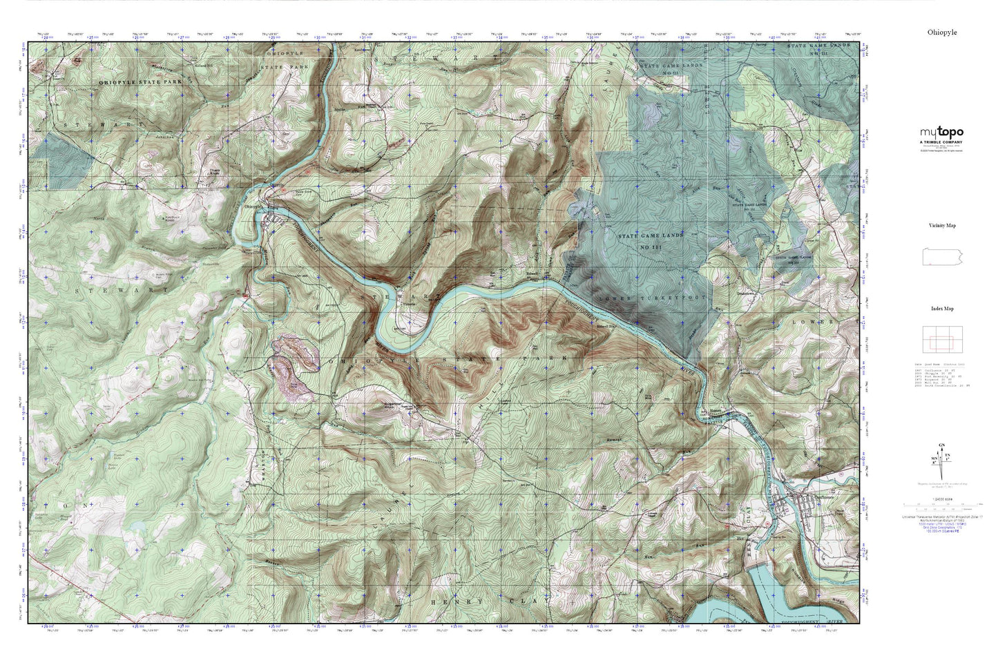
Topographic map of Yough Xtreme in the state of Pennsylvania. From the MyTopo Explorer Series.
This topo map features shaded relief and comes with UTM / MGRS and Latitude/Longitude grids.
For more than two decades, MyTopo has provided maps to the most adventurous among us.. those who love to explore our nation’s remote wilderness areas, climb our highest peaks, and trek across our vast public lands. This map is part of a curated collection of the most popular places for which MyTopo customers have designed maps. It is a “bucket list” of the most amazing places to hike, hunt, and explore.
This map contains the following named places: 15470,Beaver Creek,Bidwell,Bidwell Station,Bidwell Station Run,Bluegill Pond,Borough of Ohiopyle,Bryner School,Camp Run,Cucumber Falls,Cucumber Run,Deadman Run,Drake Run,Fairoaks Church,Free Gospel Church,Great Gorge Trail,Horseshoe Bend,Huston,Irwin Memorial Cemetery,Jim Run,Johnson Chapel,Johnson Chapel Cemetery,Kentuck Knob,Kentuck Union Church,Lambie Cemetery,Laurel Run,Leonard Family Cemetery,Lick Run,Long Run,Meadow Run,Meadow Run Valley Church,Middle Ridge Cemetery,Mitchell Cemetery,Morris Family Cemetery,Nemacolin Airport,Noahs Glade,North Branch Cucumber Run,Oak Grove School,Ohiopyle,Ohiopyle Falls,Ohiopyle Gorge,Ohiopyle Post Office,Ohiopyle State Park,Ohiopyle Stewart Volunteer Fire Department Station 31,Peck Run,Peters Lake,Ramcat Run,Rock Spring Run,Rock Spring School,Rockville School,Russell Lake,Sands Cemetery,Sands Church,Sheepskin Run,Spear Cemetery,State Game Lands Number 111,Stonerville,Sugar Grove Cemetery,Sugar Loaf Cemetery,Sugarloaf Chapel,Sugarloaf Fire Tower,Sugarloaf Knob,Tharp Knob,Three Maples School,Township of Stewart,Tressler Farm Cemetery,Victoria