
MyTopo
Pingree Park MyTopo Explorer Series Map
Couldn't load pickup availability
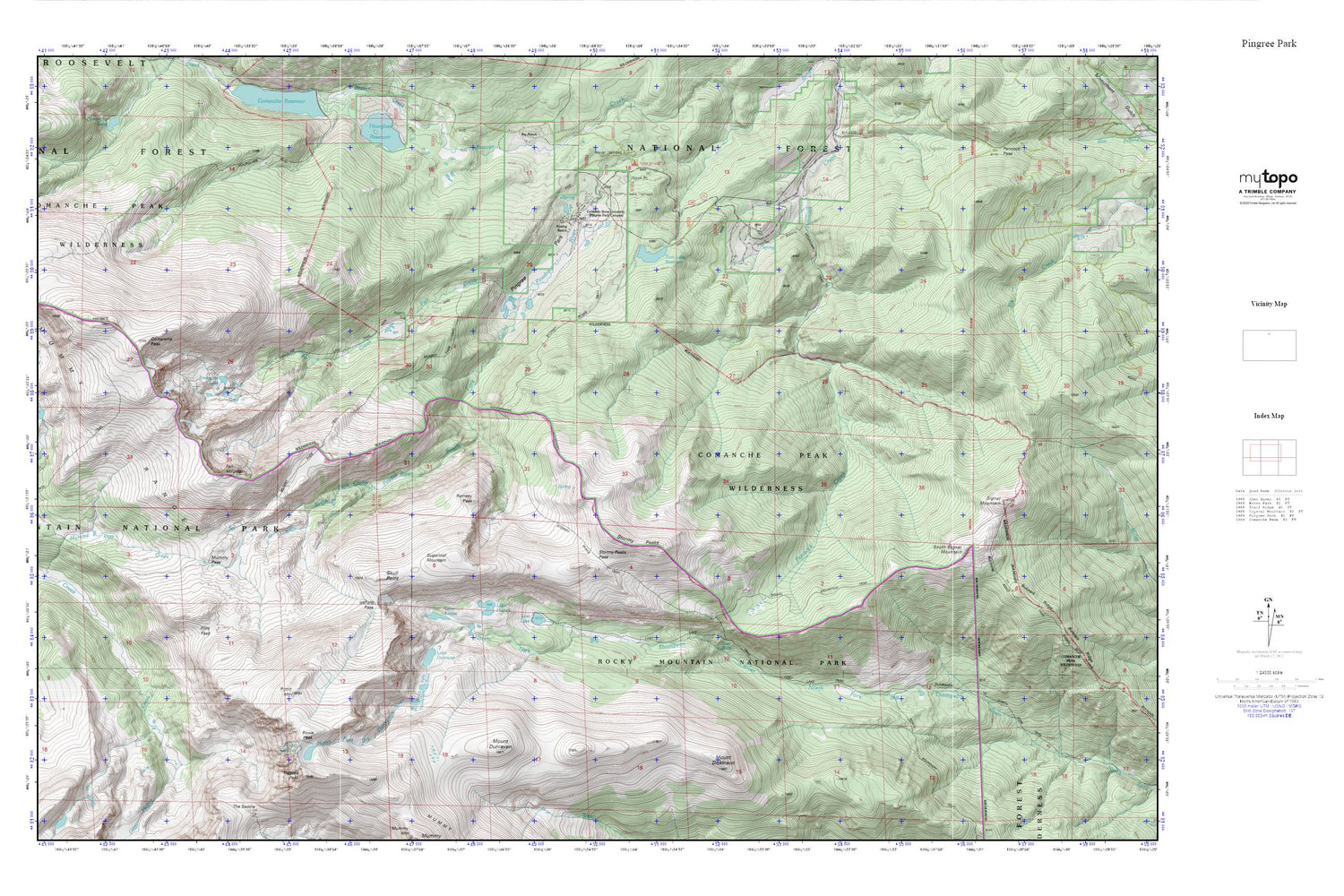
Topographic map of Pingree Park in the state of Colorado. From the MyTopo Explorer Series.
This topo map features shaded relief and comes with UTM / MGRS and Latitude/Longitude grids.
For more than two decades, MyTopo has provided maps to the most adventurous among us.. those who love to explore our nation’s remote wilderness areas, climb our highest peaks, and trek across our vast public lands. This map is part of a curated collection of the most popular places for which MyTopo customers have designed maps. It is a “bucket list” of the most amazing places to hike, hunt, and explore.
This map contains the following named places: Beaver Trailhead,Cirque Lake,Colorado State University Pingree Park Campus,Comanche Peak,Emmaline Lake,Emmaline Lake Trail,Fall Creek,Fall Mountain,Flint Pass,Glacier Number 1 Dam,Glacier Number 1 Reservoir,Hagues Peak,Icefield Pass,Koenig Ranch,Lake Dunraven,Lake Husted,Lake Louise,Latman Lake,Lost Falls,Lost Lake,Lost Lake Trail,Mirror Lake Trail,Mount Dickinson,Mount Dunraven,Mummy Pass,Mummy Pass Trail,Mummy Range,North Fork Ranger Station,Pennock Creek Dam,Pennock Creek Reservoir,Pingree Park,Pingree Park Cemetery,Ramsey Peak,Roosevelt National Forest,Rowe Glacier,Rowe Mountain,Rowe Peak,Skull Point,South Signal Mountain,Stormy Peaks,Stormy Peaks Pass,Stormy Peaks Trail,Stormy Peaks Trailhead,Sugarloaf Mountain,Tom Bennett Campground,Twin Lake Reservoir


