MyTopo
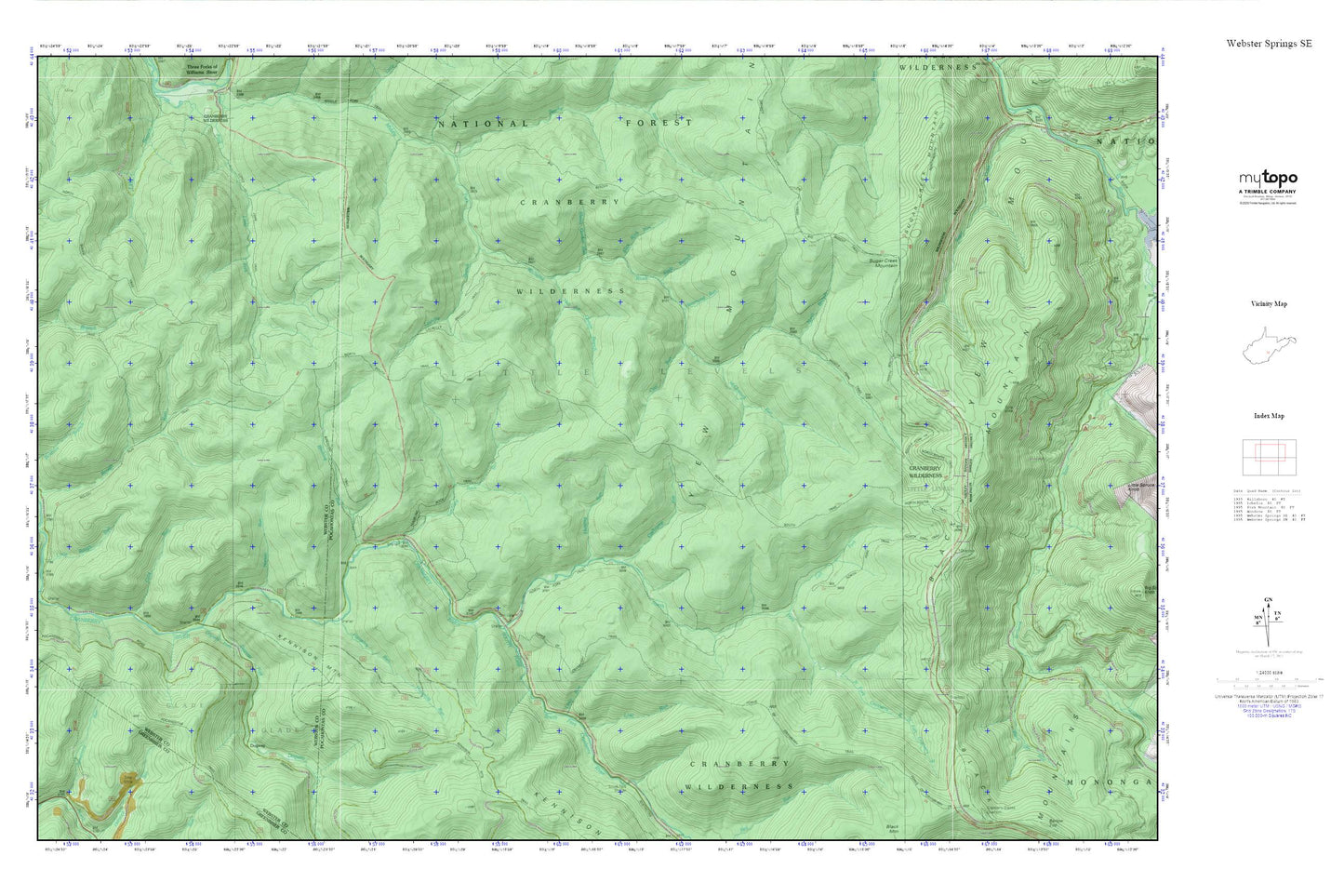
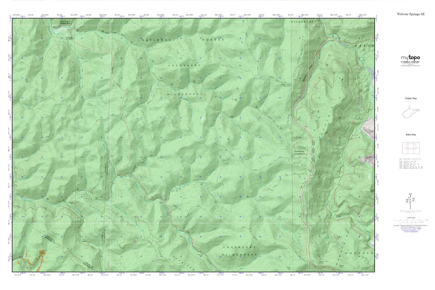
Cranberry Wilderness MyTopo Explorer Series Map
Couldn't load pickup availability
Topographic map of Cranberry Wilderness in the state of West Virginia. From the MyTopo Explorer Series.
This topo map features shaded relief and comes with UTM / MGRS and Latitude/Longitude grids.
For more than two decades, MyTopo has provided maps to the most adventurous among us.. those who love to explore our nation’s remote wilderness areas, climb our highest peaks, and trek across our vast public lands. This map is part of a curated collection of the most popular places for which MyTopo customers have designed maps. It is a “bucket list” of the most amazing places to hike, hunt, and explore.
This map contains the following named places: Beechy Run,Big Beechy Trail,Birchlog Run,Birchlog Trail,Cashcamp Run,Coal Run,Cold Run,Cranberry Back Country,Cranberry Wilderness,Cranberry Wildlife Management Area,Dogway,Dogway Camping Shelter,Dogway Fork,Forks of Cranberry Trail,Goose Hollow,Hammond Run,Hell for Certain Branch,Houselog Run,Hunting Run,Kennison Mountain,Laurelly Branch,Laurelly Branch Trail,Left Fork North Fork Cranberry River,Lick Branch Trail,Little Fork Trail,Little Red Run,Little Rough Run,Little Run,Lost Run,McClintock Run,Middle Fork Trail,North Branch Middle Fork Williams River,North Fork Cranberry River,North Fork Trail,North South Trail,Norton Run,Pheasant Hollow,Pleasant Hollow Camping Shelter,Pocahontas Trail,Rough Run,Sheets Gordon Run,Slade Branch,Slick Rock Run,South Fork Cranberry River,Sugar Creek Mountain,Tumbling Rock Camping Shelter,Tumbling Rock Run,Tumbling Rock Trail,Yew Mountains