MyTopo
Caribou Lake MyTopo Explorer Series Map
Couldn't load pickup availability
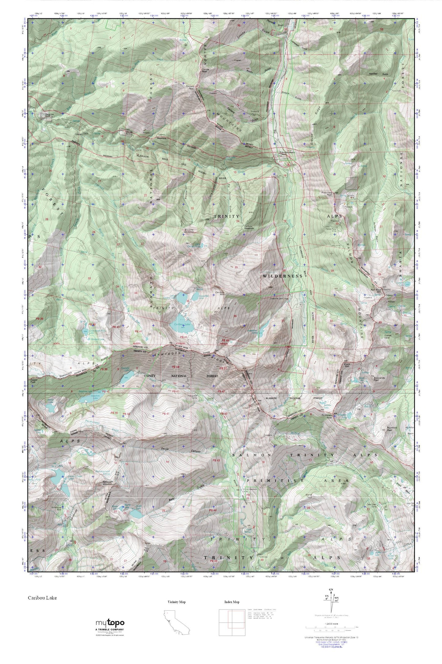
Topographic map of Caribou Lake in the state of California. From the MyTopo Explorer Series.
This topo map features shaded relief and comes with UTM / MGRS and Latitude/Longitude grids.
For more than two decades, MyTopo has provided maps to the most adventurous among us.. those who love to explore our nation’s remote wilderness areas, climb our highest peaks, and trek across our vast public lands. This map is part of a curated collection of the most popular places for which MyTopo customers have designed maps. It is a “bucket list” of the most amazing places to hike, hunt, and explore.
This map contains the following named places: Abrams Cabin,Bear Gap,Bear Gulch,Big Conrad Gulch,Big Flat,Big Flat Campground,Black Mountain,Blue Lady Spring,Browns Gulch,Browns Meadow,Bullards Basin,Canyon Creek Lakes,Caribou Creek,Caribou Gulch,Caribou Lake,Caribou Meadows,Caribou Mountain,Carter Cabin,Coyote Peak,Crosby Gulch,Devils Canyon,Dorleska Mine,Emerald Lake,Grouse Ridge,Gulick Creek,Gulick Mine,Horseshoe Lake,Josephine Lake,Kidd Creek,L Lake,Lakeview Ranch,Le Roy Mine,Little Caribou Lake,Little Conrad Gulch,Little Lake,Little South Fork Lake,Little South Fork Salmon River,Lower Caribou Lake,Middle Fork of Little South Fork,Moraine Lake,Morris Meadows,Morris Meadows Camp,Mountain Meadow Ranch,Packers Gulch,Packers Peak,Portuguese Camp,Preachers Peak,Red Rock Mountain,Rocky Gulch,Salmon Lake,Sapphire Lake,Sawtooth Mountain,Sawtooth Ridge,Smith Lake,Snowslide Lake,Snowslide Peak,Stone Face,Stonehouse,Thompson Gulch,Tri-Forest Peak,Ward Lake,Willow Creek,Yellow Rose Mine