
MyTopo
Split Mountain MyTopo Explorer Series Map
Couldn't load pickup availability
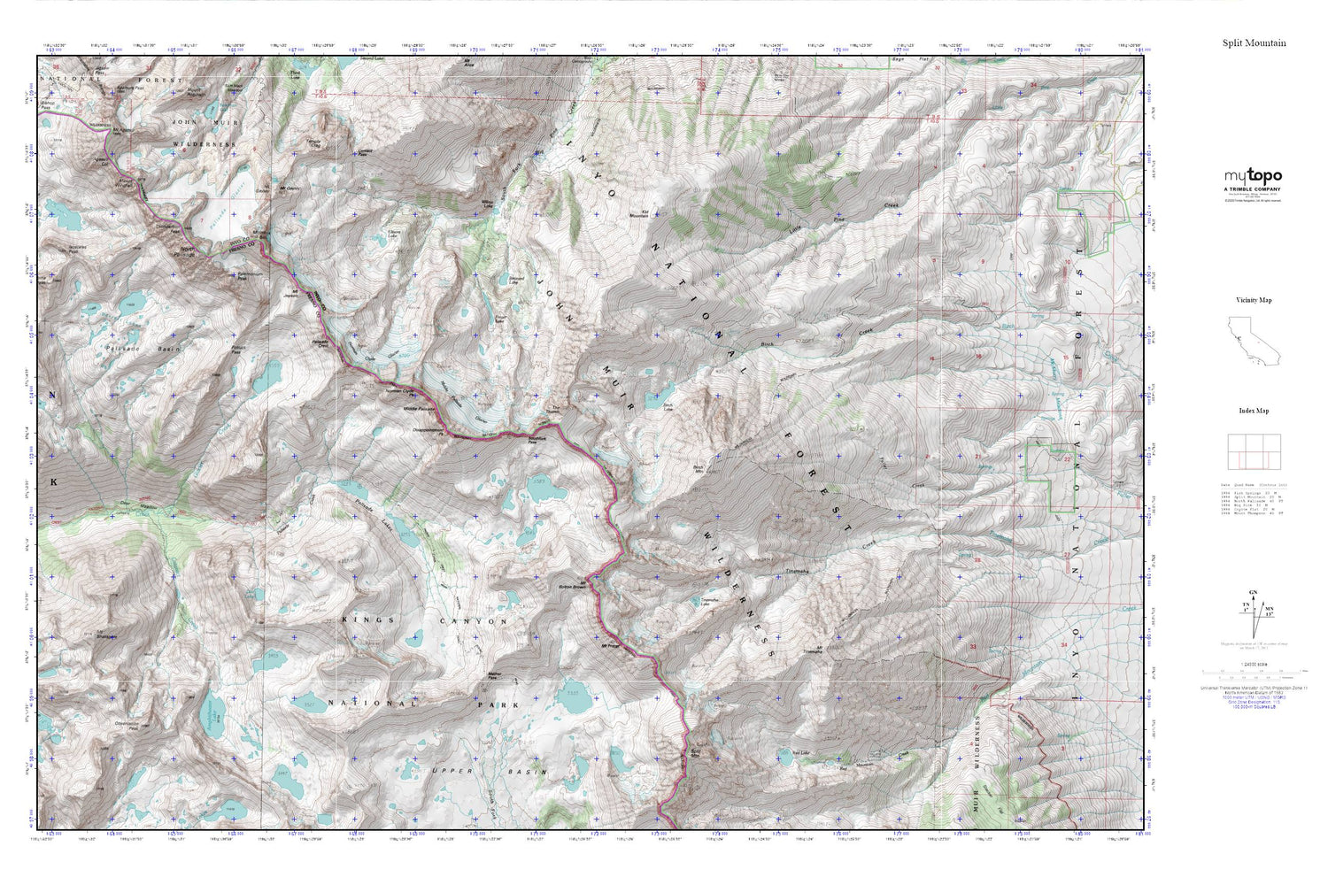
Topographic map of Split Mountain in the state of California. From the MyTopo Explorer Series.
This topo map features shaded relief and comes with UTM / MGRS and Latitude/Longitude grids.
For more than two decades, MyTopo has provided maps to the most adventurous among us.. those who love to explore our nation’s remote wilderness areas, climb our highest peaks, and trek across our vast public lands. This map is part of a curated collection of the most popular places for which MyTopo customers have designed maps. It is a “bucket list” of the most amazing places to hike, hunt, and explore.
This map contains the following named places: Agassiz Col,Amphitheater Lake,Barrett Lakes,Birch Lake,Birch Mountain,Brainerd Lake,Cataract Creek,Columbine Peak,Contact Pass,Deer Meadow,Disappointment Peak,Doe Lake,Elinor Lake,Finger Lake,Glacier Creek,Isosceles Peak,Kid Mountain,Knapsack Pass,Mather Pass,Middle Palisade,Middle Palisade Glacier,Mount Bolton Brown,Mount Gayley,Mount Jepson,Mount Prater,Mount Shakspere,Mount Sill,Mount Tinemaha,Mount Winchell,Norman Clyde Glacier,Norman Clyde Peak,North Palisade,Observation Peak,Palisade Basin,Palisade Crest,Palisade Glacier,Palisade Lakes,Polemonium Peak,Potluck Pass,Red Lake,Southfork Pass,Split Mountain,Temple Crag,The Thumb,Thunderbolt Peak,Tinemaha Lake,Willow Lake


