MyTopo
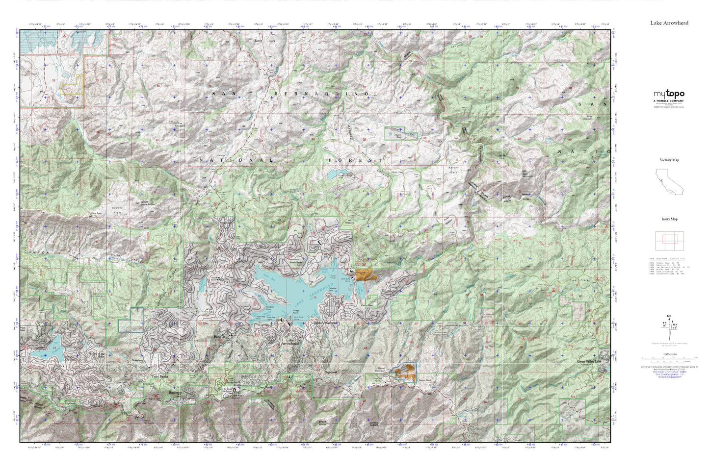
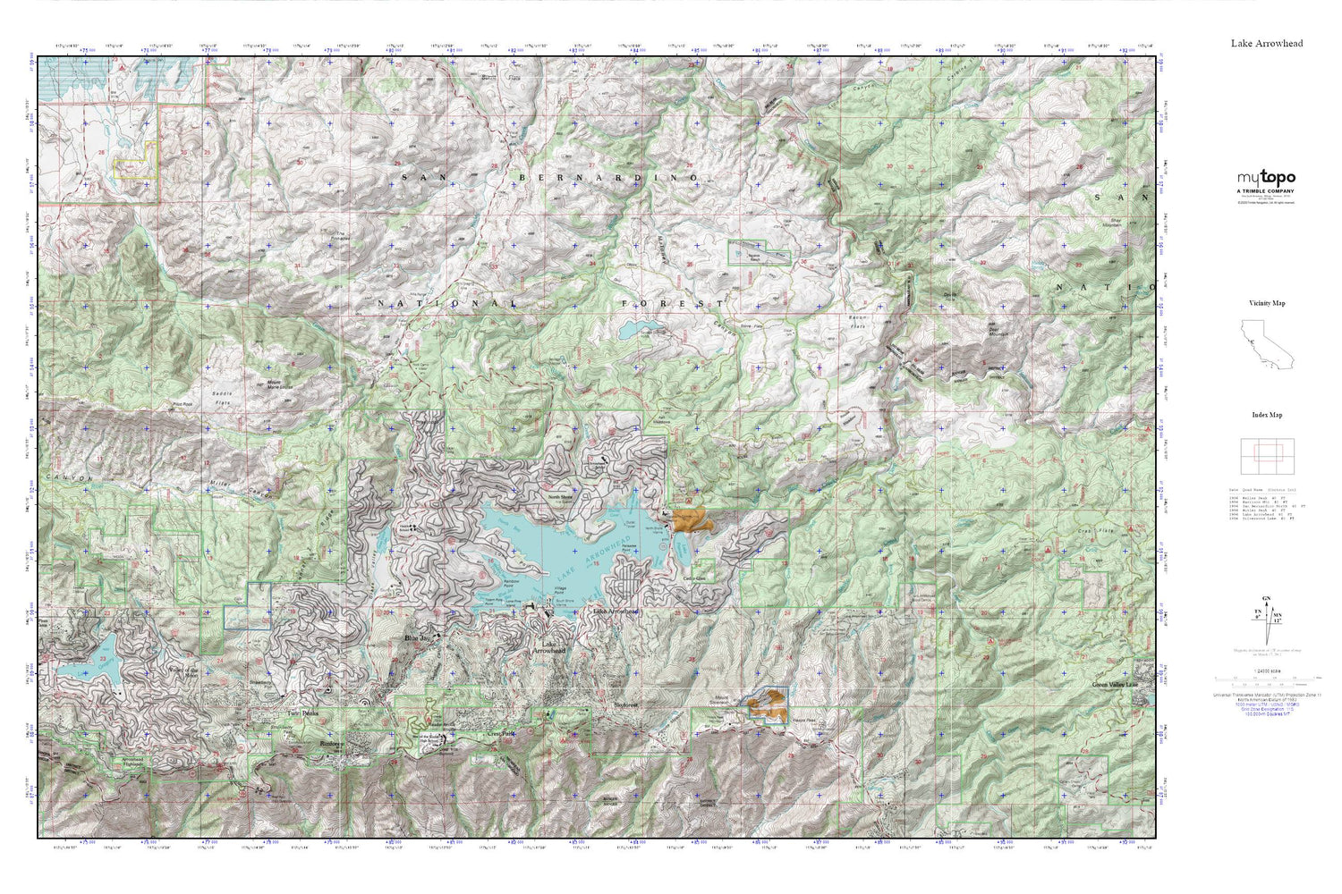
Lake Arrowhead MyTopo Explorer Series Map
Couldn't load pickup availability
Topographic map of Lake Arrowhead in the state of California. From the MyTopo Explorer Series.
This topo map features shaded relief and comes with UTM / MGRS and Latitude/Longitude grids.
For more than two decades, MyTopo has provided maps to the most adventurous among us.. those who love to explore our nation’s remote wilderness areas, climb our highest peaks, and trek across our vast public lands. This map is part of a curated collection of the most popular places for which MyTopo customers have designed maps. It is a “bucket list” of the most amazing places to hike, hunt, and explore.
This map contains the following named places: 92321,92325,92352,92378,92391,Agua Fria,Allison Ranch,Arrowhead Highlands,Arrowhead Ranger Station,Ash Meadows,Bacon Flats,Blue Jay,Blue Jay Bay,Blue Jay Canyon,Blue Jay Post Office,Burnt Mill Creek,Calvary Chapel Christian School,Cedar Creek,Cedar Glen,Cedar Glen Post Office,Coxey Creek,Crab Creek,Crest Forest Fire Protection District Station 5,Crest Forest Fire Protection District Station 6,Crest Line Park,Crest Park,Crest Summit,Crestline,Crestline Post Office,Daley Canyon,Dart Creek,Deer Lodge Park,Deer Mountain,Devils Hole,Dishpan Spring,Dogwood Campground,Dogwood Canyon,Eagle Point,Emerald Bay,Fern Creek,Fishermans Campground,Fleming Creek,Grandview Elementary School,Grass Valley,Grass Valley 805-002 Dam,Grass Valley Lake,Green Valley Creek,Heaps Peak,Hencks Meadow,Holcomb Creek,Hooks Creek,Houston Creek,Huston Flat,KBON-FM (Lake Arrowhead),KGGI-FM (Riverside),Kuffel Canyon,Lake Arrowhead,Lake Arrowhead 805 Dam,Lake Arrowhead Airport,Lake Arrowhead Branch San Bernardino County Library,Lake Arrowhead Census Designated Place,Lake Arrowhead Country Club,Lake Arrowhead Division,Lake Arrowhead Elementary School,Lake Arrowhead Post Office,Lake Arrowhead Scout Camps,Lake Arrowhead Village Shopping Center,Lake Gregory,Lake Gregory 1803-003 Dam,Little Bear Creek,Lone Pine Island,Long Point,Maloney Canyon,Mary P Henck Intermediate School,Meadow Bay,Meadowbrook Woods,MH15 Heaps Peak-US Forest Service Heliport,Miller Canyon Trail,Mount Marie Louise,Mount Sorenson,Mountain High School,Mountains Community Hospital,Mountains Community Hospital Heliport,Mountaintop Academy,New Lake Arrowhead 1803-002 Dam,North Bay,North Shore,North Shore Campground,North Shore Marina,North Shore Ranger Station,Orchard Bay,Orchard Creek,Palisades Point,Papoose Lake,Paradise Bay,Pilot Rock,Pilot Rock Conservation Camp,Pilot Rock Truck Trail,Rainbow Bay,Rainbow Point,Rim of the World Senior High School,Rimforest,Rimforest Post Office,Rock Camp Guard Station,Rouse Meadow,Saddle Flats,San Bernardino County Fire Department Station 26,San Bernardino County Fire Department Station 91 - Lake Arrowhead,San Bernardino County Fire Department Station 92 - Lake Arrowhead,San Bernardino County Fire Department Station 93 - Lake Arrowhead,San Bernardino County Fire Department Station 94 - Lake Arrowhead,San Bernardino County Sheriff's Office,San Bernardino National Forest Arrowhead Ranger Station Fire District,Santas Village,Shake Creek,Sheep Creek,Shelter Cove,Skyforest,Skyforest Post Office,Skyland,South Shore Marina,Squints Ranch,Stove Flats,Strawberry Flat,Strawberry Peak,Switzer Park,Tavern Bay,The Pinnacles,Thousand Pines Camp,Toll Road Campground,Totem Pole Point,Tunnel Two Ridge,Twin Peaks,Twin Peaks Post Office,University of California Los Angeles Conference Center,Valley of the Moon,Village Bay,Village Point,Willow Creek Jeep Trail,Winter Harbor Cove,Yacht Club Bay


