
MyTopo
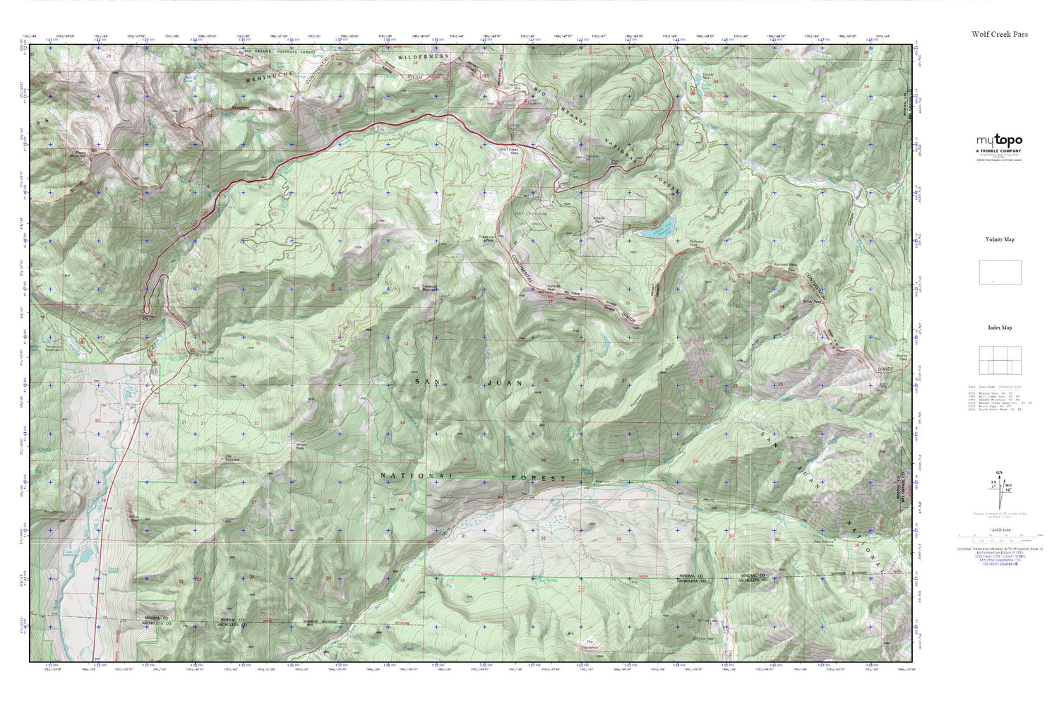
Wolf Creek Pass MyTopo Explorer Series Map
Couldn't load pickup availability
Topographic map of Wolf Creek Pass in the state of Colorado. From the MyTopo Explorer Series.
This topo map features shaded relief and comes with UTM / MGRS and Latitude/Longitude grids.
For more than two decades, MyTopo has provided maps to the most adventurous among us.. those who love to explore our nation’s remote wilderness areas, climb our highest peaks, and trek across our vast public lands. This map is part of a curated collection of the most popular places for which MyTopo customers have designed maps. It is a “bucket list” of the most amazing places to hike, hunt, and explore.
This map contains the following named places: Alberta Park,Alberta Park Dam,Alberta Park Reservoir,Alberta Peak,Allen Creek,Camp Creek,Chapson Ditch,Fall Creek,Hatcher Lakes,Himes Creek,Indian Head,Lake Creek,Lane Creek,Lost Creek,Lost Lake,McCoy Cemetery,Newton Spring,Peterson Ridge,Quartz Creek,Railroad Pass,San Juan Mountains,Sheep Mountain,Silver Creek,Silver Creek Trail,Silver Falls Guard Station,T Lazy T Reservoir,Treasure Creek,Treasure Falls,Treasure Mountain,Treasure Mountain Trail,Waterfall Creek,West Fork Campground,West Fork Ranch,Windy Pass,Windy Pass Trail,Wolf Creek,Wolf Creek Campground,Wolf Creek Pass


