MyTopo
Vallecito Reservoir MyTopo Explorer Series Map
Couldn't load pickup availability
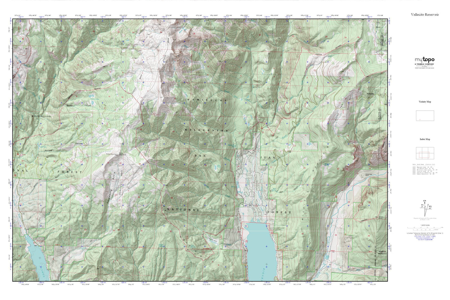
Topographic map of Vallecito Reservoir in the state of Colorado. From the MyTopo Explorer Series.
This topo map features shaded relief and comes with UTM / MGRS and Latitude/Longitude grids.
For more than two decades, MyTopo has provided maps to the most adventurous among us.. those who love to explore our nation’s remote wilderness areas, climb our highest peaks, and trek across our vast public lands. This map is part of a curated collection of the most popular places for which MyTopo customers have designed maps. It is a “bucket list” of the most amazing places to hike, hunt, and explore.
This map contains the following named places: Bear Creek,Berri Creek,Blodgett Creek,Burnt Timber Creek,Carbonate Basin,Chain Lakes,D Creek,Dark Canyon,Fall Creek,Florida Campground,Freeman Creek,Freeman Creek Picnic Area,Freeman Park,Gold Nugget Claim,Grimes Creek,Lake Eileen,Long Hollow,Lost Creek,Lost Lake,McClure Canyon,McCoy Gulch,Middle Mountain,Miller Mountain,North Burnt Timber Creek,Pine River Campground,Runlett Park,San Juan National Forest,South Bear Creek,South Burnt Timber Creek,Stump Canyon,Stump Lakes,Transfer Park Campground,Upper Lemon Picnic Area,Vallecito Campground,Vallecito Creek,Vallecito Guard Station,Virginia Gulch,Waldner Creek,Weasel Skin Creek,West Mountain,Willow Creek,Wits End Ranch,Youngs Canyon