
MyTopo
Isolation Peak MyTopo Explorer Series Map
Couldn't load pickup availability
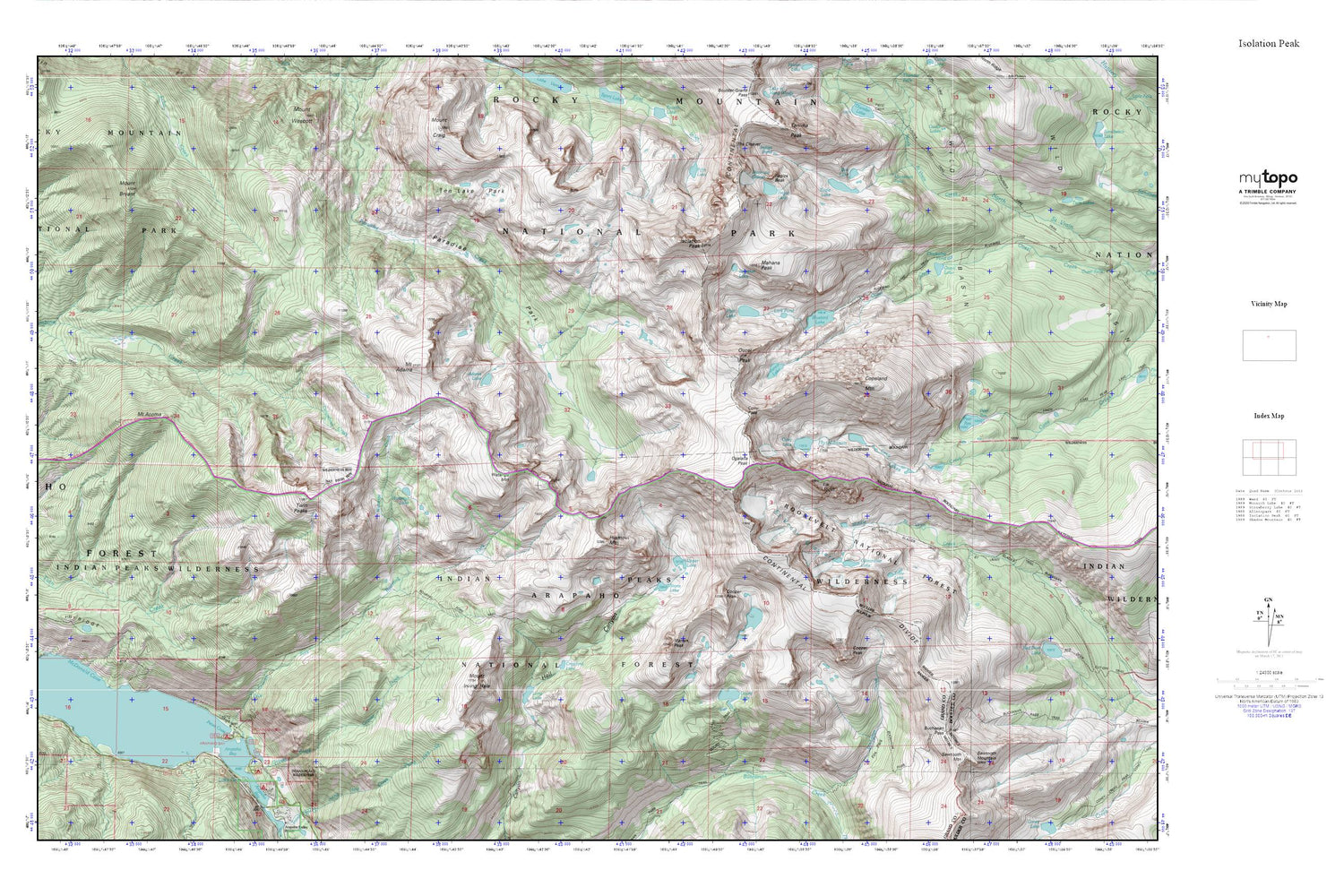
Topographic map of Isolation Peak in the state of Colorado. From the MyTopo Explorer Series.
This topo map features shaded relief and comes with UTM / MGRS and Latitude/Longitude grids.
For more than two decades, MyTopo has provided maps to the most adventurous among us.. those who love to explore our nation’s remote wilderness areas, climb our highest peaks, and trek across our vast public lands. This map is part of a curated collection of the most popular places for which MyTopo customers have designed maps. It is a “bucket list” of the most amazing places to hike, hunt, and explore.
This map contains the following named places: Adams Lake,Bluebird Dam,Bluebird Lake,Bluebird Lake Trail,Box Lake,Buchanan Pass,Buchanan Pass Trail,Chickadee Pond,Cony Lake,Cony Pass,Cooper Peak,Copeland Mountain,Crawford Lake,Eagle Lake,Eagles Beak,Elk Tooth,Fifth Lake,Fox Park,Frigid Lake,Gourd Lake,Gourd Lake Trail,Grouse Creek,Hiamovi Mountain,Hutcheson Lakes,Indigo Pond,Island Lake,Isolation Lake,Isolation Peak,Junco Lake,Knight Ridge,Lake Envy,Lake Gibraltar,Lark Pond,Long Lake,Mahana Peak,Marten Peak,McDonald Cove,Mertensia Falls,Moomaw Glacier,Moraine Campground,Mount Acoma,Mount Adams,Mount Bryant,Mount Irving Hale,Ogalalla Peak,Ouzel Lake,Ouzel Peak,Paradise Park,Pear Dam,Pear Reservoir,Petes Cove,Pipit Lake,Roaring Fork Arapaho Creek,Roaring Fork Campground,Roaring Fork Ranger Station,Roaring Fork Trail,Roaring Fork Trailhead,Round Lake,Saint Vrain Glacier Trail,Saint Vrain Glaciers,Sawtooth Mountain,Stone Lake,Ten Lake Park,Twin Peaks,Upper Lake,Watanga Creek,Watanga Lake,Watanga Mountain


