MyTopo
Timber Knob MyTopo Explorer Series Map
Couldn't load pickup availability
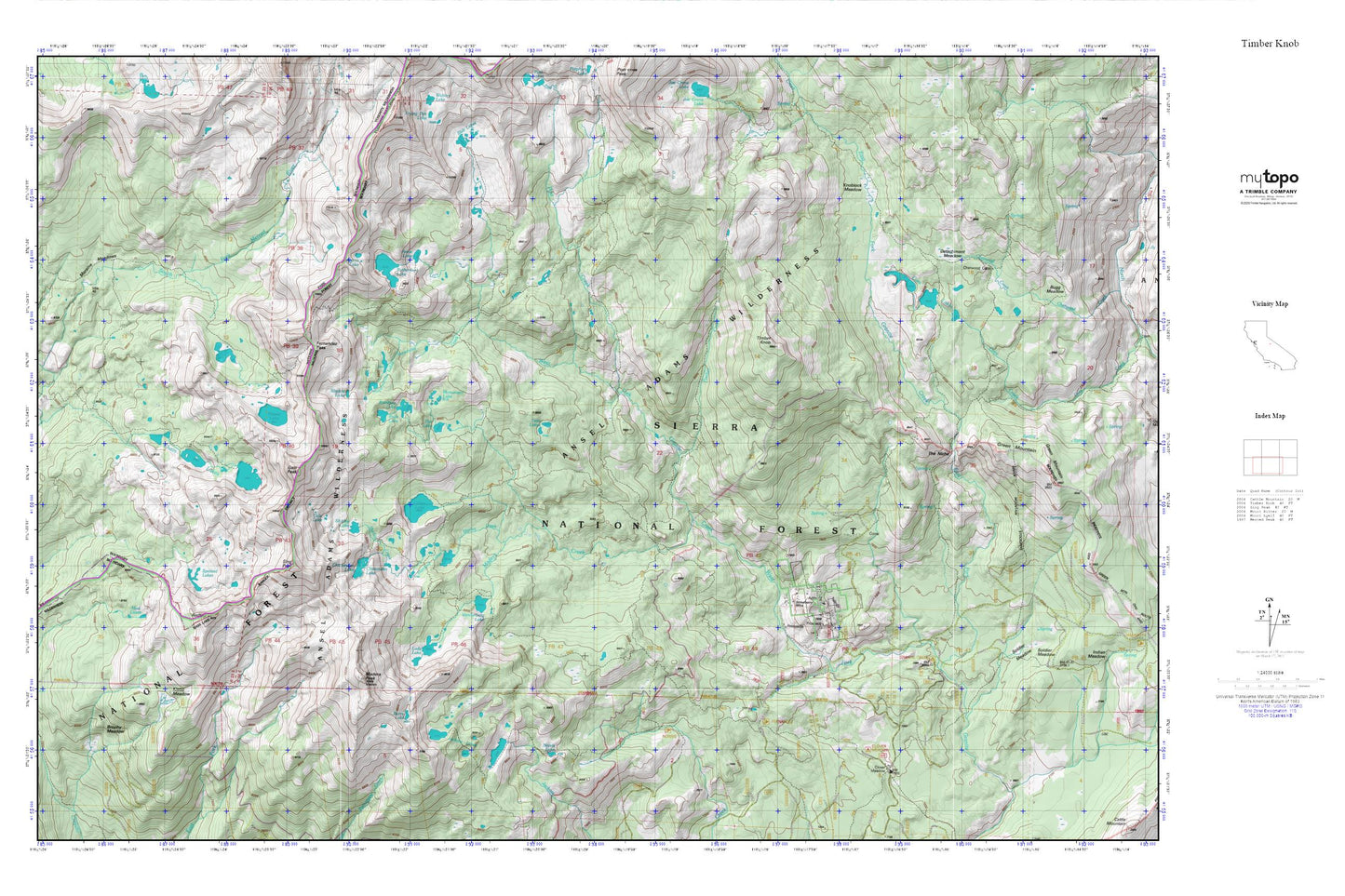
Topographic map of Timber Knob in the state of California. From the MyTopo Explorer Series.
This topo map features shaded relief and comes with UTM / MGRS and Latitude/Longitude grids.
For more than two decades, MyTopo has provided maps to the most adventurous among us.. those who love to explore our nation’s remote wilderness areas, climb our highest peaks, and trek across our vast public lands. This map is part of a curated collection of the most popular places for which MyTopo customers have designed maps. It is a “bucket list” of the most amazing places to hike, hunt, and explore.
This map contains the following named places: Alpine Lake,Anne Lake,Blackie Lake,Breeze Lake,Brophy Meadow,Burro Lake,Chain Lakes,Chetwood Cabin,Chiquito Lake,Chittenden Lake,Clover Meadow Campground,Clover Meadow Ranger Station,Cora Lakes,Detachment Meadow,East Fork Granite Creek,Fernandez Creek,Fernandez Lakes,Fernandez Pass,Flat Lake,Gale Lake,Gale Peak,Granite Creek Campground,Jackass Lakes,Klette Meadow,Knoblock Cabin,Knoblock Meadow,Lady Lake,Lillian Lake,Madera Creek,Madera Lakes,Madera Peak,Monument Lake,Moraine Meadows,Mud Lakes,Norris,Norris Lake,Post Creek,Rainbow Lake,Redtop,Ruth Lake,Rutherford Lake,Rutherford Lake 1-036 Dam,Shirley Creek,Shirley Lake,Sing Peak,Spotted Lakes,Staniford Lakes,Strawberry Mine,Strawberry Mines,The Niche,Timber Creek,Timber Knob,Twin Lakes,Vanderburgh Lake,West Fork Granite Creek