MyTopo
Cooper Peak MyTopo Explorer Series Map
Couldn't load pickup availability
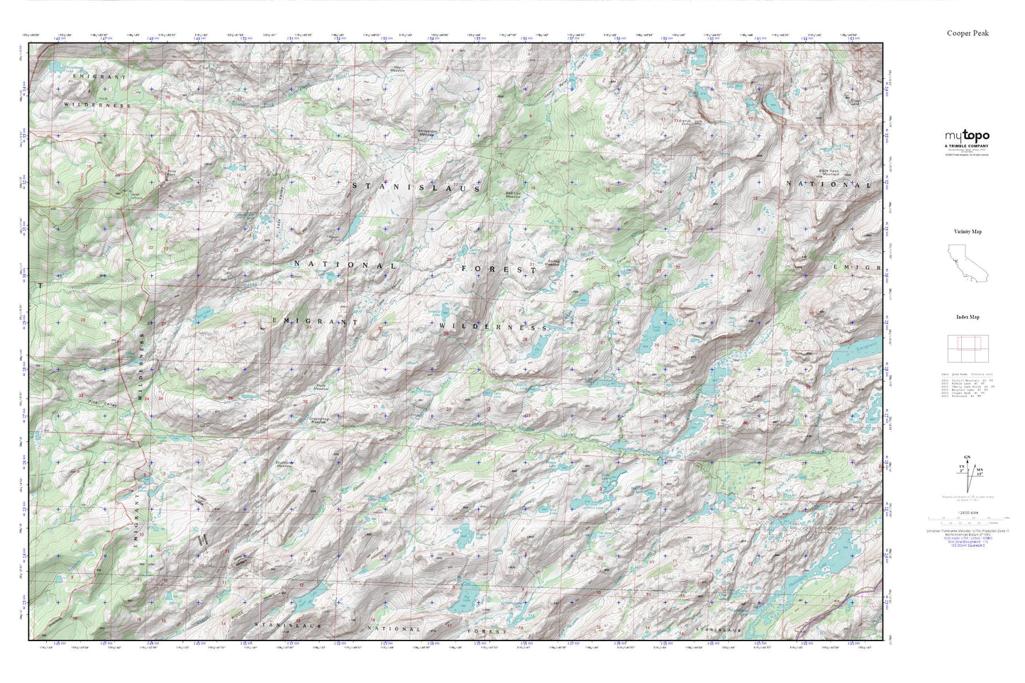
Topographic map of Cooper Peak in the state of California. From the MyTopo Explorer Series.
This topo map features shaded relief and comes with UTM / MGRS and Latitude/Longitude grids.
For more than two decades, MyTopo has provided maps to the most adventurous among us.. those who love to explore our nation’s remote wilderness areas, climb our highest peaks, and trek across our vast public lands. This map is part of a curated collection of the most popular places for which MyTopo customers have designed maps. It is a “bucket list” of the most amazing places to hike, hunt, and explore.
This map contains the following named places: Bear Lake,Bear Lake Dam,Box Spring,Buck Lake,Buck Lakes,Buck Meadow Creek,Burst Rock,Camp Lake,Chain Lakes,Chewing Gum Lake,Cow Meadow Lake,Coyote Lake,Crabtree Campsite,Deer Lake,Emigrant Wilderness,Five Acre Lake,Gem Lake,Gianelli Cabin,Granite Dome,Granite Lake,Groundhog Meadow,Grouse Lake,Jewelry Lake,Karls Lake,Kole Lake,Lake Valley,Leighton Dam,Leighton Lake,Leopold Lake,Long Lake,Long Lake Dam,Louse Canyon,Lower Buck Lake 1-025 Dam,Mud Lake,Olive Lake,Pine Valley,Pingree Lake,Pinto Lakes,Piute Creek,Piute Lake,Piute Meadow,Post Corral Canyon,Powell Lake,Red Can Lake,Rosasco Lake,Salt Lick Meadow,Spring Creek,Spring Meadow,Starvation Lake,Studhorse Meadow,Toejam Lake,Toms Canyon,Whitesides Meadow,Wire Lakes,Wood Lake,Y Meadow Dam,Y Meadows Dam,Y Meadows Reservoir