MyTopo
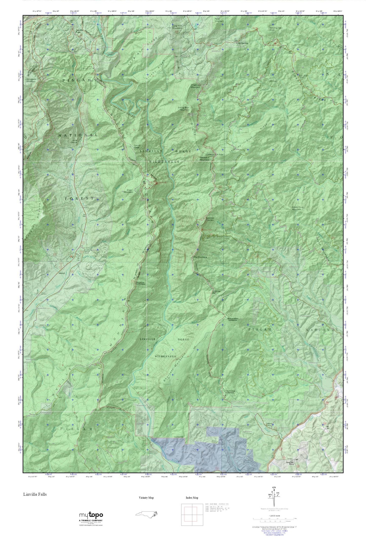
Linville Gorge MyTopo Explorer Series Map
Couldn't load pickup availability
Topographic map of Linville Gorge in the state of North Carolina. From the MyTopo Explorer Series.
This topo map features shaded relief and comes with UTM / MGRS and Latitude/Longitude grids.
For more than two decades, MyTopo has provided maps to the most adventurous among us.. those who love to explore our nation’s remote wilderness areas, climb our highest peaks, and trek across our vast public lands. This map is part of a curated collection of the most popular places for which MyTopo customers have designed maps. It is a “bucket list” of the most amazing places to hike, hunt, and explore.
This map contains the following named places: Ashford,Back Creek,Bandy Cove Mountain,Barkhouse Picnic Area,Brown Cemetery,Brown Mountain Overlook Scenic View,Brushy Ridge,Buck Creek,Bull Branch,Cambric Branch,Chestnut Cove Branch,Chimney Branch,Chimney Gap,Cold Springs,Concord Church,Daniel Boone Wildlife Management Area,Dogback Mountain,Dogback Spring Branch,Gingercake Creek,Gingercake Mountain,Green Mountain,Gulf Branch,Hawksbill Mountain,Laurel Branch,Laurel Knob,Lettered Rock Ridge,Linville Falls,Linville Falls Post Office,Linville George Wilderness,Linville Gorge Wilderness,Linville Mountain,Long Arm Ridge,North Carolina Outward Bound,Pinnacle,Pond Branch,Reedys Fork,Rich Cove Branch,Ripshin Ridge,Rose Mountain,Shortoff Mountain,Sitting Bear Mountain,Table Rock Fish Hatchery Dam,Table Rock Fish Hatchery Lake,Table Rock Mountain,Table Rock Picnic Area,Tablerock Church,Tablerock State Fish Hatchery,The Chimneys,Township of Jonas Ridge,Wilson Cemetery,Wisemans View