MyTopo
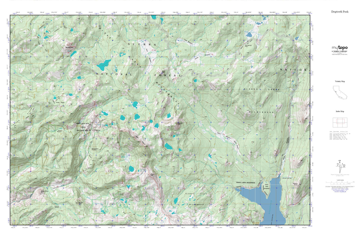
Dogtooth Peak MyTopo Explorer Series Map
Couldn't load pickup availability
Topographic map of Dogtooth Peak in the state of California. From the MyTopo Explorer Series.
This topo map features shaded relief and comes with UTM / MGRS and Latitude/Longitude grids.
For more than two decades, MyTopo has provided maps to the most adventurous among us.. those who love to explore our nation’s remote wilderness areas, climb our highest peaks, and trek across our vast public lands. This map is part of a curated collection of the most popular places for which MyTopo customers have designed maps. It is a “bucket list” of the most amazing places to hike, hunt, and explore.
This map contains the following named places: Arkansas Creek,Arkansas Meadow,Beryl Lake,Black Peak,Brewer Lake,Brown Peak,Bullfrog Lake,Cliff Lake,Cow Creek,Coyote Lake,Dinkey Dome,Dinkey Lakes Wilderness,Dinkey Trailhead,Dogtooth Peak,Dusy Creek,East Lake,Eastern Brook Lake,Fingerbowl Lake,First Dinkey Lake,Foster Ridge,Game Dike Mine,Grouse Lake,Helms Meadow,Hot Springs Pass,Island Lake,Limestone Campsite,Little Doris Lake,Little Lake,Long Meadow,Marble Point,Miningtown Meadow,Mud Lakes,Mystery Lake,Qualls Camp,Rainbow Lake,Rainbow Mine,Red Lake,Red Mountain,Red Mountain Trail,Rock Lake,Rock Meadow,Rodeo Meadow,Second Dinkey Lake,South Lake,Swamp Creek,Swamp Lake,Swamp Meadow,Swede Lake,Three Sisters,Tocher Lake,Willow Meadow