MyTopo
Emigrant Lake MyTopo Explorer Series Map
Couldn't load pickup availability
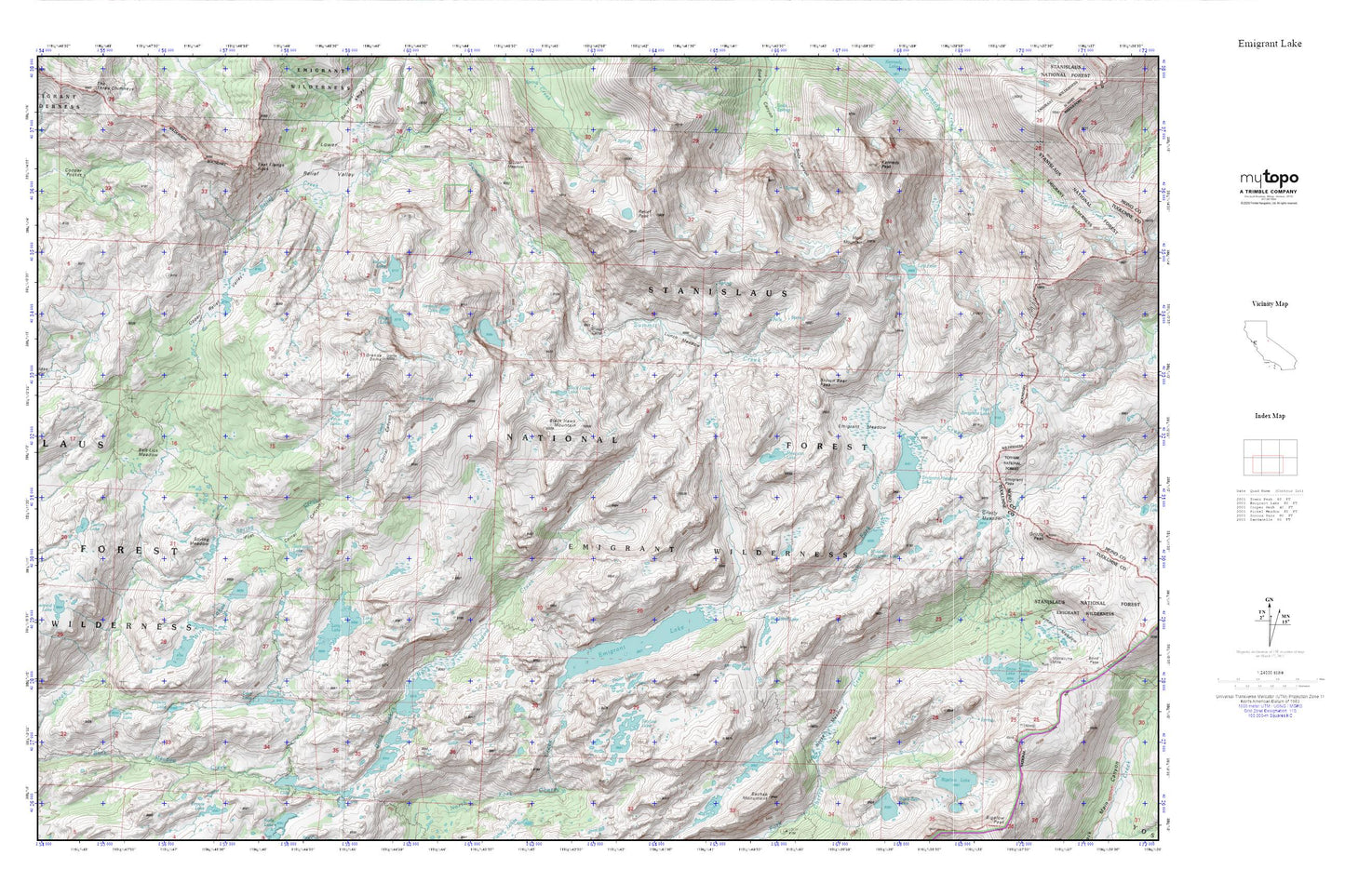
Topographic map of Emigrant Lake in the state of California. From the MyTopo Explorer Series.
This topo map features shaded relief and comes with UTM / MGRS and Latitude/Longitude grids.
For more than two decades, MyTopo has provided maps to the most adventurous among us.. those who love to explore our nation’s remote wilderness areas, climb our highest peaks, and trek across our vast public lands. This map is part of a curated collection of the most popular places for which MyTopo customers have designed maps. It is a “bucket list” of the most amazing places to hike, hunt, and explore.
This map contains the following named places: Bigelow Lake,Bigelow Lake 1-026 Dam,Black Hawk Lake,Black Hawk Mountain,Blackbird Lake,Brown Bear Pass,Buck Lake,Buck Lake Dam,Buck Lakes,Deer Lake,East Flange Rock,Emigrant Lake,Emigrant Lake Dam,Emigrant Meadow,Emigrant Meadow Lake,Emigrant Pass,Emigrant Wilderness,Fraser Lakes,Gem Lake,Granite Dome,Grizzly Meadow,High Emigrant Lake,High Emigrant Lake 1-027 Dam,Horse Meadow,Horse Meadow Reservoir,Iceland Lake,Jewelry Lake,Kennedy Peak,Leopold Lake,Lewis Lakes,Long Lake,Long Lake Dam,Lost Lake,Lunch Meadow,Maxwell Lake,Middle Emigrant Dam,Middle Emigrant Lake,Molo Mountain,Mosquito Lake,Pinto Lakes,Piute Lake,Post Corral Canyon,Relief Peak,Ridge Lake,Salt Lick Meadow,Sardella Lake,Saucer Meadow,Shallow Lake,Sheep Camp,Snowlake Dam,Snowlake Reservoir,Spring Creek,Spring Meadow,Starvation Lake,Toejam Lake,Upper Relief Valley,W Lake,Wire Lakes