MyTopo
Warbonnet Peak MyTopo Explorer Series Map
Couldn't load pickup availability
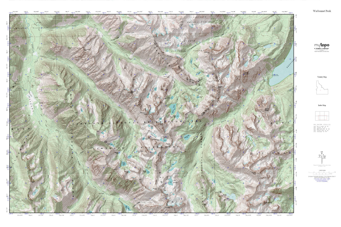
Topographic map of Warbonnet Peak in the state of Idaho. From the MyTopo Explorer Series.
This topo map features shaded relief and comes with UTM / MGRS and Latitude/Longitude grids.
For more than two decades, MyTopo has provided maps to the most adventurous among us.. those who love to explore our nation’s remote wilderness areas, climb our highest peaks, and trek across our vast public lands. This map is part of a curated collection of the most popular places for which MyTopo customers have designed maps. It is a “bucket list” of the most amazing places to hike, hunt, and explore.
This map contains the following named places: Alpine Lake,Baron Creek Falls,Baron Lake,Baron Lakes,Bead Lakes,Big Meadows,Blue Rock Lake,Braxon Lake,Braxon Peak,Bugle Mountain,Cony Lake,Cony Peak,Deadman Cabin,Feather Lakes,Fern Falls,Garden Creek,Goat Creek,Grandjean Peak,Heyburn Mountain,Horstmann Peak,Lake Creek,Lake Kathryn,Limber Lake,Little Baron Lake,Lower Cramer Lake,McWillards Lake,Meadow Lake,Middle Cramer Lake,Mink Creek,Monte Verita,Moolack Creek,Oreamnos Lake,Packrat Lake,Packrat Peak,Pinchot Creek,Pitchfork Creek,Reward Peak,Stevens Lakes,Taylor Spring,Three Lake,Tohobit Peak,Upper Baron Lake,Upper Redfish Lakes,Warbonnet Lake,Warbonnet Peak