
MyTopo
Koip Peak MyTopo Explorer Series Map
Couldn't load pickup availability
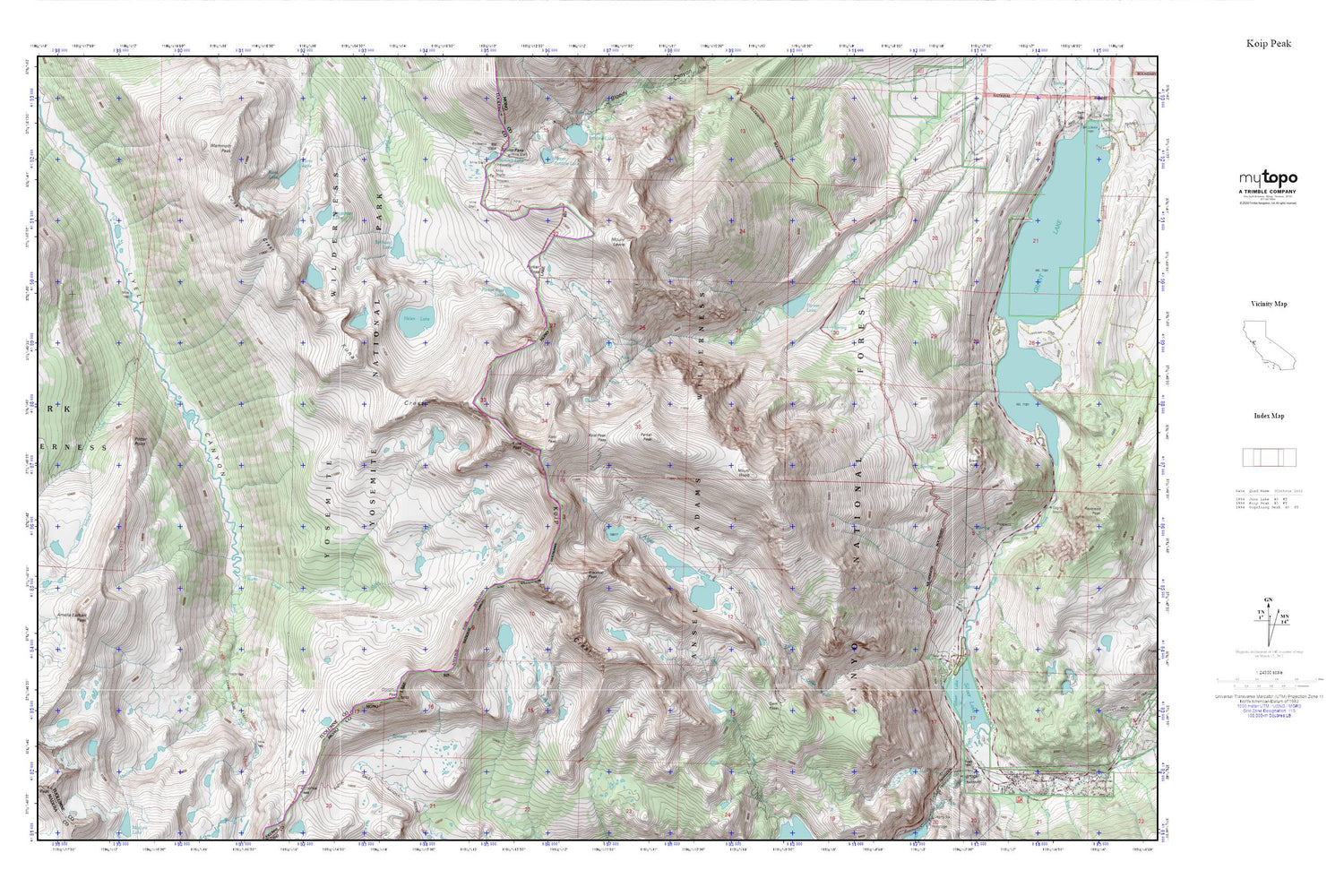
Topographic map of Koip Peak in the state of California. From the MyTopo Explorer Series.
This topo map features shaded relief and comes with UTM / MGRS and Latitude/Longitude grids.
For more than two decades, MyTopo has provided maps to the most adventurous among us.. those who love to explore our nation’s remote wilderness areas, climb our highest peaks, and trek across our vast public lands. This map is part of a curated collection of the most popular places for which MyTopo customers have designed maps. It is a “bucket list” of the most amazing places to hike, hunt, and explore.
This map contains the following named places: Alger Creek,Alger Lakes,Amelia Earhart Peak,Bingaman Lake,Blacktop Peak,Donohue Peak,Gem Pass,Grant Lake Boating Site,Grant Lake Camground,Helen Lake,Ireland Creek,Koip Crest,Koip Peak,Koip Peak Pass,Kuna Creek,Kuna Crest,Kuna Lake,Kuna Peak,Lost Lakes,Maclure Creek,Mammoth Peak,Mono Pass,Mount Andrea Lawrence,Mount Lewis,Mount Wood,Parker Lake,Parker Lake Trailhead,Parker Pass,Parker Pass Lake,Parker Peak,Potter Point,Reversed Creek,Rush Creek Recreation Site,Rush Creek Trailhead,Sardine Lakes,Silver Lake,Silver Lake Boat Launch,Silver Lake Campground,Silver Lake Picnic Site,Spillway Lake,Summit Lake,Trailer Park Campground,Upper Sardine Lake


