MyTopo
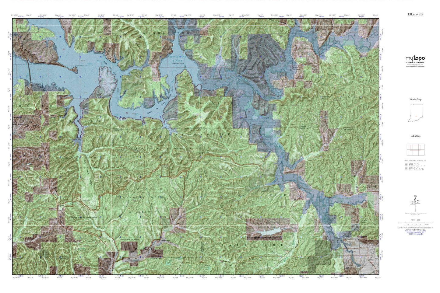
Elkinsville MyTopo Explorer Series Map
Couldn't load pickup availability
Topographic map of Elkinsville in the state of Indiana. From the MyTopo Explorer Series.
This topo map features shaded relief and comes with UTM / MGRS and Latitude/Longitude grids.
For more than two decades, MyTopo has provided maps to the most adventurous among us.. those who love to explore our nation’s remote wilderness areas, climb our highest peaks, and trek across our vast public lands. This map is part of a curated collection of the most popular places for which MyTopo customers have designed maps. It is a “bucket list” of the most amazing places to hike, hunt, and explore.
This map contains the following named places: Axsom Branch,Axsom Branch Pond,Bad Hollow,Blackwell Church,Blackwell Lake,Blackwell Pond Campground,Bret Kimberlin Lake,Bret Kimberlin Lake Dam,Browning Hill,Burgoon Church Cemetery,Callahan Hollow,Charles C Deam Wilderness,Charles C. Deam Wilderness,Combs Branch,Combs Creek,Cope Hollow,Deckard Church,Dennis Murphy Hollow,Dutch Ridge,Dutch Ridge Lookout Tower,Eel Creek,Elkinsville,Fleetwood Branch,Frank Grubb Ridge,Frog Pond Ridge,Geiger Ridge Pond,Hayes Hollow,Hickory Ridge,Hickory Ridge Lookout Tower,Hillenburg Cemetery,Hunter Creek Church,Hunter Creek Pond,Jay Pond,John Grubb Ridge,Jones Branch,Lake Tarzian,Lake Tarzian Dam,Lincoln Back Branch,Martin Hollow,Maumee,Maumee Boy Scout Reservation,Middle Fork Salt Creek,Middle Fork State Wildlife Refuge,Mitchell Cemetery,Mose Ray Branch,Negro Creek,North Fork Salt Creek,Porter Hollow,Rayburn Hollow,Robertson Cemetery,Saddle Creek,South Fork Salt Creek,South Granger Post Office,Spanker Branch,Starnes Branch,Swain Branch,Sycamore Branch,Tanyard Branch,Taylor Branch,Terrill Cemetery,Terrill Ridge,Terrill Ridge Pond,Todd Cemetery,Township of Polk,Warren Lake,Wilkerson Hill,Will Hay Branch,Yellowstone,Youno