MyTopo
Granite Chief MyTopo Explorer Series Map
Couldn't load pickup availability
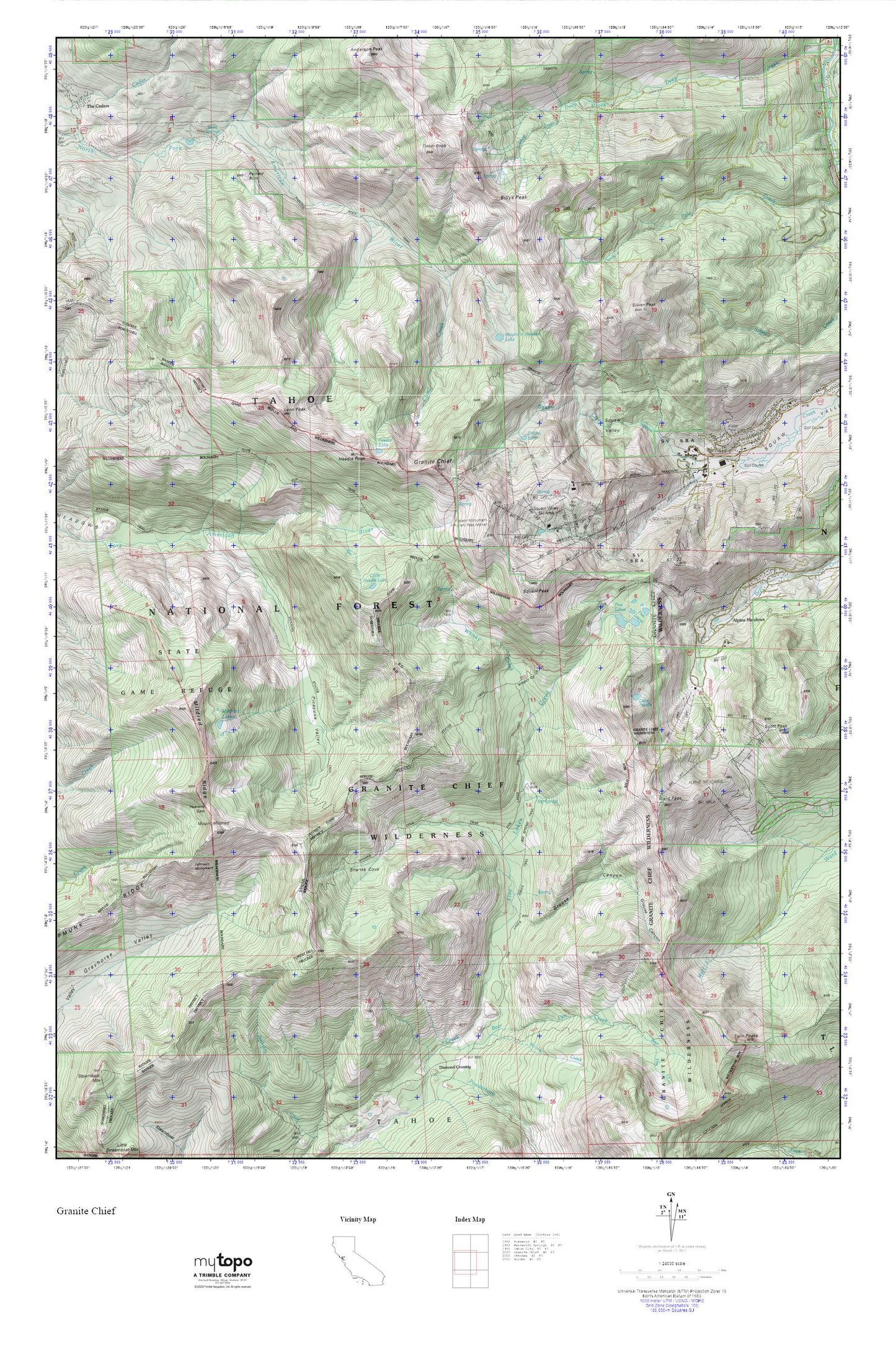
Topographic map of Granite Chief in the state of California. From the MyTopo Explorer Series.
This topo map features shaded relief and comes with UTM / MGRS and Latitude/Longitude grids.
For more than two decades, MyTopo has provided maps to the most adventurous among us.. those who love to explore our nation’s remote wilderness areas, climb our highest peaks, and trek across our vast public lands. This map is part of a curated collection of the most popular places for which MyTopo customers have designed maps. It is a “bucket list” of the most amazing places to hike, hunt, and explore.
This map contains the following named places: 96146,Alpine Meadows,Alpine Meadows Ski Area,Bear Den Canyon,Bear Pen Creek,Big Spring,Big Spring Trail,Billys Peak,Chief Creek,Chipmunk Ridge,Five Lakes,Five Lakes Creek Trail,Five Lakes Trailhead,Granite Chief,Granite Chief Trail,Granite Chief Wilderness,Grouse Canyon,Heavens Gate,Johnson Monument,KT-22,Lake Estelle,Little Needle Lake,Lyon Peak,Mildred Lakes,Mildred Ridge,Mount Mildred,Mountain Meadow Lake,Needle Lake,Needle Peak,Olympic Valley Post Office,Painted Rock,Painted Rock Trail,Picayune Valley,Poulsen Peak,Scott Peak,Shanks Cove,Shanks Cove Trail,Shirley Lake,Silver Peak,Soda Springs,Squaw Peak,Squaw Valley Ski Area,Squaw Valley State Reservation Area,Tinker Knob,Ward Peak,Watson Monument Emigrant Pass Marker,Whisky Creek,Whisky Creek Camp,Willow Creek