MyTopo
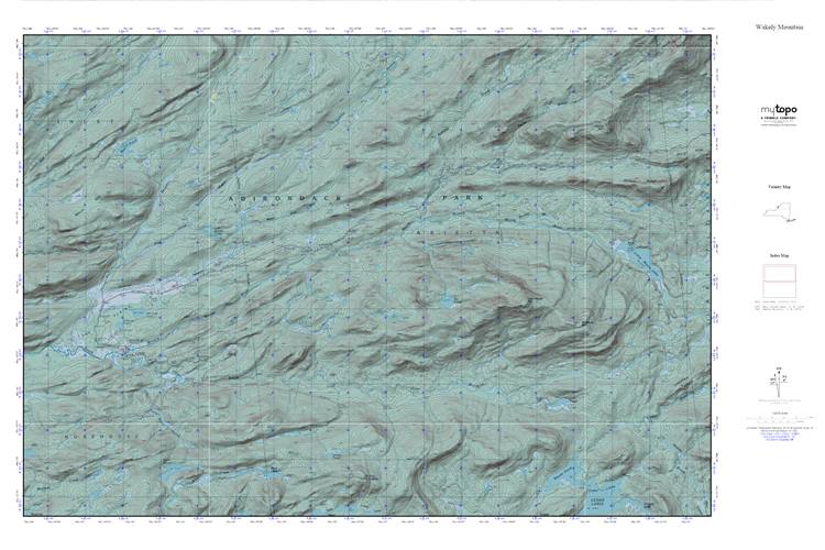
Wakely Mountain MyTopo Explorer Series Map
Couldn't load pickup availability
Topographic map of Wakely Mountain in the state of New York. From the MyTopo Explorer Series.
This topo map features shaded relief and comes with UTM / MGRS and Latitude/Longitude grids.
For more than two decades, MyTopo has provided maps to the most adventurous among us.. those who love to explore our nation’s remote wilderness areas, climb our highest peaks, and trek across our vast public lands. This map is part of a curated collection of the most popular places for which MyTopo customers have designed maps. It is a “bucket list” of the most amazing places to hike, hunt, and explore.
This map contains the following named places: Bear Paw Creek,Bear Pond,Beaver Pond,Benedict Creek,Bradley Brook,Butter Brook,Cellar Brook,Falls Pond,Falls Pond Outlet,Helldiver Pond,Icehouse Pond,Jimmy Creek,Jimmy Pond,Kenwells,Kitty Cobble,Little Moose Mountain,Lost Pond,Lost Ponds,Manbury Mountain,Moose River Recreation Area,Mount Tom,Otter Brook,Pine Grove Creek,Silver Run,Sly Pond,Sumner Stream,The Plains,Wolf Lake