MyTopo
West Beckwith Mountain MyTopo Explorer Series Map
Couldn't load pickup availability
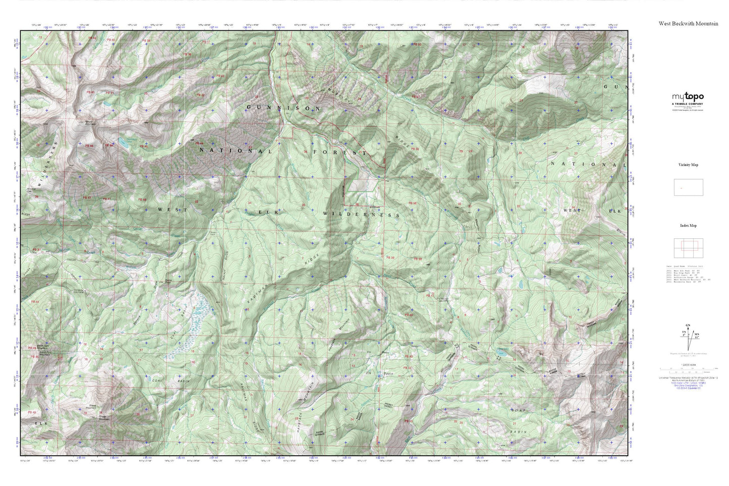
Topographic map of West Beckwith Mountain in the state of Colorado. From the MyTopo Explorer Series.
This topo map features shaded relief and comes with UTM / MGRS and Latitude/Longitude grids.
For more than two decades, MyTopo has provided maps to the most adventurous among us.. those who love to explore our nation’s remote wilderness areas, climb our highest peaks, and trek across our vast public lands. This map is part of a curated collection of the most popular places for which MyTopo customers have designed maps. It is a “bucket list” of the most amazing places to hike, hunt, and explore.
This map contains the following named places: Beaver Jungle,Coal Basin,Cutler Creek,Elk Basin,Gunnison Lake,Hoodoo Gap,Kaufman Creek,Little Robinson Cow Camp,Little Robinson Creek,Minnesota Cow Camp,Moseley Ridge,Mount Gunnison,Navajo Cabin,Navajo Gulch,Peter Creek,Ranger Creek,Robinson Creek,Sams Peak,Sheep Lake,Sheep Mountain,Smith Fork Mountain,Soap Basin,Spruce Creek,Spruce Draw,Three Knobs,Wapiti Creek,West Elk Mountains,Willow Creek