
MyTopo
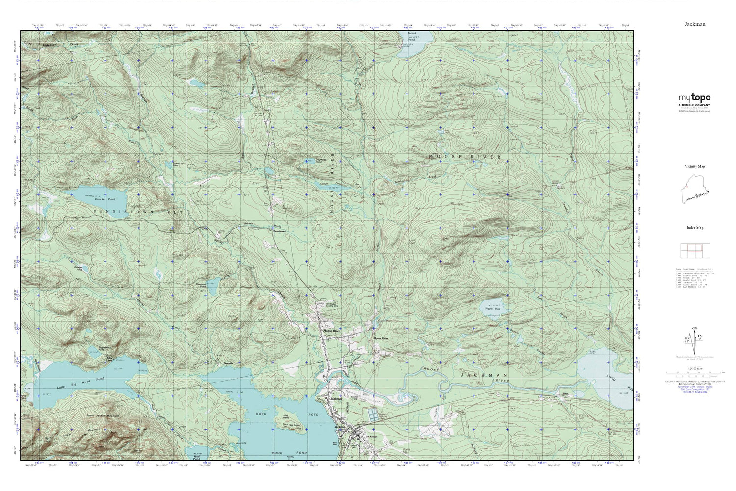
Jackman MyTopo Explorer Series Map
Couldn't load pickup availability
Topographic map of Jackman in the state of Maine. From the MyTopo Explorer Series.
This topo map features shaded relief and comes with UTM / MGRS and Latitude/Longitude grids.
For more than two decades, MyTopo has provided maps to the most adventurous among us.. those who love to explore our nation’s remote wilderness areas, climb our highest peaks, and trek across our vast public lands. This map is part of a curated collection of the most popular places for which MyTopo customers have designed maps. It is a “bucket list” of the most amazing places to hike, hunt, and explore.
This map contains the following named places: Alder Brook,Brandy Brook,Burnt Land Pond,Coburn Pond,Crocker Pond,Crocker Pond Dam,Daymond Pond,Dennistown,Dyerville,East Branch Sandy Stream,Forest Hills Consolidated School,Foxs Camp,Gander Brook,Gander Pond,Halfway Brook,Heald Stream,Heald Stream Dam,Hog Island,Holden Cemetery,Jackman,Jackman Mill,Jackman Moose River Fire Department,Jackman Post Office,Jackman Public Library,Kimball Brook,Little Big Wood Pond,Moose River,Moose River Campground,Moose River Seaplane Base,Newton Field,Plantation of Dennistown,Rancourt Pond,Sky Lodge Landing Strip,Stetson School,Sugar Berth Pond,Supply Pond,Town of Moose River,West Branch Sandy Stream


