MyTopo
Mount Hilton MyTopo Explorer Series Map
Couldn't load pickup availability
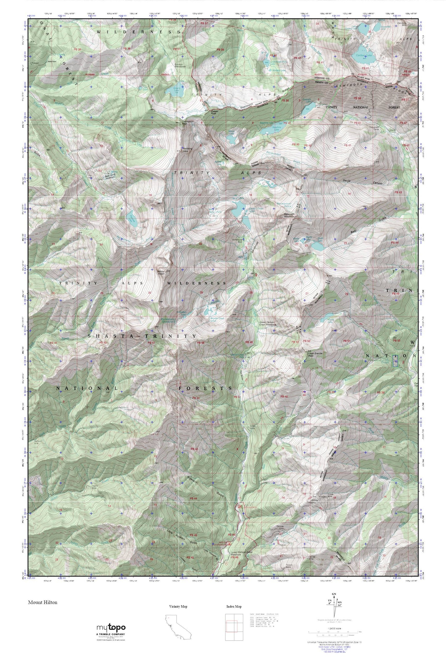
Topographic map of Mount Hilton in the state of California. From the MyTopo Explorer Series.
This topo map features shaded relief and comes with UTM / MGRS and Latitude/Longitude grids.
For more than two decades, MyTopo has provided maps to the most adventurous among us.. those who love to explore our nation’s remote wilderness areas, climb our highest peaks, and trek across our vast public lands. This map is part of a curated collection of the most popular places for which MyTopo customers have designed maps. It is a “bucket list” of the most amazing places to hike, hunt, and explore.
This map contains the following named places: Alaska Mine,Alpine Lake,Backbone Ridge,Bear Creek,Bear Valley Meadows,Bear Valley Meadows Camp,Boulder Creek,Boulder Creek Lakes,Caesar Peak,Canyon Creek Falls,Canyon Creek Lakes,Canyon Creek Trailhead Parking,Caribou Lake,Chloride Mine,Coast Ranges,Emerald Lake,Enos Camp,Forbidden Lakes,Globe Mill,Globe Mine,Grizzly Lake,Grizzly Meadows,Kalmia Lake,L Lake,Little Granite Peak,Little Lake,Little South Fork Lake,Lois Lake,McKay Camp,Mirror Lake,Moraine Lake,Mount Hilton,Papoose Lake,Portuguese Camp,Salmon Mountains,Sapphire Lake,Sawtooth Mountain,Smith Lake,Stonehouse,Stonehouse Gulch,Thompson Peak,Trinity Alps,Upper Canyon Creek Meadows,Wedding Cake