MyTopo
Grouse Ridge MyTopo Explorer Series Map
Couldn't load pickup availability
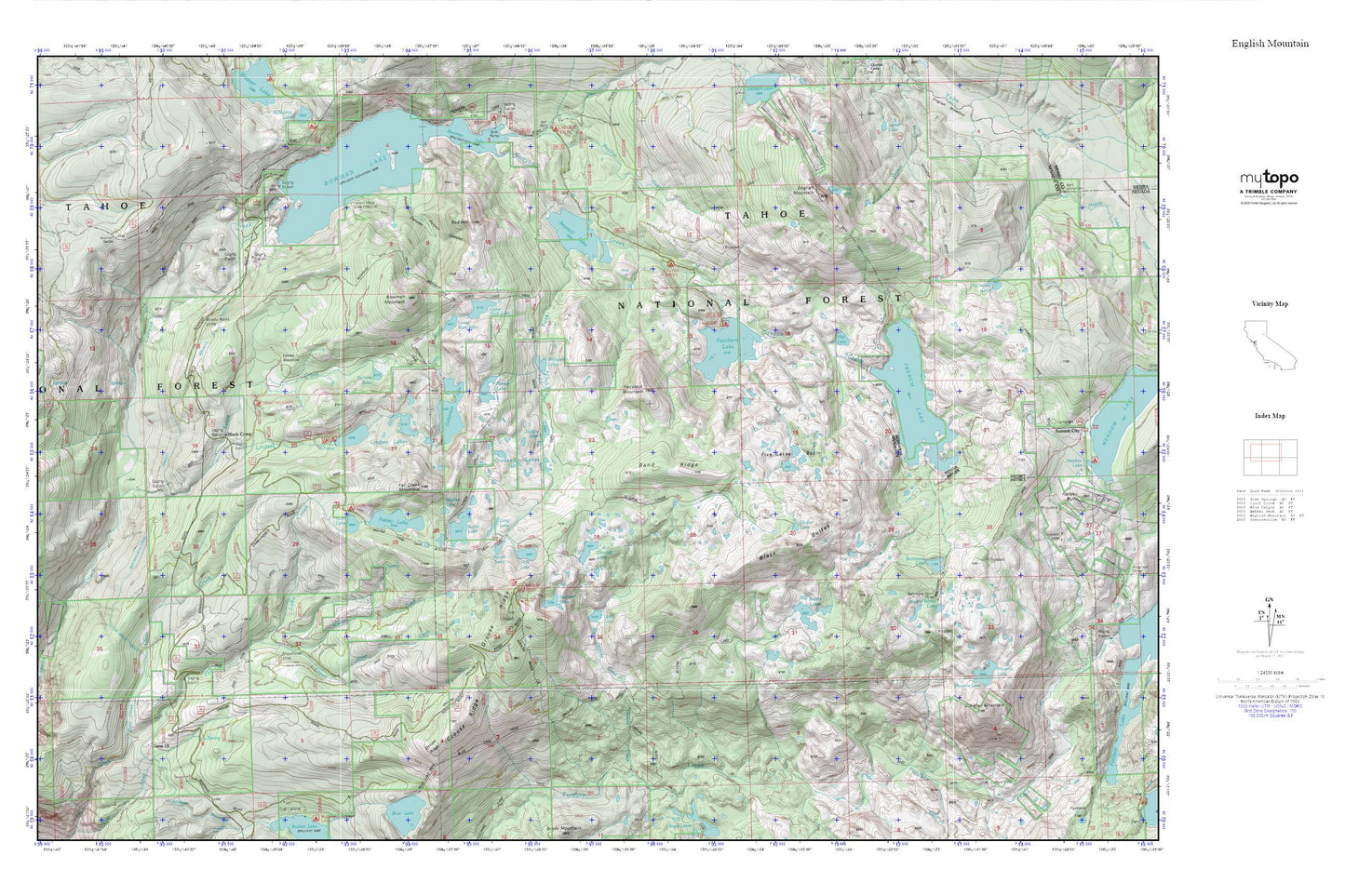
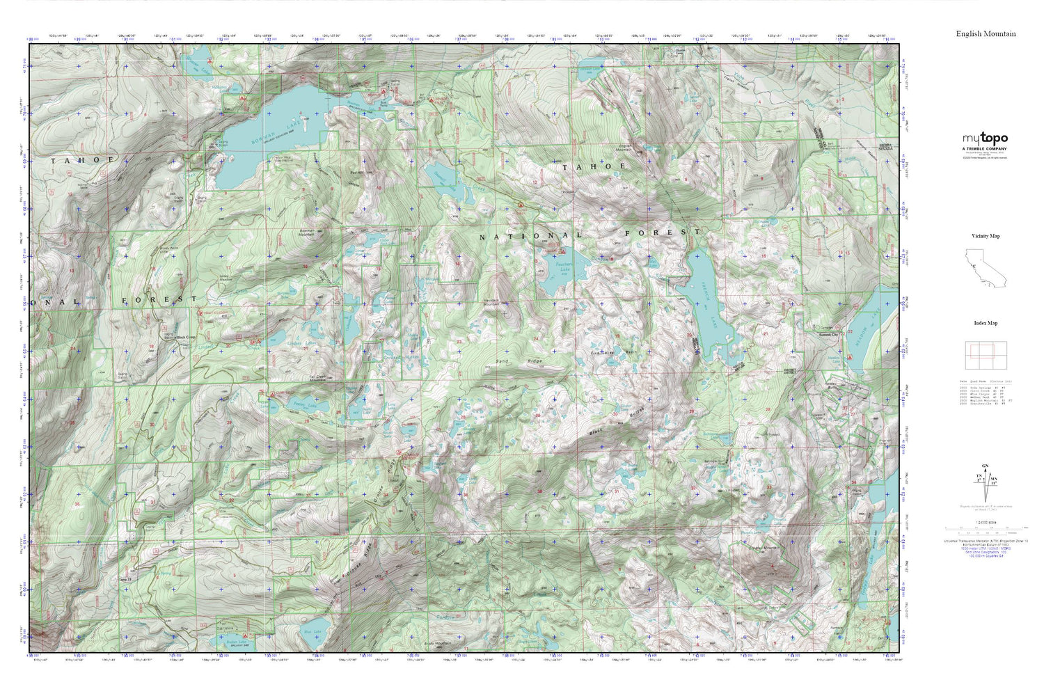
Topographic map of Grouse Ridge in the state of California. From the MyTopo Explorer Series.
This topo map features shaded relief and comes with UTM / MGRS and Latitude/Longitude grids.
For more than two decades, MyTopo has provided maps to the most adventurous among us.. those who love to explore our nation’s remote wilderness areas, climb our highest peaks, and trek across our vast public lands. This map is part of a curated collection of the most popular places for which MyTopo customers have designed maps. It is a “bucket list” of the most amazing places to hike, hunt, and explore.
This map contains the following named places: Alder Creek,Baltimore Lake,Baltimore Town,Baltimore Trail,Beyers Lake,Beyers Lake Trail,Beyers Lakes,Big Downey Lake 1-024 Dam,Black Buttes,Black Camp,Blue Lake Trail,Bowman House,Bowman Lake,Bowman Mountain,Bowman Mountain Trail,Bowman Rockfill 61-002 Dam,Bowman Tunnel,Bullpen Lake,Camp Lundeen,Camp Nineteen,Canyon Creek Campground,Canyon Creek Trail,Carr Lake,Carr-Feeley Campground,Clear Creek,Clear Creek Tunnel,Crooked Lakes,Crooked Lakes Trail,Culbertson 97-017 Dam,Culbertson Lake,Downey Lake,Echo Lake,English Mountain,Fall Creek Mountain,Faucherie 61-022 Dam,Faucherie Campground,Faucherie Lake,Feeley Lake,Five Lakes Basin,French Lake,French Lake 61-006 Dam,Glacier Lake,Glacier Lakes Trail,Granite Creek,Grouse Ridge,Grouse Ridge Campground,Haystack Mountain,Hidden Lake,Island Lake,Lake Creek,Lindsey Campground,Lindsey Creek,Lindsey Lakes,Linsey Lake Trail,Loney Lake,Loney Meadow,Long Lake,Lower Feeley Lake 97-035 Dam,Lower Lindsey 97-036 Dam,Lower Rock Lake,Mary Jane Mine,Mid Lindsey Lake 97-041 Dam,Middle Lake,Milk Lake,Money Creek,Old Man Mountain,Penner Lake,Phoenix Lake,Poison Canyon,Red Hill,Round Lake,Round Lake Trail,Sand Ridge,Sanford Lake,Sawmill Lake,Sawmill Lake 61-010 Dam,Shotgun Lake,Snowflower Mine,South Fork Canyon Creek,Tahoe National Forest,Texas Creek,Tollhouse Lake,Upper Feeley Lake 97-045 Dam,Upper Rock Lake,Upper Rock Lake 97-048 Dam,Wagon Wheel Lake,Weil Lake,Willow Spring,Windy Point Cliffs,Yellow Metal Mine