MyTopo
Five Ponds MyTopo Explorer Series Map
Couldn't load pickup availability
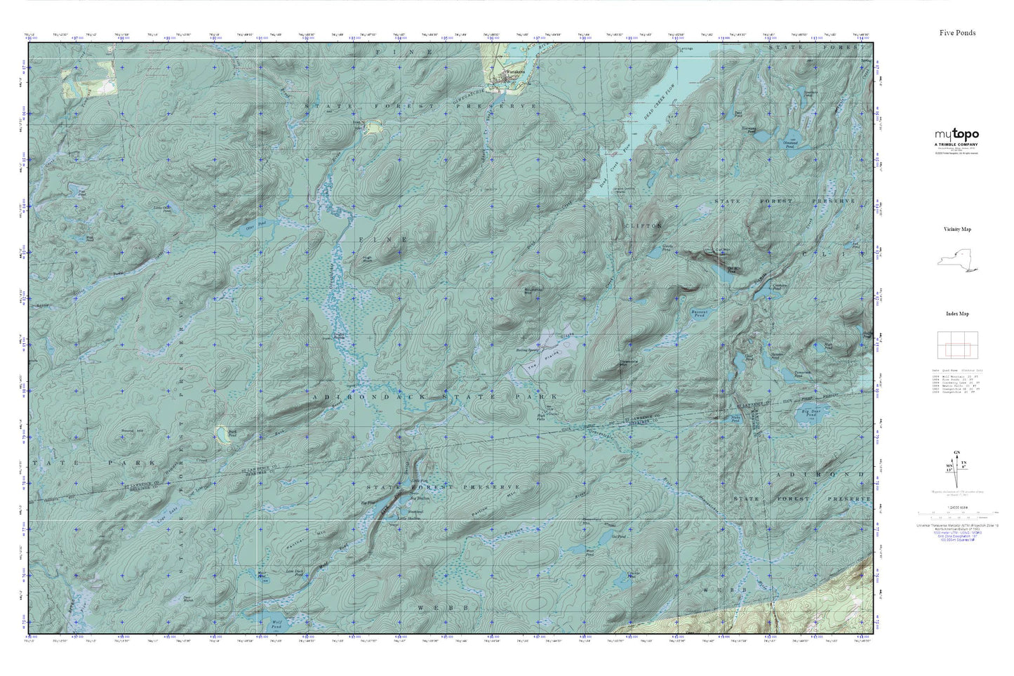
Topographic map of Five Ponds in the state of New York. From the MyTopo Explorer Series.
This topo map features shaded relief and comes with UTM / MGRS and Latitude/Longitude grids.
For more than two decades, MyTopo has provided maps to the most adventurous among us.. those who love to explore our nation’s remote wilderness areas, climb our highest peaks, and trek across our vast public lands. This map is part of a curated collection of the most popular places for which MyTopo customers have designed maps. It is a “bucket list” of the most amazing places to hike, hunt, and explore.
This map contains the following named places: 13690,13695,Bassout Pond,Big Five,Big Shallow,Boiling Spring,Buck Brook,Buck Pond,Cage Lake,Cage Lake Outlet,Cat Mountain,Cat Mountain Pond,Cracker Pond,Cranberry Lake,Dead Creek,Dead Creek Flow,Five Ponds,Gal Pond,Glasby Creek,Glasby Pond,Greenfield Mountain,Griffin Rapids,Hammer Creek,High Falls,High Rock,Inlet,Janacks Landing Shelter,Little Five,Little Otter Pond,Little Shallow,Lone Duck Pond,Mud Pond,Muir Pond,Nicks Pond,Otter Pond,Panther Mountain,Partlow Mountain,Pine Pond,Robinson River,Round Hill,Roundtop Mountain,The Plains,Threemile Mountain,Toad Pond,Washbowl,West Pond,Wolf Pond Outlet