MyTopo
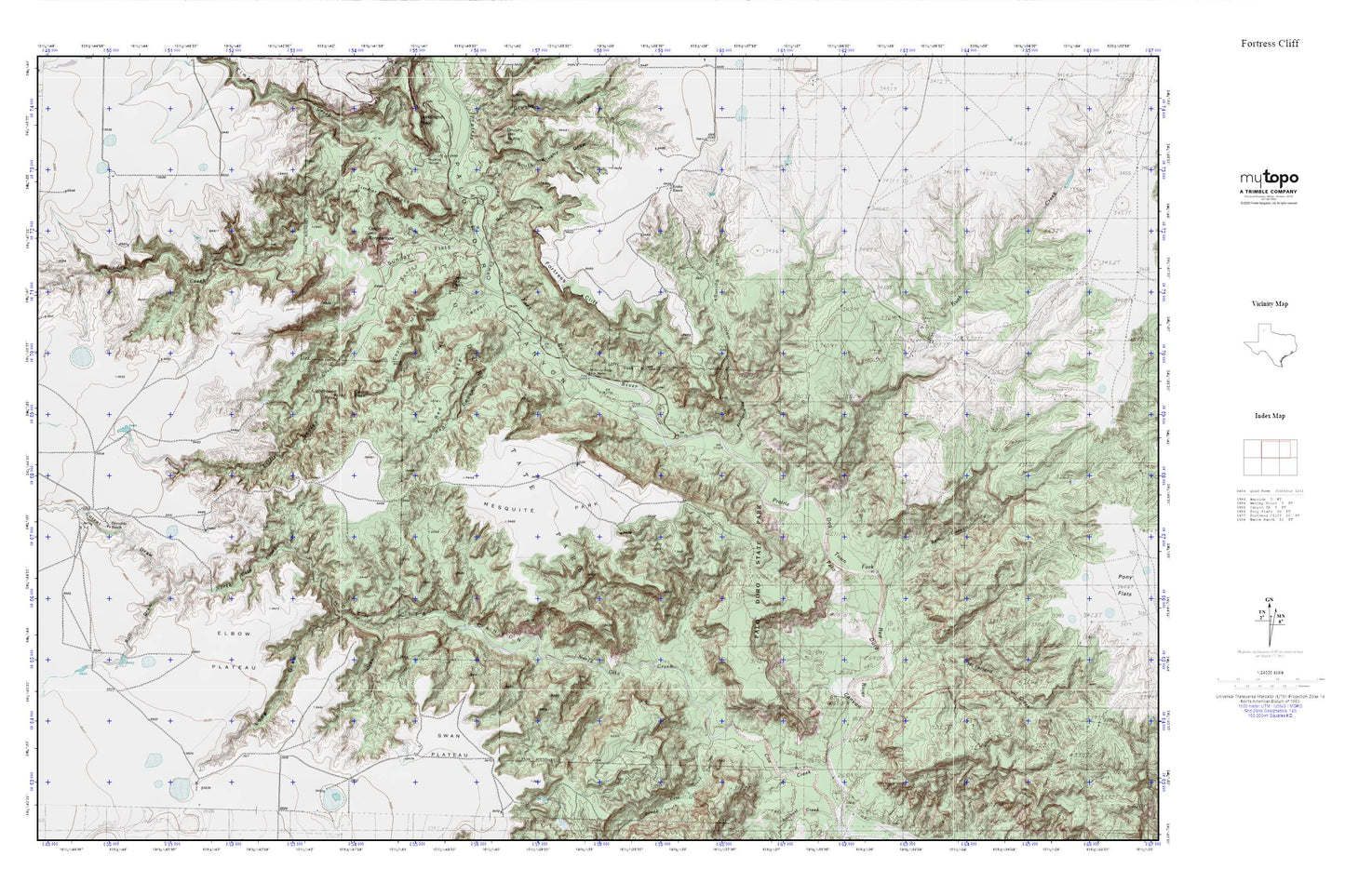
Palo Duro Canyon MyTopo Explorer Series Map
Couldn't load pickup availability
Topographic map of Palo Duro Canyon in the state of Texas. From the MyTopo Explorer Series.
This topo map features shaded relief and comes with UTM / MGRS and Latitude/Longitude grids.
For more than two decades, MyTopo has provided maps to the most adventurous among us.. those who love to explore our nation’s remote wilderness areas, climb our highest peaks, and trek across our vast public lands. This map is part of a curated collection of the most popular places for which MyTopo customers have designed maps. It is a “bucket list” of the most amazing places to hike, hunt, and explore.
This map contains the following named places: Bull Canyon,Bull Draw,Burnt Draw,Capitol Mesa,Capitol Peak,Capitol Peak Canyon,Castle Peak,Corral Draw,Devils Tombstone,Elbow Plateau,Fortress Cliff,Harrell Ranch,Judys Arch,Krahn Ranch,Lighthouse Peak,Little Sunday Creek,Long Draw,Mackenzie Battleground,McFarland Creek,Mesquite Park,North Cita Canyon,North Cita Creek,Palo Duro Canyon State Park Trail,Palo Duro State Park,Pin Draw,Red Canyon,Red Mesa,Reynolds Ranch,Rush Creek,Rustlers Draw,South Brushy Draw,South Cita Canyon,South Cita Creek,Sunday Creek,Sunday Flats,Swan Plateau,Timber Creek,Timber Mesa,Tub Springs,Tub Springs Draw,Woody Draw