MyTopo
Covington Mill MyTopo Explorer Series Map
Couldn't load pickup availability
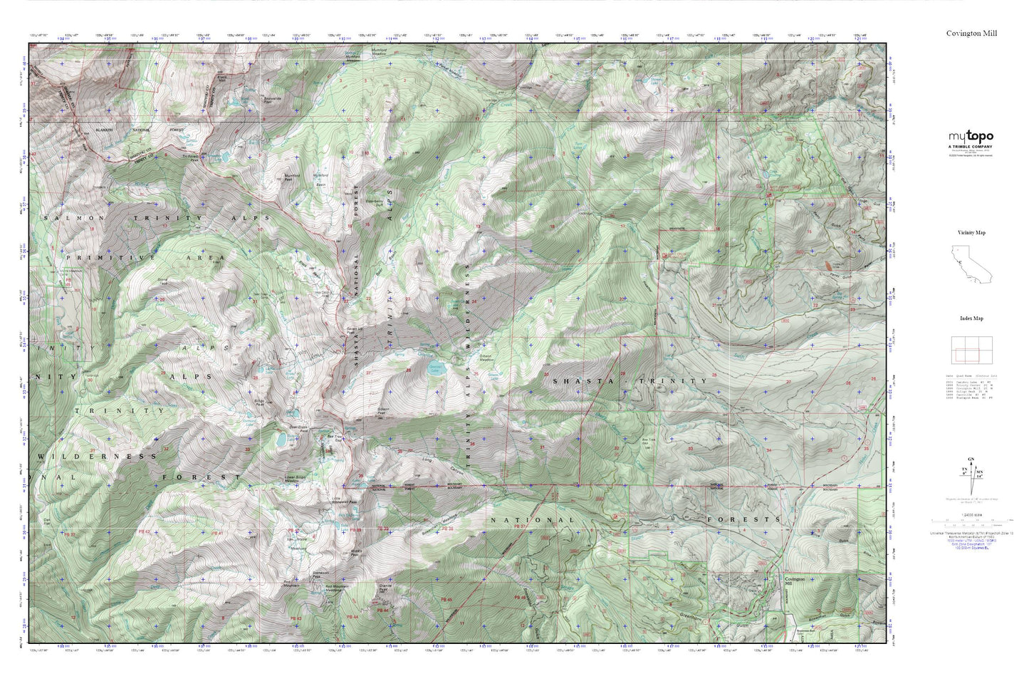
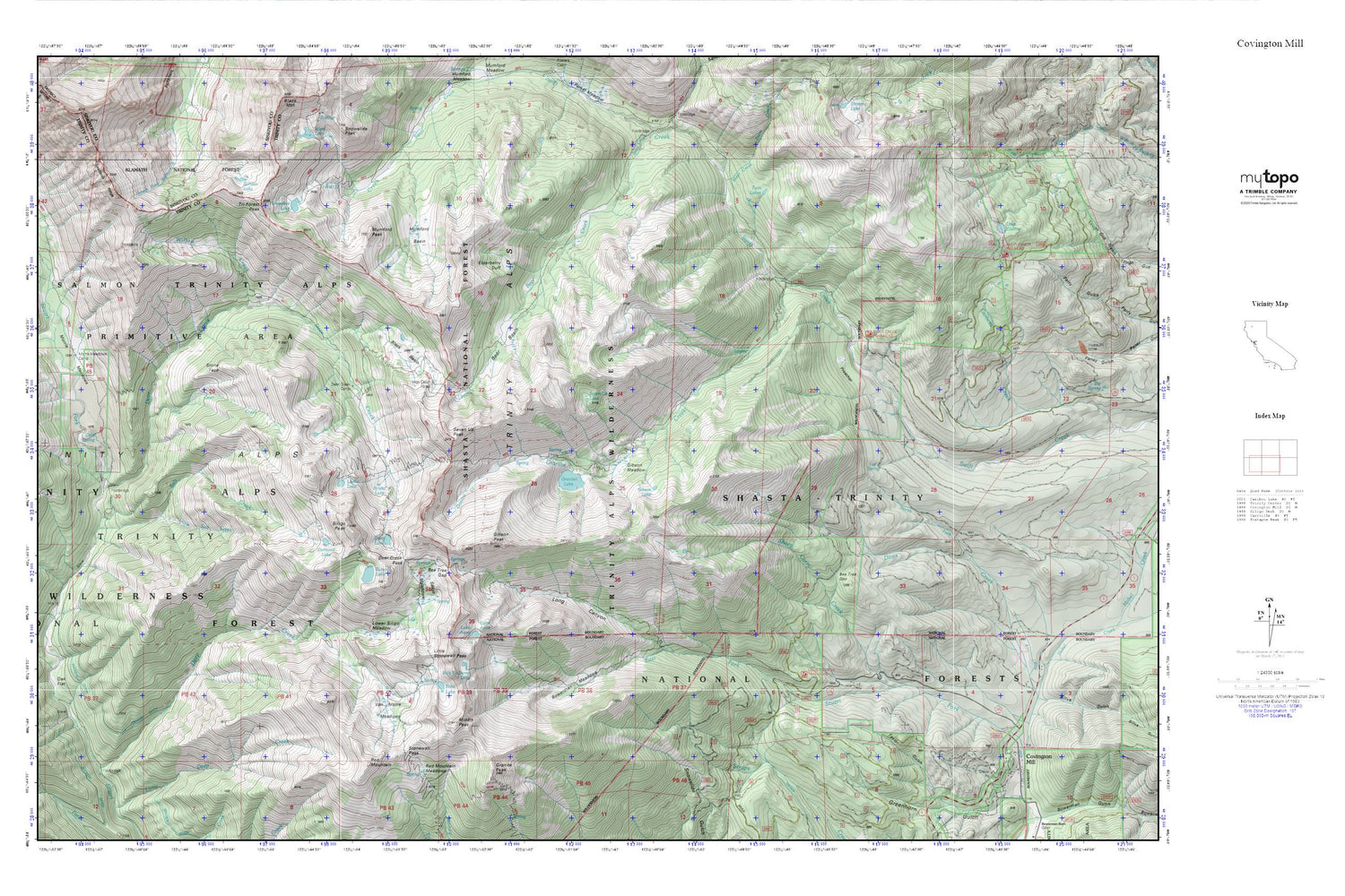
Topographic map of Covington Mill in the state of California. From the MyTopo Explorer Series.
This topo map features shaded relief and comes with UTM / MGRS and Latitude/Longitude grids.
For more than two decades, MyTopo has provided maps to the most adventurous among us.. those who love to explore our nation’s remote wilderness areas, climb our highest peaks, and trek across our vast public lands. This map is part of a curated collection of the most popular places for which MyTopo customers have designed maps. It is a “bucket list” of the most amazing places to hike, hunt, and explore.
This map contains the following named places: Bear Basin,Bear Gap,Bear Gulch,Bee Tree Gap,Billy-Be-Damn Lake,Black Basin,Bowerman Meadows,Buckeye Ditch,Cold Spring,Deep Creek,Deer Creek,Deer Creek Camp,Deer Creek Pass,Deer Lake,Diamond Lake,Echo Lake,Elderberry Duff,Gibson Lake,Gibson Meadow,Gibson Peak,Granite Canyon,Granite Creek,Granite Lake,Granite Peak,Horseshoe Lake,Lake Anna,Little Deer Creek,Little Salt Creek,Little Stonewall Pass,Long Canyon,Long Canyon Trailhead Parking,Longs Cabin,Lower Siligo Meadow,Luella Lake,Middle Peak,Morris Meadows,Morris Meadows Camp,Mumford Basin,Mumford Peak,Nancy Creek,North Fork Davis Creek,Preacher Meadow,Red Mountain,Round Lake,Salmon Lake,Salt Creek,Seven Up Lake,Seven Up Peak,Sheep Corral Creek,Siligo Meadows,Siligo Peak,Steer Creek,Stone Face,Stonewall Pass,Summit Lake,Tri-Forest Peak,Twin Lakes,Van Matre Meadows,Weaverville Division,Willow Creek