
MyTopo
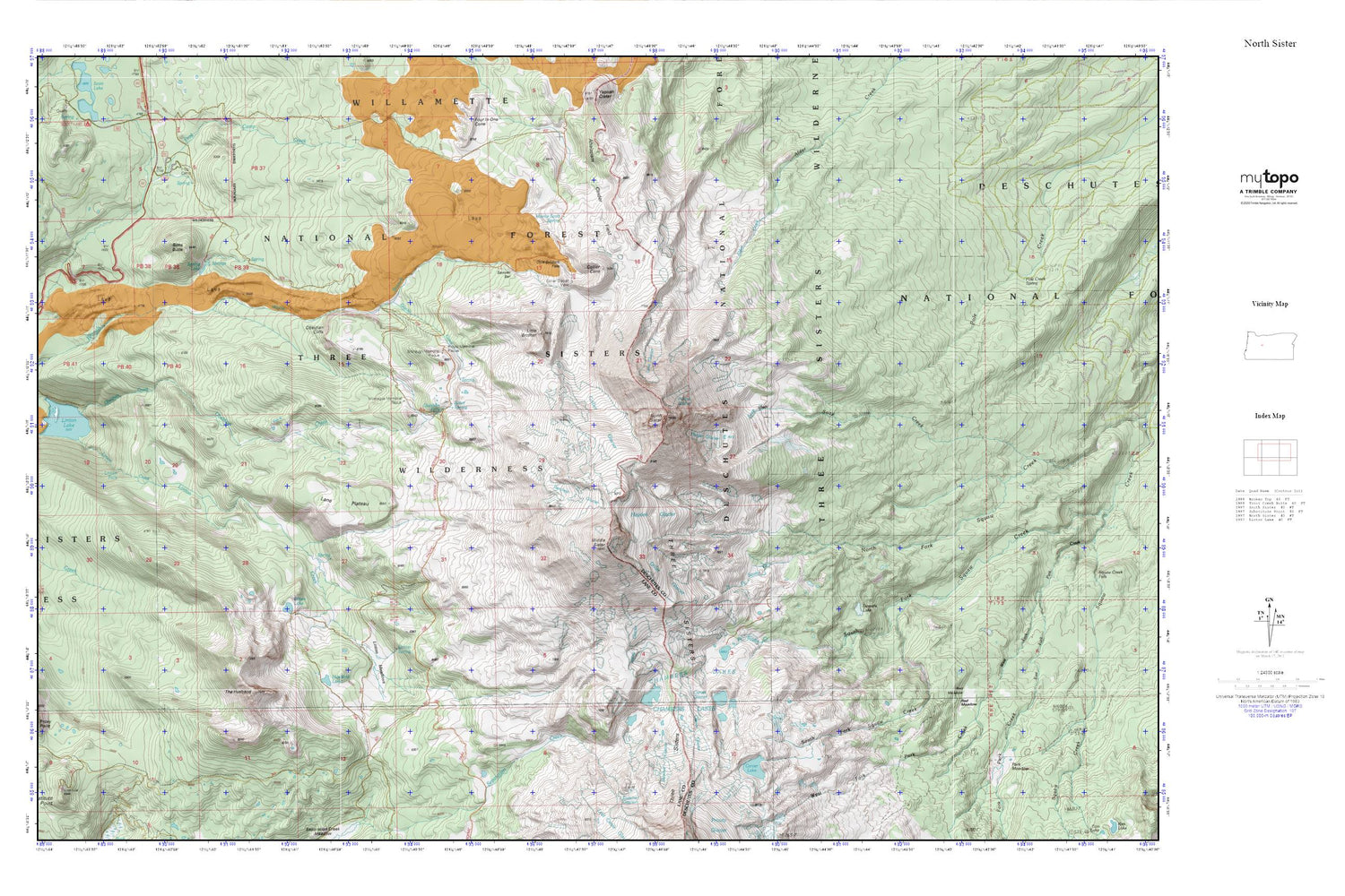
North Sister MyTopo Explorer Series Map
Couldn't load pickup availability
Topographic map of North Sister in the state of Oregon. From the MyTopo Explorer Series.
This topo map features shaded relief and comes with UTM / MGRS and Latitude/Longitude grids.
For more than two decades, MyTopo has provided maps to the most adventurous among us.. those who love to explore our nation’s remote wilderness areas, climb our highest peaks, and trek across our vast public lands. This map is part of a curated collection of the most popular places for which MyTopo customers have designed maps. It is a “bucket list” of the most amazing places to hike, hunt, and explore.
This map contains the following named places: Ahalapam Cinder Field,Bronaugh Memorial Plaque,Camp Lake,Carver Glacier,Carver Lake,Chambers Lakes,Collier Cone,Collier Glacier,Collier Glacier View,Demaris Lake,Diller Glacier,Eileen Lake,Frazier Upland,Frog Camp,Glacier Creek,Glacier Way,Hayden Glacier,Husband Lake,Irving Glacier,Lane Plateau,Linn Glacier,Linton Creek,Linton Falls,Linton Meadows,Linton Spring,Little Brother,Middle Sister,Minnie Scott Spring,Montague Memorial Plaque,North Sister,Obsidian Cliffs,Obsidian Falls,Obsidian Trail,Opie Dilldock Pass,Prouty Memorial Plaque,Red Meadow,Reese Lake,Renfrew Glacier,Sawyer Bar,Sims Butte,Sister Spring,Skinner Glacier,Spring Lake,Thayer Glacier,The Husband,Villard Glacier


