MyTopo
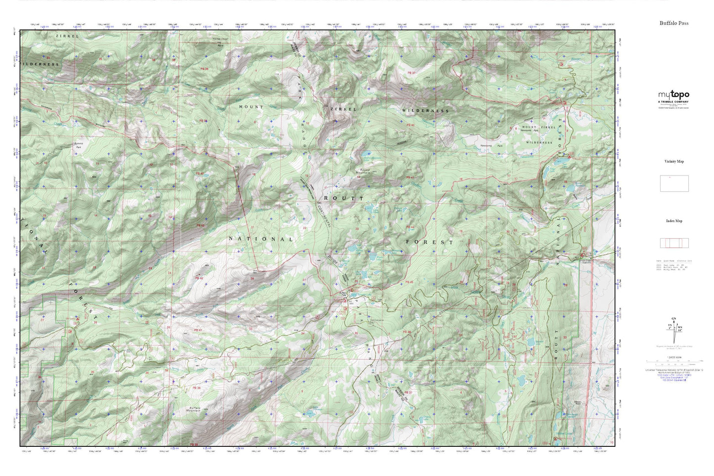
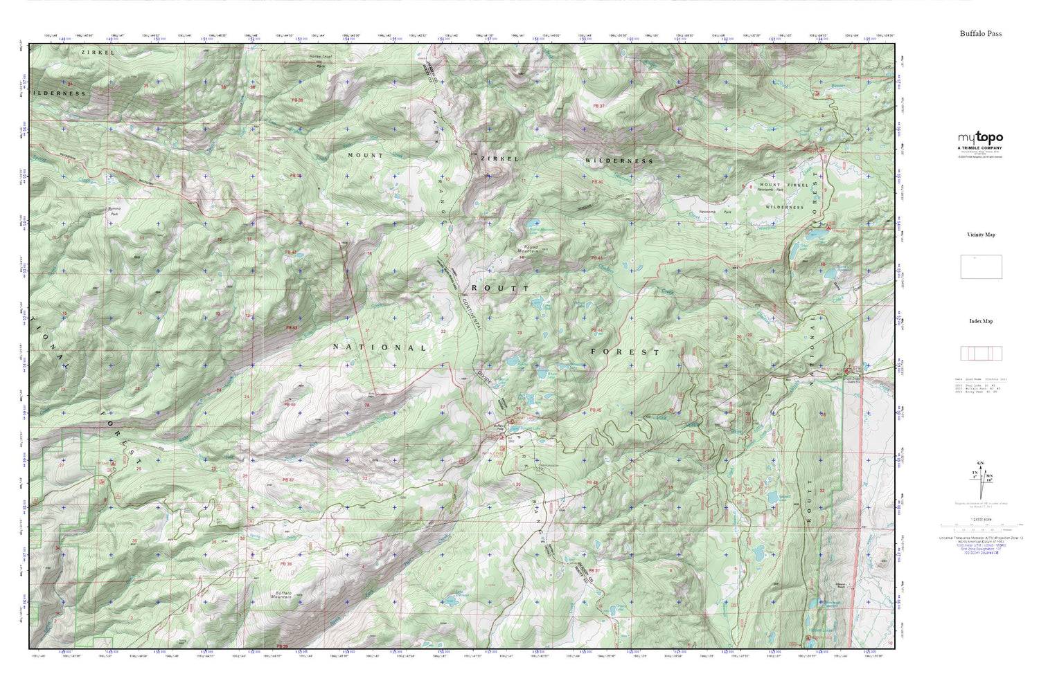
Buffalo Pass MyTopo Explorer Series Map
Couldn't load pickup availability
Topographic map of Buffalo Pass in the state of Colorado. From the MyTopo Explorer Series.
This topo map features shaded relief and comes with UTM / MGRS and Latitude/Longitude grids.
For more than two decades, MyTopo has provided maps to the most adventurous among us.. those who love to explore our nation’s remote wilderness areas, climb our highest peaks, and trek across our vast public lands. This map is part of a curated collection of the most popular places for which MyTopo customers have designed maps. It is a “bucket list” of the most amazing places to hike, hunt, and explore.
This map contains the following named places: Buffalo Mountain,Buffalo Pass,Dry Lake Campground,East Branch South Fork Mad Creek,George Lake,Jonah Lake,Lake Albert,Lake Dinosaur,Martha Lake,Newcomb Creek Trail,Newcomb Park,Round Mountain,Round Mountain Lake,Routt National Forest,Sawmill Creek,Shoestring Lake,Soda Creek Mine,Soda Mountain,South Fork Soda Creek,South Fork Soda Creek Mine,Summit Lake,Summit Lake Campground,Summit Lake Guard Station,Summit Park,Victoria Lake,Whale Lake