MyTopo
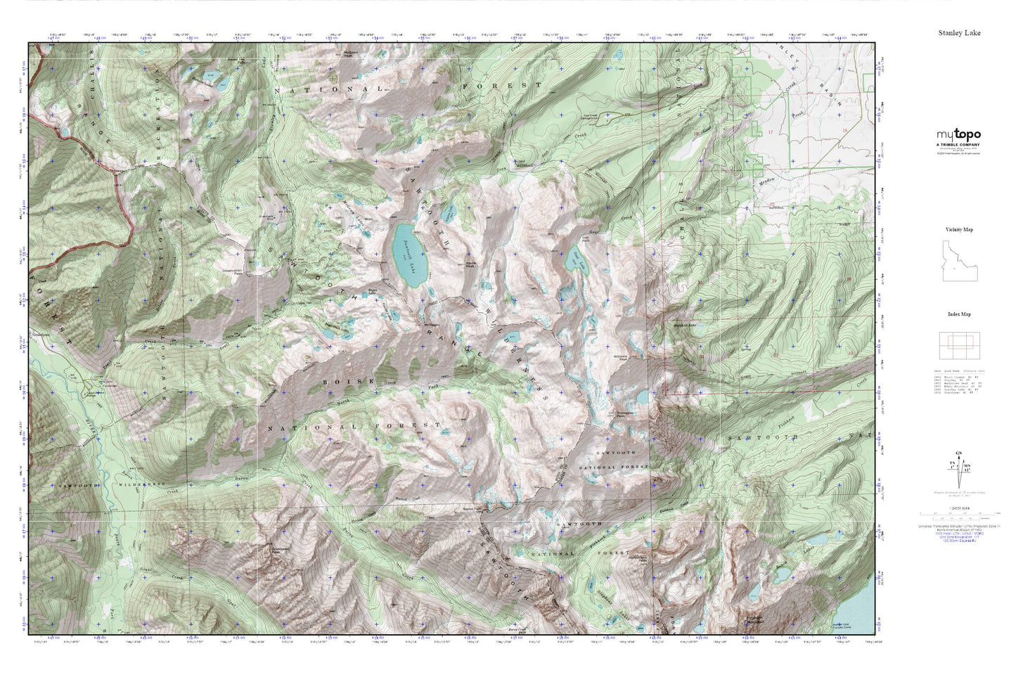
Stanley Lake MyTopo Explorer Series Map
Couldn't load pickup availability
Topographic map of Stanley Lake in the state of Idaho. From the MyTopo Explorer Series.
This topo map features shaded relief and comes with UTM / MGRS and Latitude/Longitude grids.
For more than two decades, MyTopo has provided maps to the most adventurous among us.. those who love to explore our nation’s remote wilderness areas, climb our highest peaks, and trek across our vast public lands. This map is part of a curated collection of the most popular places for which MyTopo customers have designed maps. It is a “bucket list” of the most amazing places to hike, hunt, and explore.
This map contains the following named places: Alpine Lake,Alpine Peak,Baron Creek,Baron Peak,Goat Creek,Goat Falls,Goat Lake,Grandjean Campground,Grandjean Creek,Grandjean Peak,Greenback Mine,Horstmann Peak,Iron Creek Campground,Marshall Lake,McGown Lakes,Moolack Creek,Mount Regan,North Fork Baron Creek,Observation Peak,Regan Lake,Sawtooth Lake,Sawtooth Range,Silver Creek,Thompson Peak,Trail Creek,Trail Creek Lakes,Trailer Lakes,Williams Peak