MyTopo
He Devil MyTopo Explorer Series Map
Couldn't load pickup availability
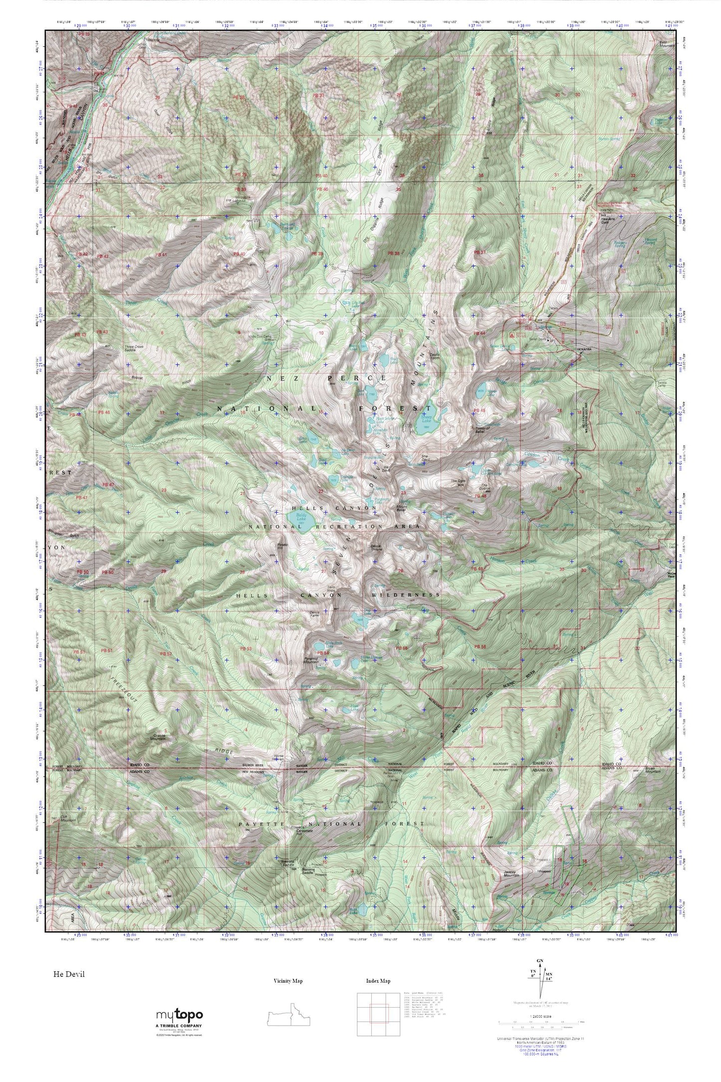
Topographic map of He Devil in the state of Idaho. From the MyTopo Explorer Series.
This topo map features shaded relief and comes with UTM / MGRS and Latitude/Longitude grids.
For more than two decades, MyTopo has provided maps to the most adventurous among us.. those who love to explore our nation’s remote wilderness areas, climb our highest peaks, and trek across our vast public lands. This map is part of a curated collection of the most popular places for which MyTopo customers have designed maps. It is a “bucket list” of the most amazing places to hike, hunt, and explore.
This map contains the following named places: Anchor Creek,Appendix Lake,Baldy Lake,Basin Lake,Bobcat Ridge,Carbonate Hill,Devils Farm,Devils Throne,Devils Tooth,Dog Creek,Dog Lake,Dry Diggins Lookout,Dry Diggins Ridge,Echo Lake,Fall Creek,Freezeout Ridge,Gem Lake,Goat Ridge,Granite Mountain,Haas Lake,Hanson Lakes,He Devil,He Devil Lake,Heavens Gate,Heavens Gate Trail,Hibbs Cow Camp,Horse Heaven,Horse Heaven Lake,Indian Trail Ridge,Lily Pad Lake,Lower Cannon Lake,Middle Ridge,Mill Creek,Mirror Lake,Mount Belial,Old Boise Trail,Oxbow Creek,Potato Hill,Purgatory Lake,Pyramid Mountain,Quad Lake,Rankin Mill,Rock Island Lake,Seven Devils Campground,Seven Devils Guard Station,Seven Devils Lake,Seven Devils Mountains,Seven Devils Recreation Site,She Devil,Sheep Lake,Shelf Lake,Slide Rock Lake,The Goblin,The Ogre,Tower of Babel,Triangle Lake,Twin Imps,Two Creek,Upper Cannon Lake,Vista Point Lookout,Windy Saddle Campground