MyTopo
Dolores Peak MyTopo Explorer Series Map
Couldn't load pickup availability
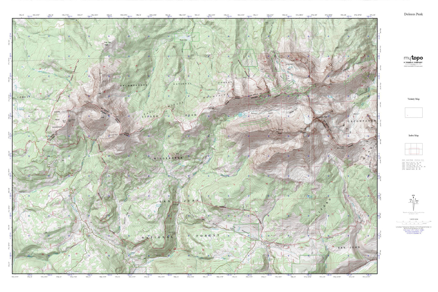
Topographic map of Dolores Peak in the state of Colorado. From the MyTopo Explorer Series.
This topo map features shaded relief and comes with UTM / MGRS and Latitude/Longitude grids.
For more than two decades, MyTopo has provided maps to the most adventurous among us.. those who love to explore our nation’s remote wilderness areas, climb our highest peaks, and trek across our vast public lands. This map is part of a curated collection of the most popular places for which MyTopo customers have designed maps. It is a “bucket list” of the most amazing places to hike, hunt, and explore.
This map contains the following named places: Boskoff Peak,Burro Bridge,Burro Bridge Campground,Cold Reservoir,Cross Mountain Trail,Dolores Peak,Dunn Peak,El Diente Peak,Fowler Peak,Gladstone Peak,Ground Hog Stock Driveway,Groundhog Stock Driveway,Kilpacker Creek,Kilpacker Trail,Lizard Head Wilderness,Meadow Creek,Middle Peak,Morgan Camp,Morrison Creek,Mount Wilson,Navajo Basin,Navajo Lake,Navajo Lake Trail,Navajo Lake Trailhead,Nelson Reservoir,Owen Lake,Rock of Ages Mine,San Miguel Mountains,Silver Pick Basin,Silver Pick Mill,Silver Pick Mine,Special Session Mine,Synopsis Mine,The Meadows,Tom Akin Reservoir,Wilson Peak,Wood Lake Trail,Woods Lake Trail