MyTopo
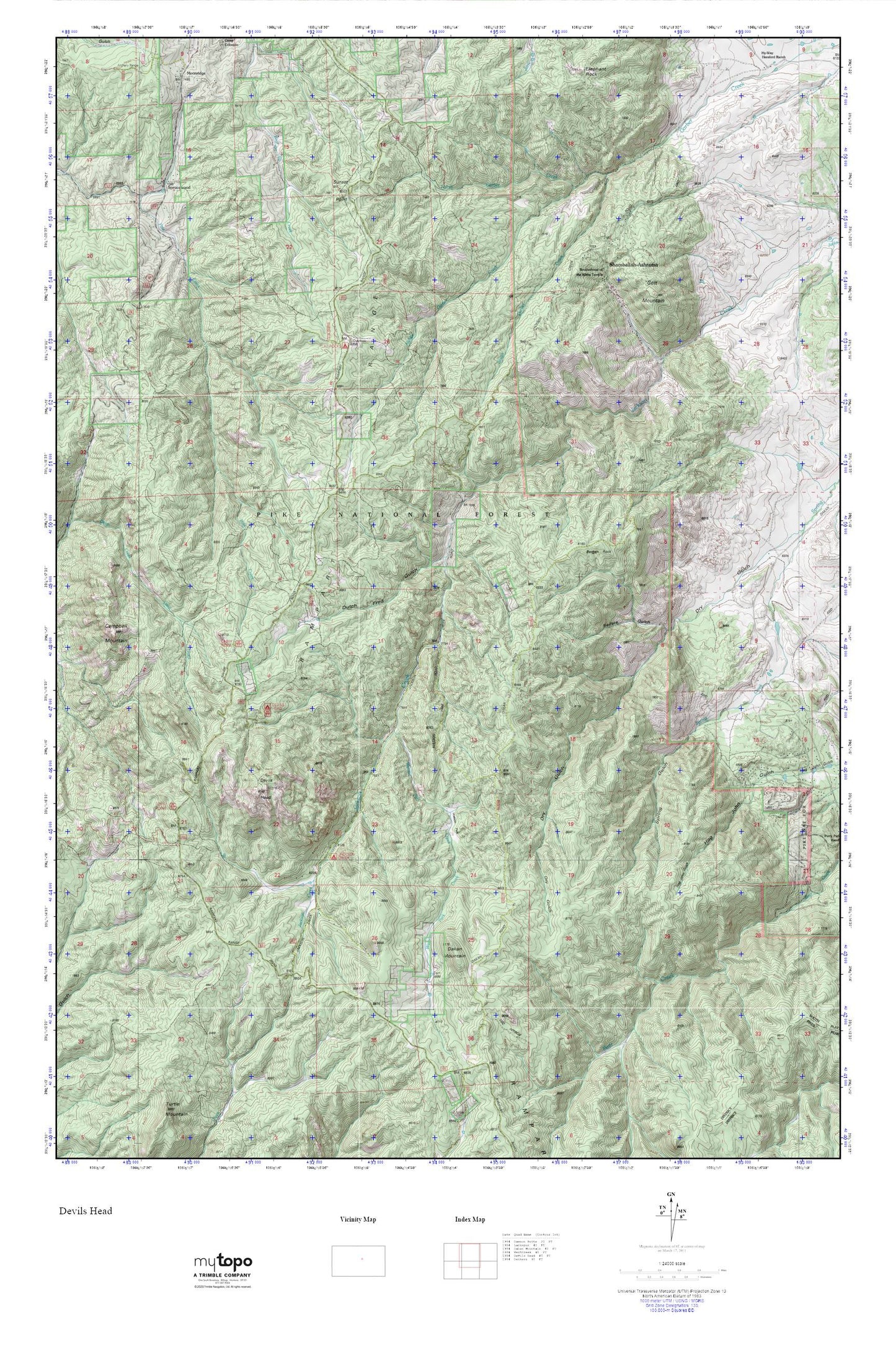
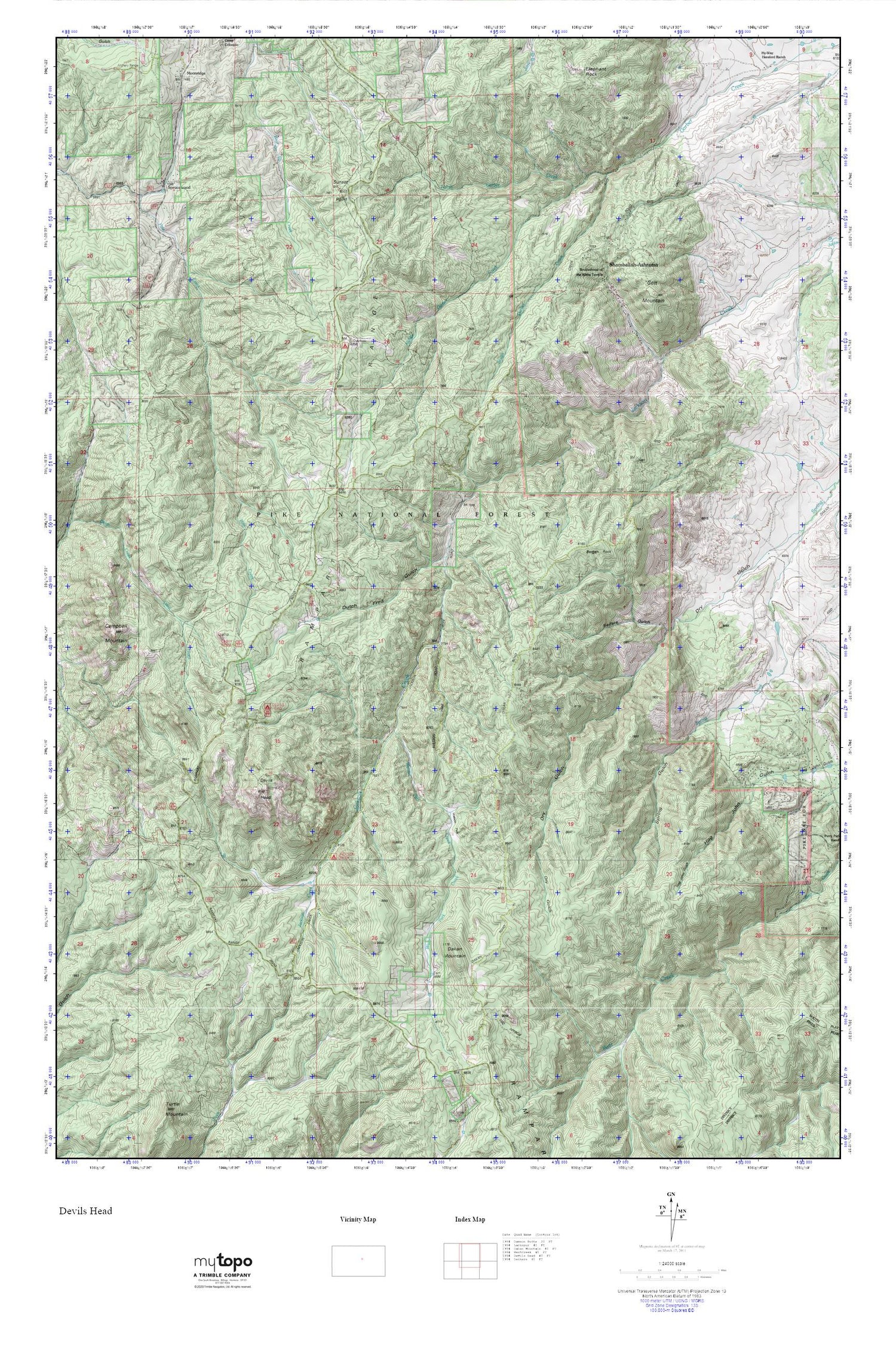
Devils Head MyTopo Explorer Series Map
Couldn't load pickup availability
Topographic map of Devils Head in the state of Colorado. From the MyTopo Explorer Series.
This topo map features shaded relief and comes with UTM / MGRS and Latitude/Longitude grids.
For more than two decades, MyTopo has provided maps to the most adventurous among us.. those who love to explore our nation’s remote wilderness areas, climb our highest peaks, and trek across our vast public lands. This map is part of a curated collection of the most popular places for which MyTopo customers have designed maps. It is a “bucket list” of the most amazing places to hike, hunt, and explore.
This map contains the following named places: B B L B Ranch,Bear Mountain Ranch,Bergen Rock,Bergen Trail,Brotherhood of the White Temple,Cabin Ridge Picnic Area,California Lode Mine,Campbell Mountain,Carolyn Holmberg Preserve at Rock Creek Farm,Colorado Mineral Society Mine,Cramer Number Two Pegmatite Mine,Cramer Pegmatite Mine,Dakan Ditch,Dakan Mountain,Devils Head,Devils Head Campground,Devils Head Copper Mine,Devils Head Lookout,Devils Head Mine,Devils Head Topaz Mine,Dutch Fred Gulch,E-B Ranch,Gott Mountain,Jackson 105 Fire Protection District - Station 141,Little Anna Mine,Middle Garber Creek,Moonridge,North Garber Creek,Pineview Ranch,Rampart Range,Rock Springs Campground,Sedalia Division,Seifers Gulch,Shamballah-Ashrama,Shamballah-Ashrama Census Designated Place,South Garber Creek,Spring Gulch,Sprucewood,Sunset Point,Topaz Point Picnic Area,Virgins Bath Overlook,Watson Park,Watson Park Creek,Watson Park Mine