
MyTopo
Mount Robson MyTopo Explorer Series Map
Couldn't load pickup availability
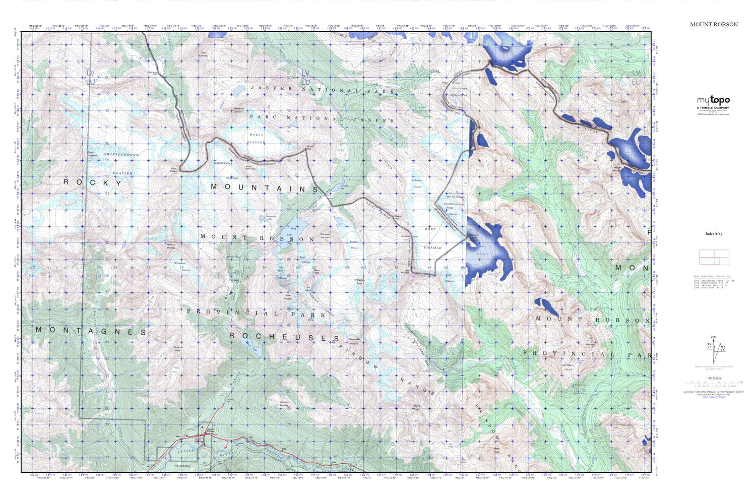
Topographic map of Mount Robson in the Canadian province of British Columbia. From the MyTopo Explorer Series.
This topo map features shaded relief and comes with UTM / MGRS and Latitude/Longitude grids.
For more than two decades, MyTopo has provided maps to the most adventurous among us.. those who love to explore our nation’s remote wilderness areas, climb our highest peaks, and trek across our vast public lands. This map is part of a curated collection of the most popular places for which MyTopo customers have designed maps. It is a “bucket list” of the most amazing places to hike, hunt, and explore.
This map contains the following named places: Berg Glacier,Berg Lake,Campion Mountain,Chushina Ridge,Cinnamon Peak,Emperor Falls,Extinguisher Tower,Falls of the Pool,Hargreaves Glacier,Hargreaves Lake,Kinney Lake,Knowlton Falls,Lazuli Lake,Lynx Mountain,Mist Glacier,Mount Anne-Alice,Mount Kain,Mount Phillips,Mount Robson,Mount Waffl,Mumm Peak,Rainbow Range,Rearguard Mountain,Reef Glaciers,Reef Icefield,Resplendent Mountain,Resplendent Valley,Robson Cirque,Robson Glacier,Robson Pass,Snowbird Pass,Steppe Glacier,Swiftcurrent Glacier,Tatei Ridge,The Dome,The Helmet,Titkana Peak,Valley of a Thousand Falls,White Falls,Whitehorn Glacier,Whitehorn Mountain


