
MyTopo
Flat Tops Wilderness MyTopo Explorer Series Map
Couldn't load pickup availability
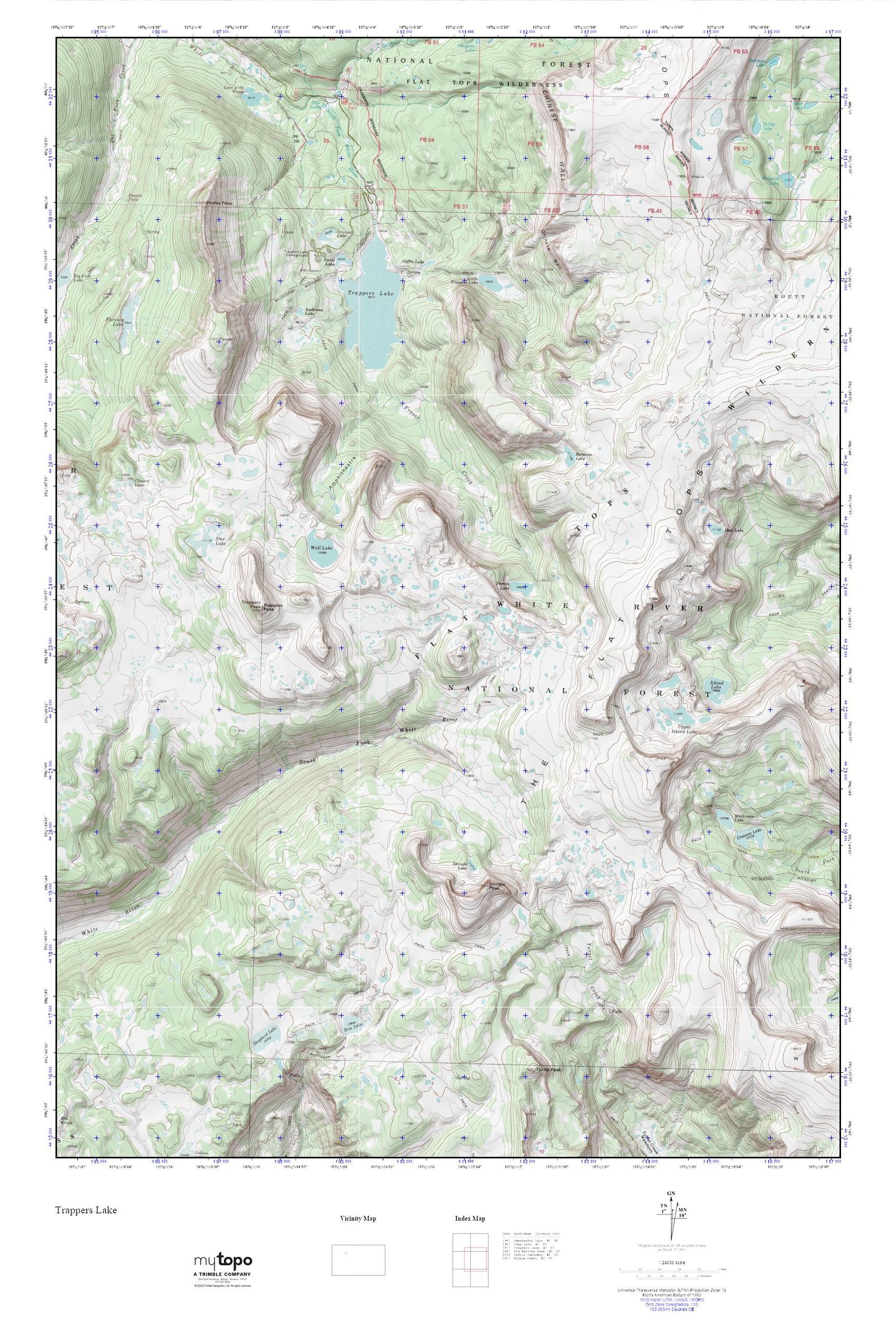
Topographic map of Flat Tops Wilderness in the state of Colorado. From the MyTopo Explorer Series.
This topo map features shaded relief and comes with UTM / MGRS and Latitude/Longitude grids.
For more than two decades, MyTopo has provided maps to the most adventurous among us.. those who love to explore our nation’s remote wilderness areas, climb our highest peaks, and trek across our vast public lands. This map is part of a curated collection of the most popular places for which MyTopo customers have designed maps. It is a “bucket list” of the most amazing places to hike, hunt, and explore.
This map contains the following named places: Amphitheatre,Anderson Lake,Blue Lake,Bucks Campground,Clinard Lake,Coffin Lake,Crescent Lake,Crescent Lake Number 1 Dam,Crescent Lake Number 2,Crescent Lake Number 2 Dam,Cutthroat Campground,Deer Lake,Flat Tops Wilderness,Florence Lake,Fraser Creek,Himes Peak,Island Lake,Lake of the Woods,Lake of the Woods Dam,Little Trappers Lake,Mackinaw Lake,McGinnis Meadows Reservoir Dam,McGinnis Reservoir,Mosquito Lake,Parvin Lake,Rim Lake,Scotts Bay Trailhead,Scotts Lake,Scotts Lake Trailhead,Shepherd Lake,Shepherds Rim Campground,Shingle Lake,Shingle Peak,Skillet Lake,Skinny Fish Creek,Skinny Fish Trailhead,Star Lake,Surprise Lake,Trapline Campground,Trappers Lake,Trappers Lake Campground,Trappers Outlet Trailhead,Trappers Peak,Upper Island Lake,Wall Lake,Wall Lake Trailhead


