MyTopo
Dunckley Pass MyTopo Explorer Series Map
Couldn't load pickup availability
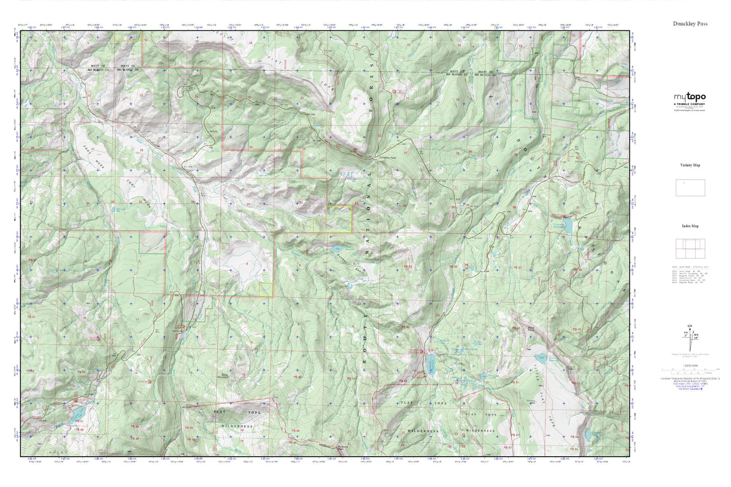
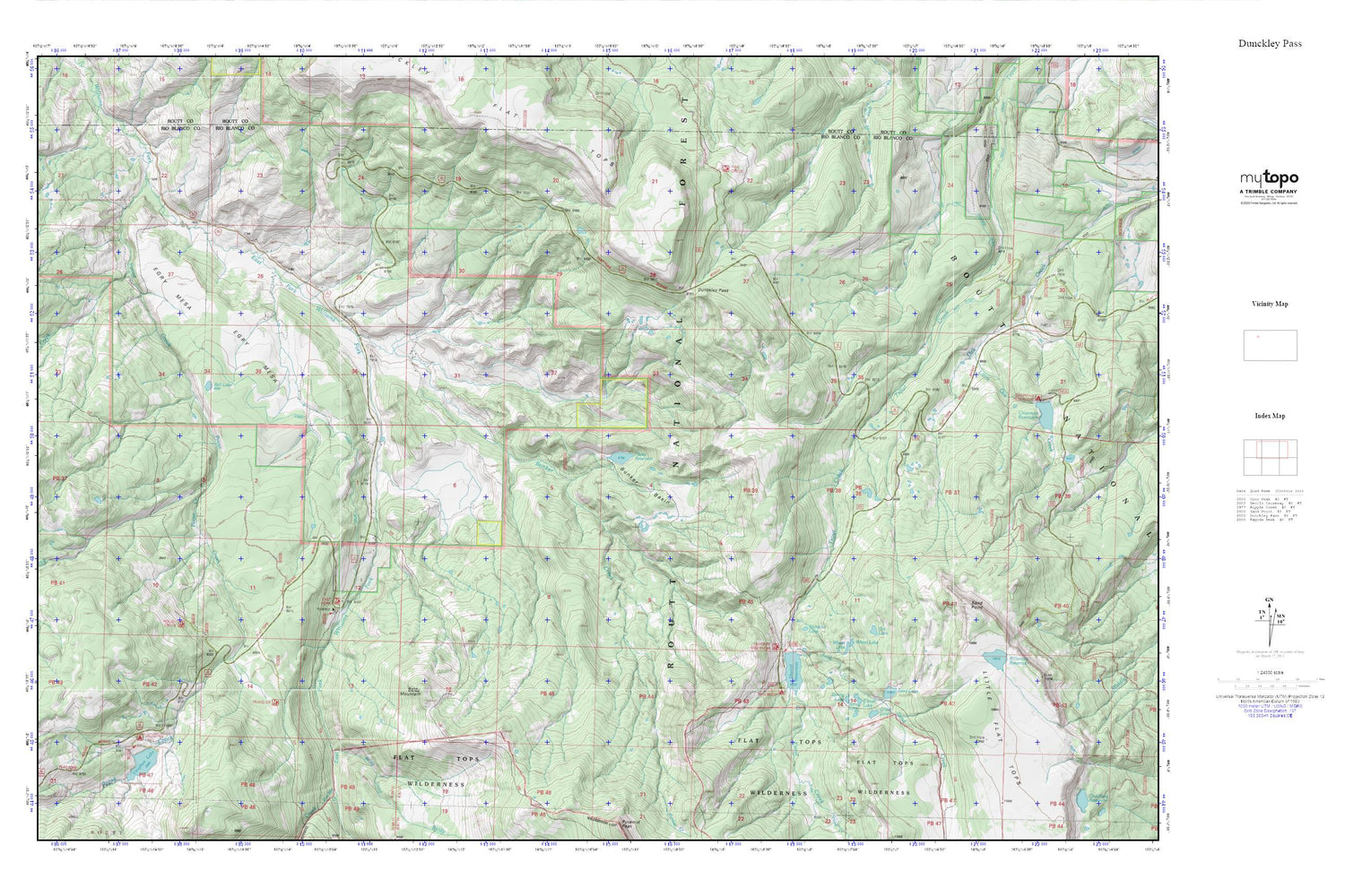
Topographic map of Dunckley Pass in the state of Colorado. From the MyTopo Explorer Series.
This topo map features shaded relief and comes with UTM / MGRS and Latitude/Longitude grids.
For more than two decades, MyTopo has provided maps to the most adventurous among us.. those who love to explore our nation’s remote wilderness areas, climb our highest peaks, and trek across our vast public lands. This map is part of a curated collection of the most popular places for which MyTopo customers have designed maps. It is a “bucket list” of the most amazing places to hike, hunt, and explore.
This map contains the following named places: Baldy Creek,Baldy Mountain,Ball Lake,Baughn Lake Campground,Bunker Basin,Bunker Creek,Bunker Lake Dam,Camel Lake,Crater Lake,Cyclone Creek,Dunckley Flat Tops,Dunckley Pass,Egry Mesa,Egry Mesa Ditch,Gill Reservoir,Gill Reservoir Dam,Haley Dam,Haley Reservoir,Killarney Reservoir,Little Oak Creek,Oat Lake,Poose Creek,Poose Creek Dam,Pyramid Guard Station,Rainbow Lake,Rough Creek,Sand Creek,Sand Lake,Sand Point,Sheriff Dam,Sheriff Reservoir,Spring Lake,Vaughan Lake,Wheat Lake,Yellowjacket Pass