MyTopo
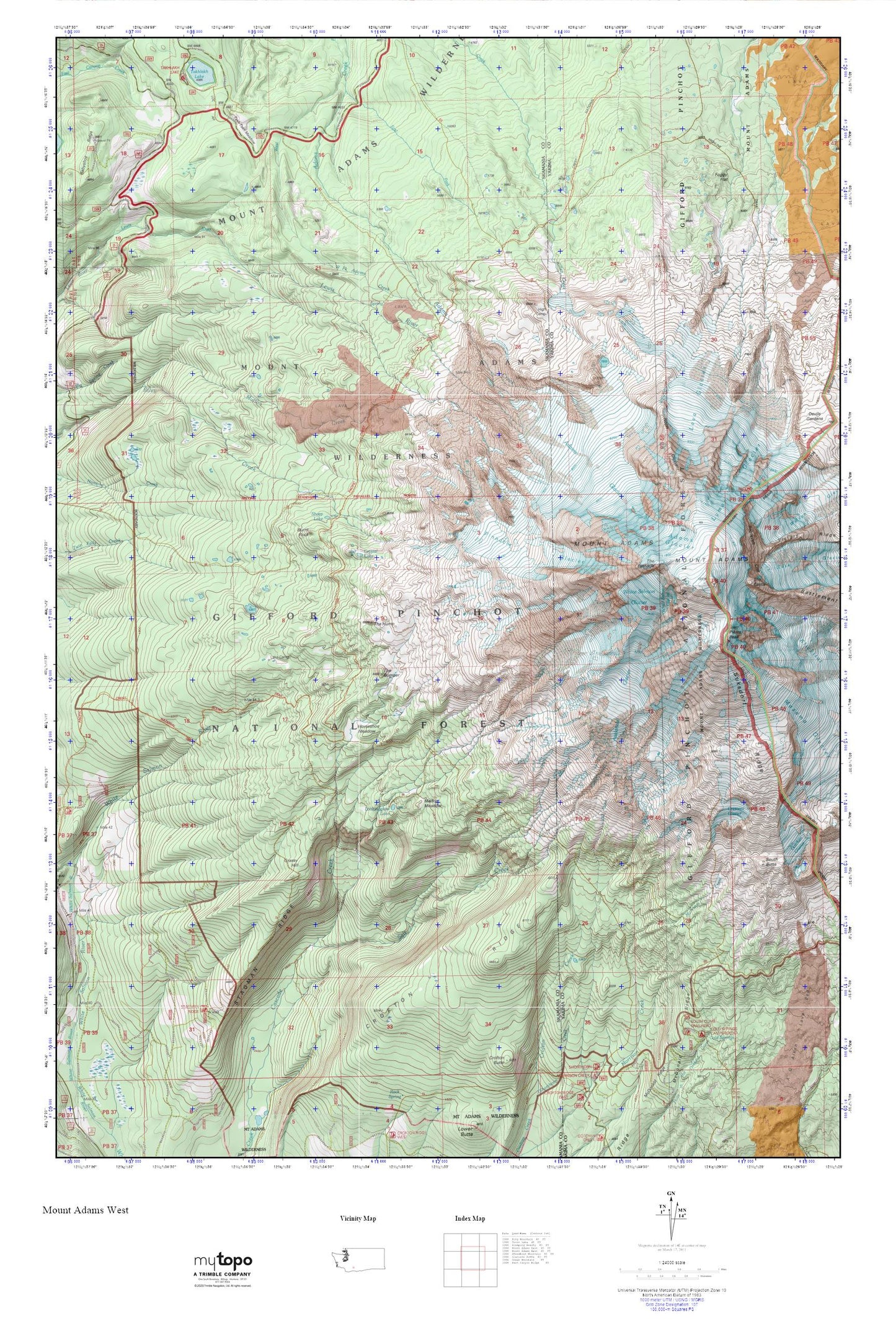
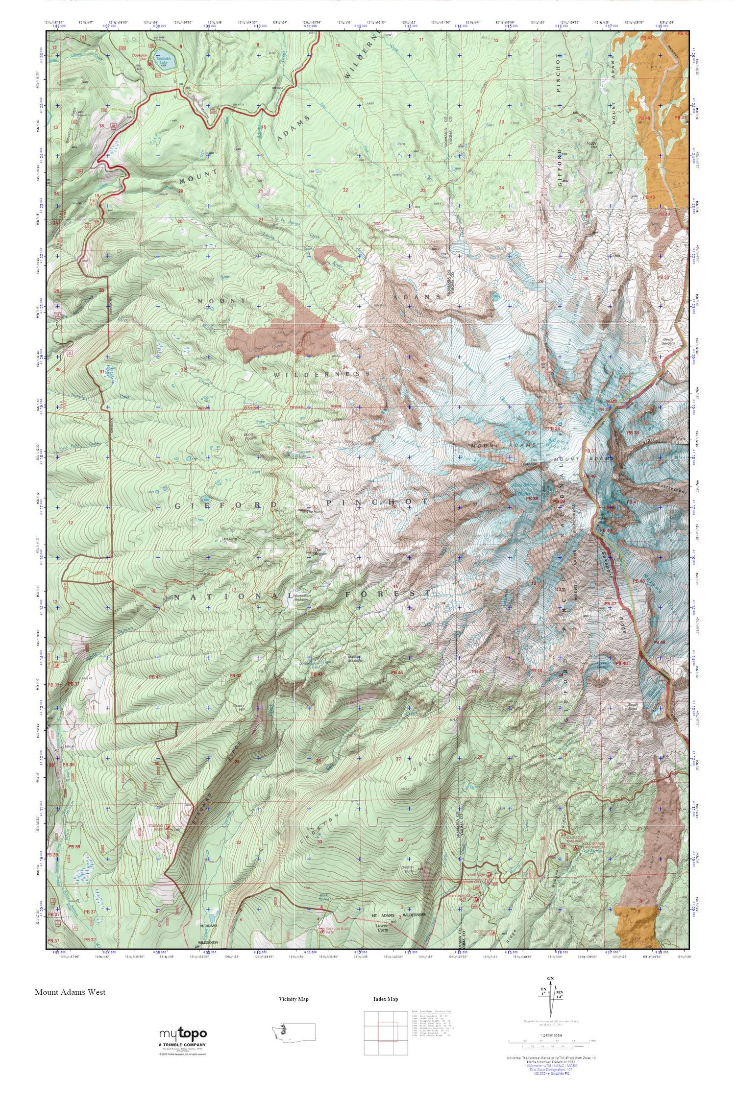
Mount Adams West MyTopo Explorer Series Map
Couldn't load pickup availability
Topographic map of Mount Adams West in the state of Washington. From the MyTopo Explorer Series.
This topo map features shaded relief and comes with UTM / MGRS and Latitude/Longitude grids.
For more than two decades, MyTopo has provided maps to the most adventurous among us.. those who love to explore our nation’s remote wilderness areas, climb our highest peaks, and trek across our vast public lands. This map is part of a curated collection of the most popular places for which MyTopo customers have designed maps. It is a “bucket list” of the most amazing places to hike, hunt, and explore.
This map contains the following named places: Adams Glacier,Avalanche Glacier,Bottle Camp,Burnt Rock,Cold Springs,Cold Springs Campground,Crescent Glacier,Crofton Ridge,Crystal Lake,Divide Camp,Divide Camp Trail,Dry Lake Camp,East Fork Adams Creek,Foggy Flat,Grassy Hill,Graveyard Camp,High Camp,Highline Trail,Horseshoe Meadow,Lake Camp,Lava Glacier,Lookingglass Lake,Madcat Meadow,McDonald Ridge,Meadow Camp,Mount Adams,Mount Adams Wilderness,Mutton Creek,North Cleaver,Pikers Peak,Pinnacle Glacier,Riley Camp,Round the Mountain Trail,Salt Creek,Sheep Lake,Sled Camp,Stagman Ridge,Suksdorf Ridge,Takh Takh Meadow,The Bumper,The Hump,The Pinnacle,Timberline Campground,White Salmon Glacier