MyTopo
Mount Goddard MyTopo Explorer Series Map
Couldn't load pickup availability
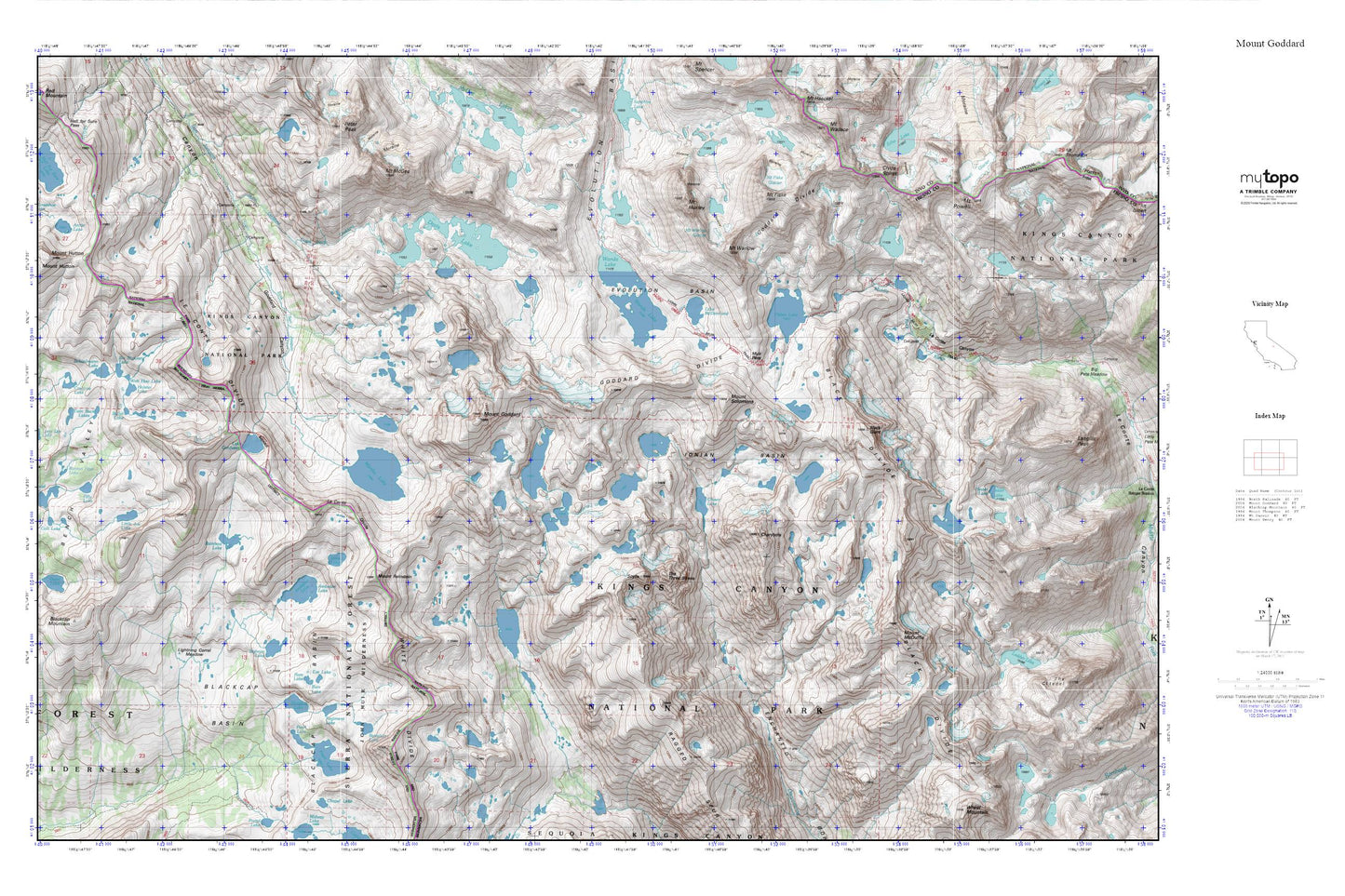
Topographic map of Mount Goddard in the state of California. From the MyTopo Explorer Series.
This topo map features shaded relief and comes with UTM / MGRS and Latitude/Longitude grids.
For more than two decades, MyTopo has provided maps to the most adventurous among us.. those who love to explore our nation’s remote wilderness areas, climb our highest peaks, and trek across our vast public lands. This map is part of a curated collection of the most popular places for which MyTopo customers have designed maps. It is a “bucket list” of the most amazing places to hike, hunt, and explore.
This map contains the following named places: Ambition Lake,Arctic Lake,Battalion Lake,Bench Valley,Bighorn Lake,Black Divide,Black Giant,Blackcap Basin,Blackcap Mountain,Bullet Lake,Charybdis,Clyde Spires,Colt Lake,Crabtree Lake,Davis Lake,Division Lake,Evolution Basin,Ewe Lake,Filly Lake,Goddard Divide,Guest Lake,Helen Lake,Hell for Sure Lake,Hester Lake,Hockey Lakes,Holster Lake,Horseshoe Lake,Ionian Basin,Lake Confusion,Lake McDermand,Le Conte Divide,Lightning Corral Meadow,Little Jo Lake,Lone Doe Lake,Martha Lake,Mount Fiske,Mount Fiske Glacier,Mount Goddard,Mount Hansen,Mount Hutton,Mount Huxley,Mount McDuffie,Mount McGee,Mount Powell,Mount Reinstein,Mount Solomons,Mount Warlow,Mount Warlow Glacier,Muir Pass,North Goddard Creek,Pearl Lake,Powell Glacier,Ragged Spur,Rainbow Lake,Ram Lake,Regiment Lake,Roman Four Lake,Schoolmarm Lake,Scylla,Six Shooter Lake,The Three Sirens,Twin Buck Lakes,Valor Lake,Wah Hoo Lake,Wanda Lake,White Divide