
MyTopo
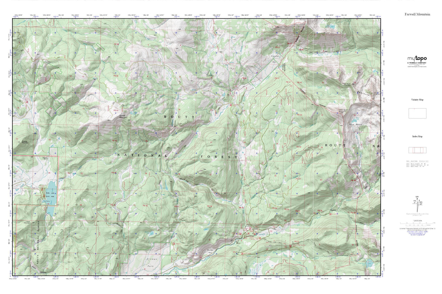
Farwell Mountain MyTopo Explorer Series Map
Couldn't load pickup availability
Topographic map of Farwell Mountain in the state of Colorado. From the MyTopo Explorer Series.
This topo map features shaded relief and comes with UTM / MGRS and Latitude/Longitude grids.
For more than two decades, MyTopo has provided maps to the most adventurous among us.. those who love to explore our nation’s remote wilderness areas, climb our highest peaks, and trek across our vast public lands. This map is part of a curated collection of the most popular places for which MyTopo customers have designed maps. It is a “bucket list” of the most amazing places to hike, hunt, and explore.
This map contains the following named places: Agnes Creek,Bootjack Ranch,Boulder Park,Box Canyon,Campbell Tunnel and Shaft,Coulton Creek Trail,Diamond Park,Emancipation Group,English Creek,Farwell Creek,Farwell Lake,Farwell Mine,Farwell Mountain,Farwell Mountain Northwest Mine,Gold Pan Campground,Grouse Mountain,Hinman Canyon,Hinman Creek Trail,Hinman Lake,Hole-in-Wall Canyon,King Solomon Creek Mine,Lester Creek,Lester Creek Dam,Lester Mountain,Lost Dog Creek,Middle Fork Campground,Middle Fork Elk River,North Fork Elk Creek,North Three Island Creek,Pearl Lake,Pearl Lake State Park,Poverty Bar Campground,Red Dirt Pass,Scott Run,Seedhouse Campground,Seedhouse Guard Station,Stevens Creek,Trail Creek,Zinc Mountain Mine


