MyTopo
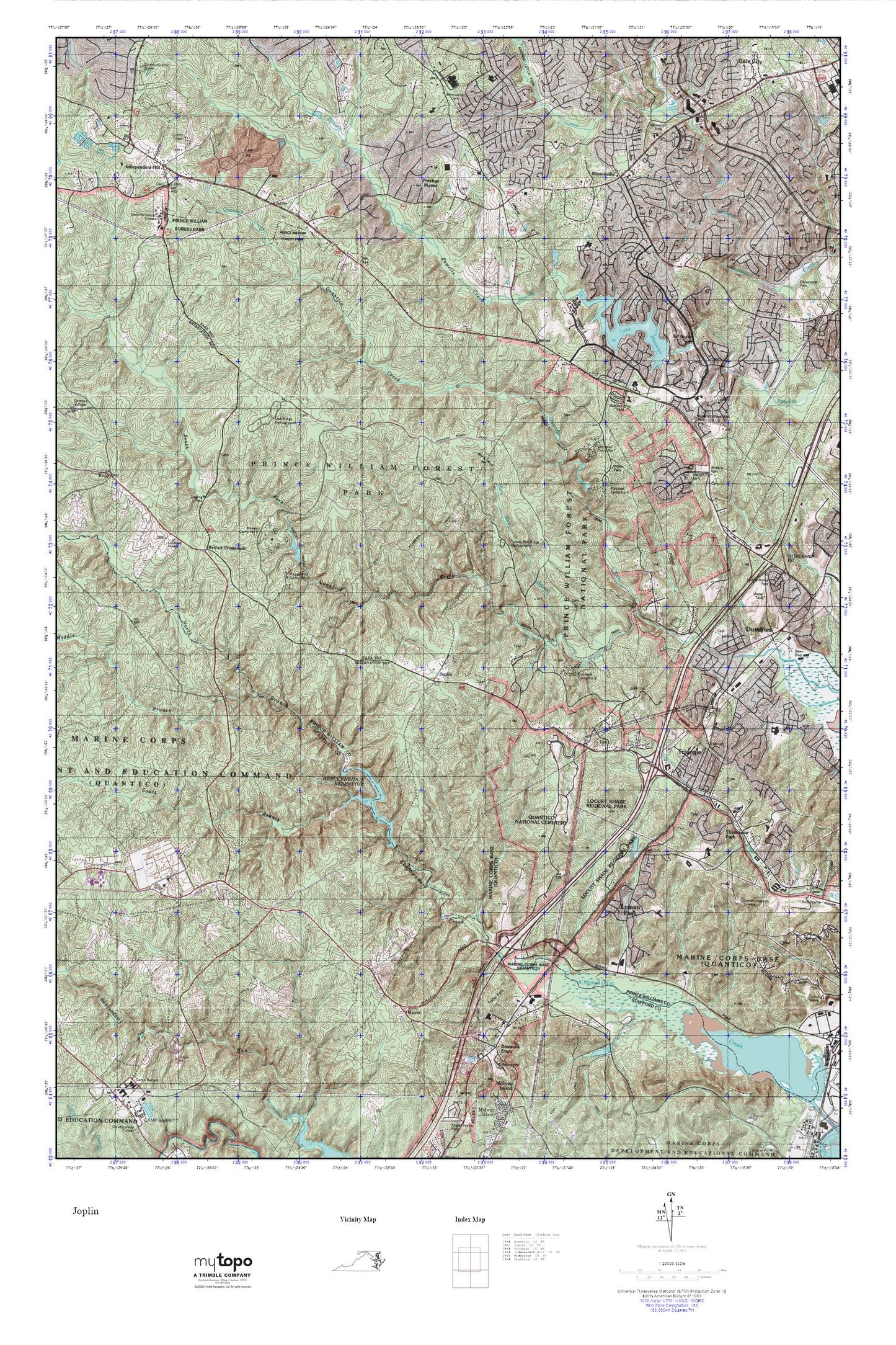
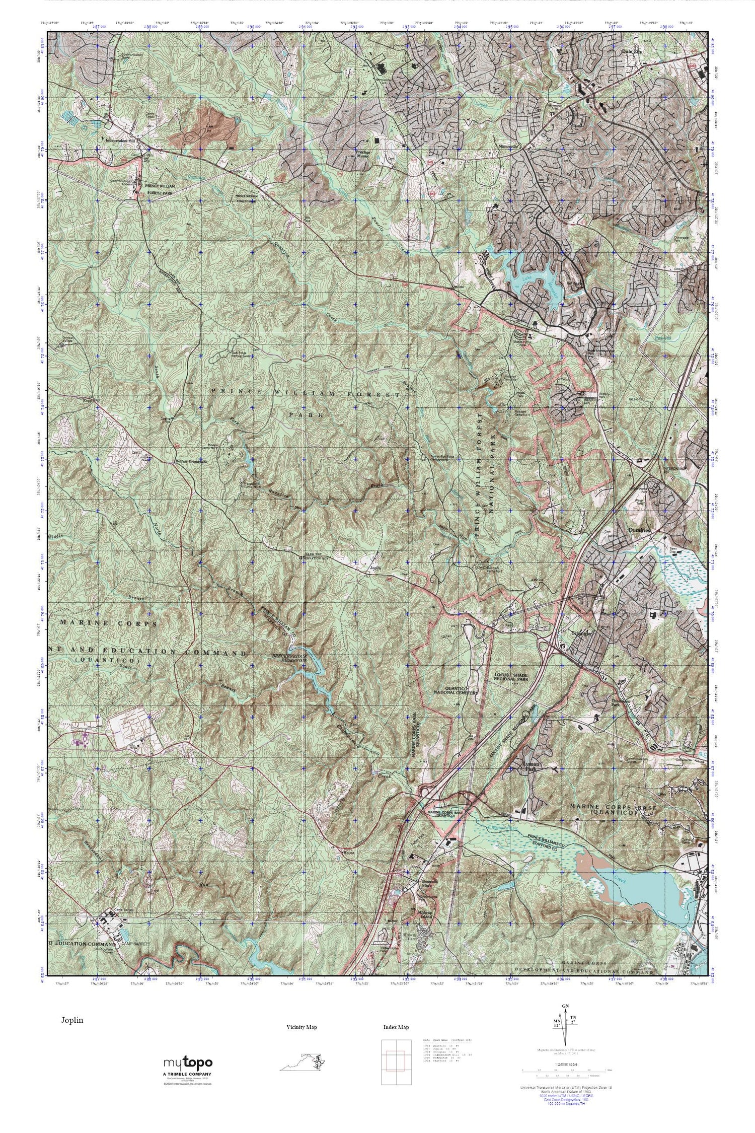
Prince William Forest Park MyTopo Explorer Series Map
Couldn't load pickup availability
Topographic map of Prince William Forest Park in the state of Virginia. From the MyTopo Explorer Series.
This topo map features shaded relief and comes with UTM / MGRS and Latitude/Longitude grids.
For more than two decades, MyTopo has provided maps to the most adventurous among us.. those who love to explore our nation’s remote wilderness areas, climb our highest peaks, and trek across our vast public lands. This map is part of a curated collection of the most popular places for which MyTopo customers have designed maps. It is a “bucket list” of the most amazing places to hike, hunt, and explore.
This map contains the following named places: 22025,22134,22172,22193,A Henderson Elementary School,All Saints' Church,Anne Moncure Wall Park,Ashland Elementary School,Azalea Mobile Home Park,Bel Air Elementary School,Belfair Crossroads,Belle Fair Mill,Birch Bluff Trail,Boswells Store,Breckenridge Reservoir,Breckinridge Dam,C D Hylton High School,Calvin Branch Mine Trail,Camp Barrett,Camp Five Dam,Camp Four Dam,Camp Four Lake,Camp One Dam,Camp One Lake,Camp Three Dam,Camp Three Lake,Captain Branch School,Carters Day Camp Pond,Carters Day Camp Pond Dam,Cathedral Christian Academy,Cecil W Garrison Park,Center Plaza Shopping Center,Central Baptist Church,Chopawamsic,Chopawamsic Backcounty Area,Chopawamsic School,Chopawamsic Trail,Christus Victor Lutheran Church,Church on the Rock Ministries,Clairmont School and Child Care,Cloverdale,Colony Woods,Community Baptist Church,Concordia Lutheran Church,Dale City Census Designated Place,Dale City Mini Library,Dale City Neighborhood Library,Darbydale,Devonshire,Dumfries,Dumfries - Triangle Rescue Squad Station 3R,Dumfries - Triangle Volunteer Fire Department Station 17,Dumfries - Triangle Volunteer Fire Department Station 3F,Dumfries District,Dumfries Elementary School,Dumfries Mini Library,Dumfries Neighborhood Library,Dumfries Plaza Shopping Center,Dumfries Police Department,Dumfries Post Office,Dumfries Public Cemetery,Dumfries Shopping Center,Dumfries Town Hall,Dumfries United Methodist Church,Dumfries-Triangle Rescue Squad,Evansdale,Farms to Forest Trail,Federal Bureau of Investigation Academy,First Mount Zion Baptist Church,First United Presbyterian Church,Forest Greens Golf Club,Forest Hill School,Forest Park High School,Forestdale,Forestdale Plaza Shopping Center,Fritter Park,Glendale Plaza Shopping Center,Goodwill Camp Number 3,Goodwill Historic District,Graham Park Middle School,Grayson Village Mobile Home Park,Greenwood Church,Greenwood Farm Park,Greenwood Primitive Baptist Cemetery,Happyland Camp Five Lake,Happyland Camp Number 5,Hardens Hill Cemetery,Hawison Homestead Park,Hayfield School,Headly Run,Heritage Christian School,Hickory Ridge Trail,High Meadows Trail,Hoadly Run,Holy Family Catholic Church,Holy Family Early Childhood Center,Hunter Run,Independent Hill,Independent Hill Census Designated Place,Independent Hill Neighborhood Library,Independent Hill Park,Independent Hill School,John F Pattie Elementary School,John F Pattie Senior Elementary School,John H Russell Elementary School,Joplin,Kopp,Lake Montclair,Lake Montclair Dam,Laurel Trail Loop,Lichtman Camp Number 1,Lindau Woods,Little Mount Zion School,Little Run Loop,Little Union Church,Locust Shade Park,Logan Park,Lutheran Church of the Covenant,Lyman Park,Manassas Air Force Station,Mary Bird Branch,Mary Bird Branch Trail,Mavel Manor,Mawavi Camp Number 2,Mawavi Historic District,Middle Branch Chopawamsic Creek,Mills E Godwin Middle School,Minnieville,Minnieville Cemetery,Minnieville Estates,Minnieville Manor,Minnieville Manor Park,Minnieville Store,Missouri Mill,Montclair,Montclair Census Designated Place,Montclair Country Club,Montclair Elementary School,Mount,Mount Zion Baptist Church,Neabsco District,Neabsco Elementary School,Neabsco Hills,North Branch Chopawamsic Creek,North Valley Trail,Oak Ridge Campground,Oak Ridge Trail,Old Chopawamsic Church,Pace East School,Pine Grove Forest Trail,Pleasant Camp Number 4,Pleasant Historic District,Posey Store,Prestige Manor,Prince William County Police Animal Control Bureau,Prince William Forest Park,Quantico Falls Trail,Quantico Fire and Emergency Services Station 33,Quantico Middle / High School,Quantico National Cemetery,Richard M Milburn High School,Ridgedale,Saint Francis of Assisi Catholic School,Saint Francis of Assisi Church,Sharon C McAuliffe Elementary School,Silverdale,Soma Sharing of Ministries Abroad,South Branch Chopawamsic Creek,South Fork Quantico Creek,South Valley Trail,Sovereign Grace Baptist Church,Star of Bethlehem Christian Academy,Star of Bethlehem Church,The Church of Saint Martin,The Crossing Trail,The National Museum of the Marine Corps,Thomason Park,Town of Dumfries,Triangle,Triangle Baptist Church,Triangle Census Designated Place,Triangle Elementary School,Triangle Post Office,Triangle Public Cemetery,Tripoli Heights,Turkey Run Ridge Campground,Turkey Run Ridge Trail,Vaughnland,Virginia State Police Division 7 Area 11 Office,W W Ashurst Elementary School,Washington - Reid Elementary School,WNVT-TV (Goldvein),Woodlea,WPWC-AM (Dumfries-Triangle)


