MyTopo
Rochester MyTopo Explorer Series Map
Couldn't load pickup availability
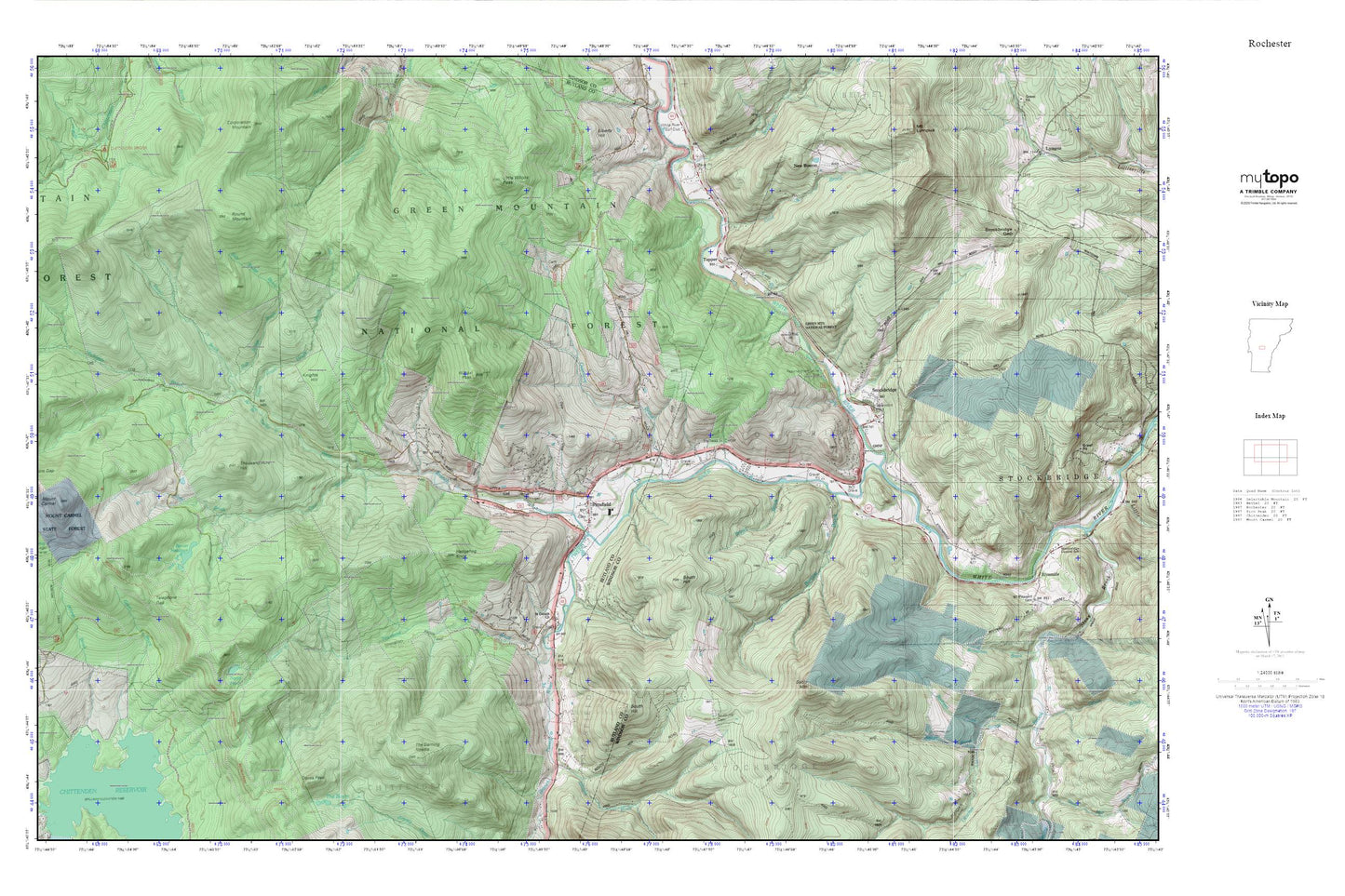
Topographic map of Rochester in the state of Vermont. From the MyTopo Explorer Series.
This topo map features shaded relief and comes with UTM / MGRS and Latitude/Longitude grids.
For more than two decades, MyTopo has provided maps to the most adventurous among us.. those who love to explore our nation’s remote wilderness areas, climb our highest peaks, and trek across our vast public lands. This map is part of a curated collection of the most popular places for which MyTopo customers have designed maps. It is a “bucket list” of the most amazing places to hike, hunt, and explore.
This map contains the following named places: 05737,05762,05772,Bartlett Brook,Bayonne Camp,Beaver Meadows,Betsy Bartlett Grave,Boutwell Brook,Breakneck Brook,Brown Brook,Brown School,Caryl Brook,Chittenden Reservoir,Cold Brook,Daves Peak,Green Brook,Guernsey Brook,Hayes Brook,Hedgehog Knoll,Johnson Brook,Knights Hill,Little Wilcox Peak,Maplewood Cemetery,Michigan,Michigan Brook,Morrill Brook,New Boston,North Pond,Parmenter Cemetery,Pittsfield,Pittsfield Post Office,Pittsfield Town Hall,Pittsfield Volunteer Fire Department,River School,Round Mountain,Sable Mountain,Saint Dennis Church,Slab Bridge Brook,South Branch Tweed River,South Hill,South Hill Cemetery,Stockbridge,Stockbridge Common Historic District,Stockbridge Post Office,Stockbridge Volunteer Fire Department,Taggart Brook,Telephone Gap,The Darning Needle,Thousand Acre Hill,Town of Pittsfield,Town of Stockbridge,Townsend Brook,Trail Head Ski Touring Center,Trail Head Winter Sports Area,Tupper,Tupper Cemetery,Tweed River,Village Cemetery,West Branch Tweed River,Wetmore Gap Trail,White School,Wilcox Peak