MyTopo
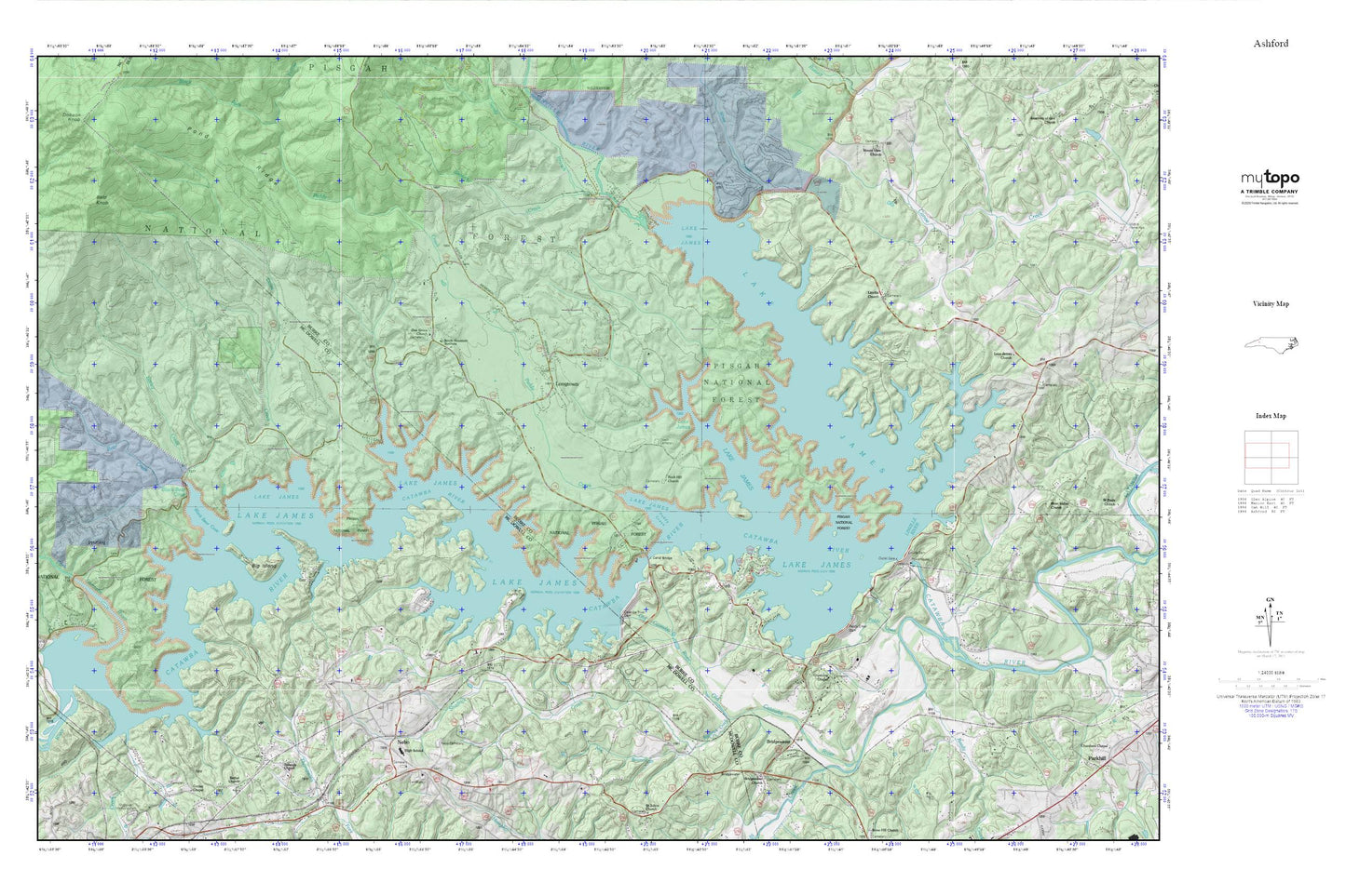
Lake James MyTopo Explorer Series Map
Couldn't load pickup availability
Topographic map of Lake James in the state of North Carolina. From the MyTopo Explorer Series.
This topo map features shaded relief and comes with UTM / MGRS and Latitude/Longitude grids.
For more than two decades, MyTopo has provided maps to the most adventurous among us.. those who love to explore our nation’s remote wilderness areas, climb our highest peaks, and trek across our vast public lands. This map is part of a curated collection of the most popular places for which MyTopo customers have designed maps. It is a “bucket list” of the most amazing places to hike, hunt, and explore.
This map contains the following named places: Bailey Creek,Bald Knob,Bear Creek,Big Island,Black Bear Cove,Bridgewater,Bridgewater Dam,Bridgewater Presbyterian Church,Canal Bridge,Catawba River Dam,Copening Church,Dales Creek,Forsyth Creek,Hall Cemetery,Hankins North - Fork Volunteer Fire Department,Hardaway,Lake James,Lake James Church,Lake James Dam,Lake James State Park,Linville,Linville Church,Linville Dam,Linville River,Longtown,Marion Country Club,Muddy Creek,Nebo,Nebo Cemetery,Nebo Census Designated Place,Nebo Post Office,Nebo Volunteer Fire Department,Nix Branch,North Fork Catawba River,Oak Grove Baptist Church Cemetery,Oak Grove Church,Obeth Cemetery,Old Catawba River,Old Paddy Creek,Paddy Creek,Paddy Creek Dam,Paddys Creek Dam,Reedy Creek,Rock Hill Church,Rolands Chapel,Sandy Branch,Shadrick Creek,Shooks Creek,South Mountain Institute,Township of Linville,Township of Nebo,White Creek