MyTopo
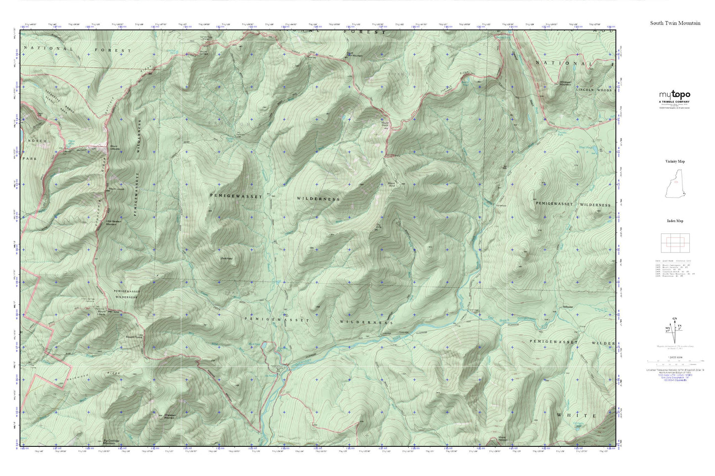
Pemigewasset Wilderness MyTopo Explorer Series Map
Couldn't load pickup availability
Topographic map of Pemigewasset Wilderness in the state of New Hampshire. From the MyTopo Explorer Series.
This topo map features shaded relief and comes with UTM / MGRS and Latitude/Longitude grids.
For more than two decades, MyTopo has provided maps to the most adventurous among us.. those who love to explore our nation’s remote wilderness areas, climb our highest peaks, and trek across our vast public lands. This map is part of a curated collection of the most popular places for which MyTopo customers have designed maps. It is a “bucket list” of the most amazing places to hike, hunt, and explore.
This map contains the following named places: 03251,Birch Island Brook,Black Brook,Black Pond,Bondcliff Trail,Camp 16 Shelter,Camp 9 Shelter,Camp Nine Shelter,Cedar Brook,Ceder Brook Trail,Crystal Brook,Eagle Lakes Hut,Eagles Lakes,Falling Water Trail,Franconia Branch,Franconia Brook Campsite,Franconia Brook Trail,Franconia Falls,Franconia Ridge,Franconia Ridge Trail,Franconia Shelter,Garfield Ridge,Greenleaf Hut,Greenleaf Trail,Hardwood Ridge,Hellgate Brook,Ice Pond,Jumping Brook,Lafayatte Brook Scenic Area,Liberty Spring Trail,Liberty Springs Campsite AMC,Lincoln Brook,Lincoln Brook Trail,Little Haystack Mountain,Mount Bond,Mount Flume,Mount Guyot,Mount Guyot Shelter,Mount Lafayette,Mount Liberty,Mount Lincoln,North Fork East Branch Pemigewasset River,Old Bridle Path,Owls Head,Pemigewasset Wilderness,Redrock Brook,The Cliffs,Thirteen Falls,Thirteen Falls Campsite,Thoreau Falls Trail,Town of Lincoln,Twin Brook,Zeacliff Trail,Zealand Ridge