MyTopo
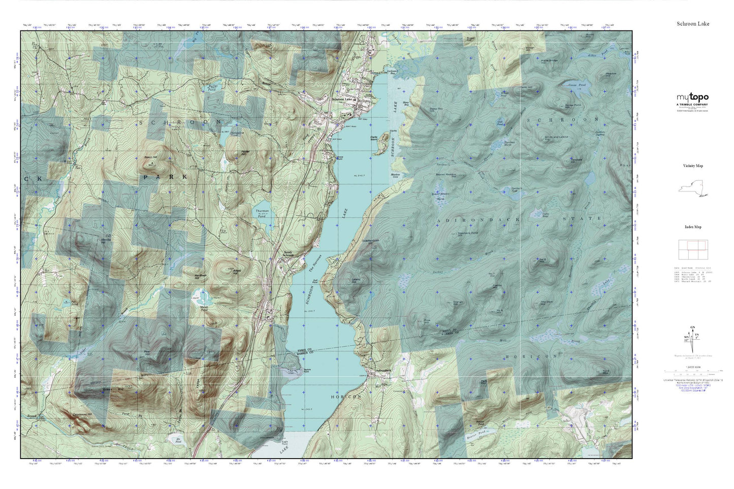
Schroon Lake MyTopo Explorer Series Map
Couldn't load pickup availability
Topographic map of Schroon Lake in the state of New York. From the MyTopo Explorer Series.
This topo map features shaded relief and comes with UTM / MGRS and Latitude/Longitude grids.
For more than two decades, MyTopo has provided maps to the most adventurous among us.. those who love to explore our nation’s remote wilderness areas, climb our highest peaks, and trek across our vast public lands. This map is part of a curated collection of the most popular places for which MyTopo customers have designed maps. It is a “bucket list” of the most amazing places to hike, hunt, and explore.
This map contains the following named places: 12808,12860,12870,Adirondack,Adirondack Post Office,Allard Hill,Beaver Meadow Hill,Beaver Meadow Marsh,Beech Hill,Bullet Pond,Carey Hill,Catamount Hill,Clarks Island,Franks Hill,Gold Course Point,Green Hill,Grove Point,Gull Point,Gull Pond,Hardhack Hill,Harrison Marsh,Horseshoe Pond,Horseshoe Pond Brook,Ledge Hill,Leland Hill,Marsh Pond,Meadow Cove,Merrills Hill,Mill Brook,Number Seven Hill,Number Six Hill,Orange Hill,Our Lady of Lourdes Church,Park Mountain,Pat Pond,Pine Hill,Poplar Hill,Quackenbush Hill,Rogers Brook,Schroon Lake,Schroon Lake Census Designated Place,Schroon Lake Community Church,Schroon Lake Municipal Golf Course,Schroon Lake Post Office,Schroon Lake Volunteer Fire Department,Schroon Lake Wastewater Treatment Plant,Shanty Bottom Brook,South Schroon,Spectacle Pond,Spectacle Pond Hill,Spectacle Pond Trail,Steep Bay,Steep Bay Hill,Sucker Brook,Taylors Point,The Narrows,Thurman Pond,Wilcox Pond,Word of Life Fellowship


