MyTopo
Cedar Key MyTopo Explorer Series Map
Couldn't load pickup availability
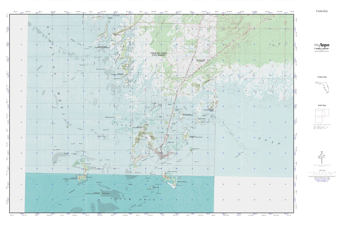
Topographic map of Cedar Key in the state of Florida. From the MyTopo Explorer Series.
This topo map features shaded relief and comes with UTM / MGRS and Latitude/Longitude grids.
For more than two decades, MyTopo has provided maps to the most adventurous among us.. those who love to explore our nation’s remote wilderness areas, climb our highest peaks, and trek across our vast public lands. This map is part of a curated collection of the most popular places for which MyTopo customers have designed maps. It is a “bucket list” of the most amazing places to hike, hunt, and explore.
This map contains the following named places: 32625,Atsena Otie Cemetery,Atsena Otie Key,Big Stake Gap,Black Point,Black Point Swamp,Candy Island,Cedar Key,Cedar Key Museum State Park,Cedar Key Police Department,Cedar Key Post Office,Cedar Key School,Cedar Key Scrub State Reserve,Cedar Key State Memorial,Cedar Key State Museum,Cedar Key Volunteer Fire Department,Cedar Keys,Cedar Point,City of Cedar Key,Corrigan Reef,Daughtry Bayou,Deadmans Channel,Deadmans Key,Dennis Creek,Derrick Key,Derrick Key Gap,Dog Island,Dorset Creek,George T Lewis Airport,Gomez Keys,Goose Creek,Grassy Key,Gulf Hammock,Hall Creek,Havens Island,Hodgson Hill,Levy County Emergency Medical Services Station 5,Live Oak Key,Lukens,Lukens Creek,McClamory Key,McCrary Cove,North Bank,North Key,Northwest Channel,Number Four Channel,Number Three Channel,Pelican Reef,Piney Point,Prodie Creek,Rattlesnake Key,Richards Island,Rye Key,Sand Creek,Scale Key,Seabreeze Creek,Seabreeze Island,South Bank,South Bar Channel,Spanish Bayonet Island,Spring Creek,Steamboat Gap,Sunset Point,Suwannee Reef,Wakasassa,Way Key,Wilder Creek