MyTopo
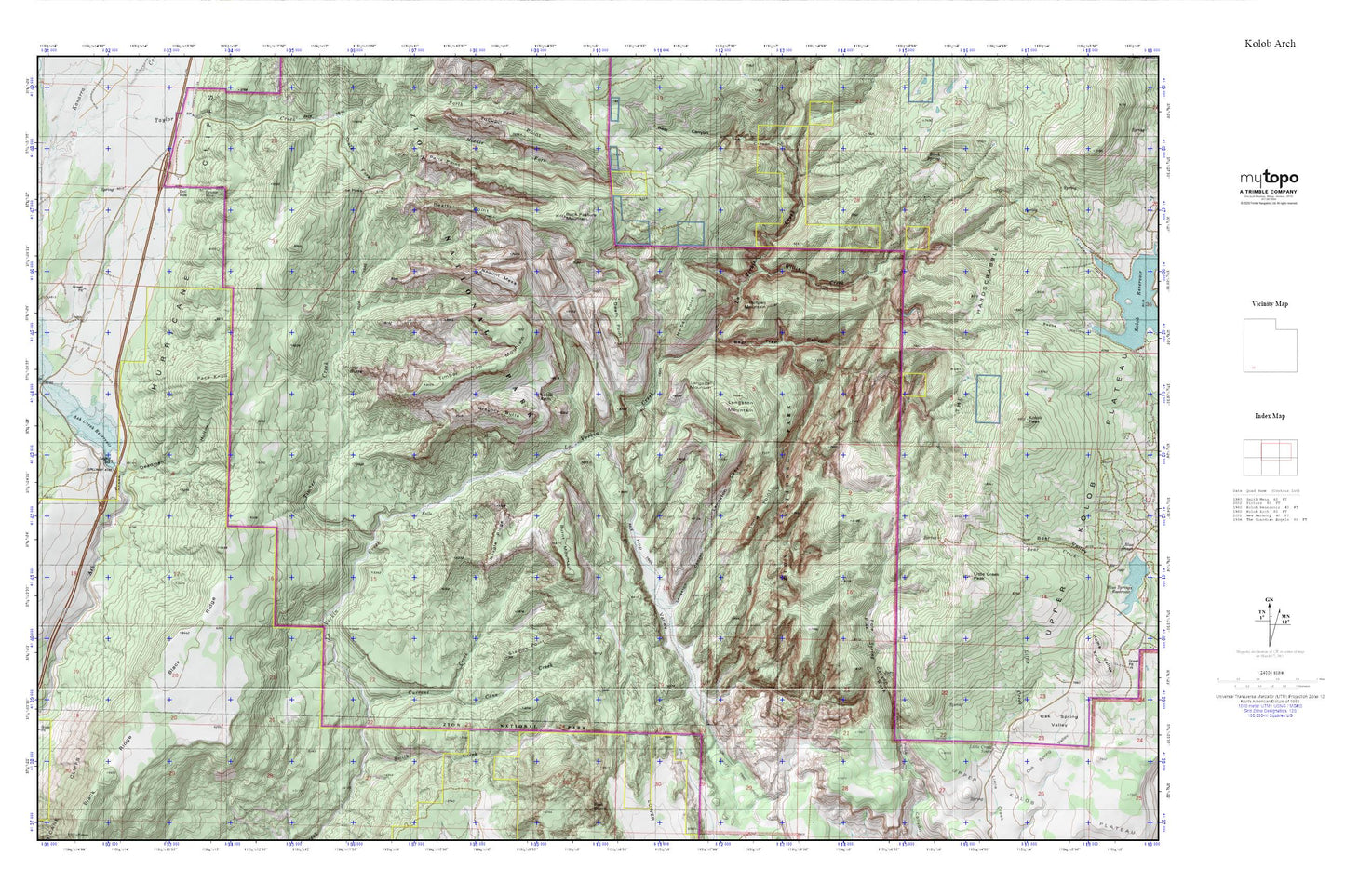
Kolob Arch MyTopo Explorer Series Map
Couldn't load pickup availability
Topographic map of Kolob Arch in the state of Utah. From the MyTopo Explorer Series.
This topo map features shaded relief and comes with UTM / MGRS and Latitude/Longitude grids.
For more than two decades, MyTopo has provided maps to the most adventurous among us.. those who love to explore our nation’s remote wilderness areas, climb our highest peaks, and trek across our vast public lands. This map is part of a curated collection of the most popular places for which MyTopo customers have designed maps. It is a “bucket list” of the most amazing places to hike, hunt, and explore.
This map contains the following named places: Ash Creek Dam,Ash Creek Reservoir,Bear Trap Canyon,Beartrap Canyon Wilderness,Beatty Point,Beatty Spring,Buck Pasture Mountain,Bullpen Mountain,Burnt Mountain,Cane Creek,Chasm Lake,Currant Creek,Deadman Hollow,Death Point,Epsolon Mine,Gregory Butte,Herbs Point,Hop Valley,Hop Valley Trail,Hurricane Cliffs,Kolob Arch,Kolob Arch Trail,Kolob Canyon Road Terminus Campground,Kolob Canyons Viewpoint,Kolob Canyons Visitor Center,La Verkin Creek Trail,Langston Canyon,Langston Mountain,Larson Cabin,LaVerkin Creek Wilderness,Lee Pass,Little Creek Peak,Little Creek Sinks,Long Point,Nagunt Mesa,Neagle Ridge,New Harmony Fire Station - Kolob Station,Pace Knoll,Paria Point,Shuntavi Butte,Smith Cabin,Stapley Point,Taylor Creek,Taylor Creek Wilderness,The Hardscrabble,Timber Creek,Timber Top Mountain,Willis Creek