
MyTopo
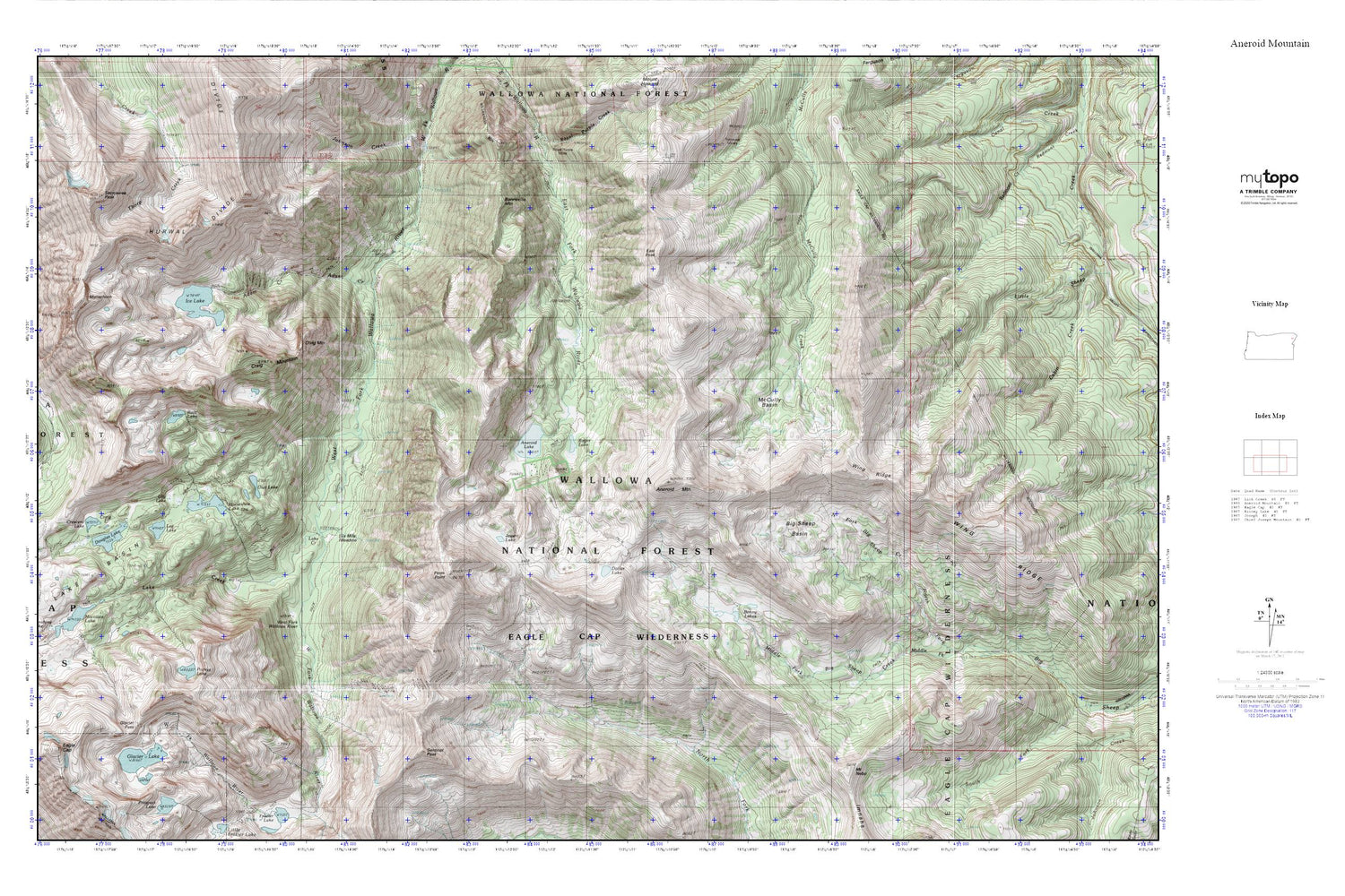
Aneroid Mountain MyTopo Explorer Series Map
Couldn't load pickup availability
Topographic map of Aneroid Mountain in the state of Oregon. From the MyTopo Explorer Series.
This topo map features shaded relief and comes with UTM / MGRS and Latitude/Longitude grids.
For more than two decades, MyTopo has provided maps to the most adventurous among us.. those who love to explore our nation’s remote wilderness areas, climb our highest peaks, and trek across our vast public lands. This map is part of a curated collection of the most popular places for which MyTopo customers have designed maps. It is a “bucket list” of the most amazing places to hike, hunt, and explore.
This map contains the following named places: Adam Creek,Aneroid Lake,Aneroid Mountain,Big Sheep Basin,Bonneville Mountain,Bonny Lakes,Craig Lake,Craig Mountain,Crescent Lake,Dollar Lake,Douglas Lake,East Peak,Glacier Lake,Glacier Pass,Horseshoe Lake,Ice Lake,Jewett Lake,Joseph Division,Lake Basin,Lake Creek,Lee Lake,Lilly Lake,McCully Basin,Middle Fork Big Sheep Creek,Mount Nebo,North Fork Big Sheep Creek,Petes Point,Pocket Lake,Razz Lake,Rogers Lake,Sacajawea Peak,Sentinel Peak,Six Mile Meadow,Tenderfoot Pass,Transvaal Mines,Unit Lake,Wing Ridge


