MyTopo
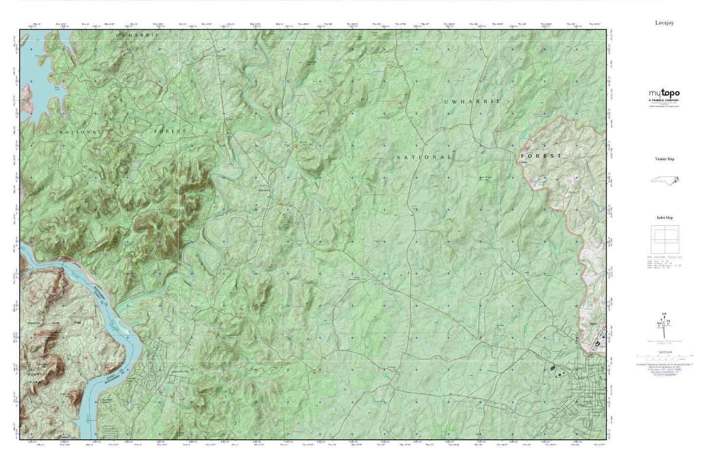
Uwharrie MyTopo Explorer Series Map
Couldn't load pickup availability
Topographic map of Uwharrie in the state of North Carolina. From the MyTopo Explorer Series.
This topo map features shaded relief and comes with UTM / MGRS and Latitude/Longitude grids.
For more than two decades, MyTopo has provided maps to the most adventurous among us.. those who love to explore our nation’s remote wilderness areas, climb our highest peaks, and trek across our vast public lands. This map is part of a curated collection of the most popular places for which MyTopo customers have designed maps. It is a “bucket list” of the most amazing places to hike, hunt, and explore.
This map contains the following named places: 27371,Badin Dam,Barnes Creek,Bethany Church,Big Island Creek,Buck Mountain,Buck Mountain Lookout Tower,Bunnel Mountain,Carolina Forest,Cattail Creek,Cedar Creek,Cove Boat Ramp,Daniel Mountain,Dutch John Creek,Dutchmans Creek,East Morris Mountain Hunt Camp,Fall Mountain,Falls Dam,Falls Mountain,Falls Reservoir,Flat Rock Branch,Gold Mine Branch,Hall Branch,Hattaway Mountain,Hogpen Branch,Jenny Wright Mountain,Lake in the Pine,Lick Mountain,Little Dumas Creek,Little Island Creek,Lomax Memorial Church,Love Joy Cemetery,Love Joy Methodist Church,Lovejoy,McLeans Creek,Mile Branch,Mill Mountain,Moccasin Creek,Morris Mountain,Morrow Mountain State Park,Mount Carmel Church,Mount Olivet Church,Narrous Dam,North Carolina Forest Service Rangers Office,Prospect Baptist Church,Prospect Cemetery,Rabbit Mountain,Refuge Mission,Sand Branch,Shiloh,Shiloh Cemetery,Shiloh Methodist Church,Shingle Trap Mountain,Spencer Creek,Sugarloaf Creek,Sugarloaf Mountain,Sugarloaf Shores,Tater Top Mountain,Tindalsville,Township of Uwharrie,Uwharrie,Uwharrie Hunting Camp,Uwharrie Jeep Trail,Uwharrie Methodist Church,Uwharrie Mountains,Uwharrie National Forest,Uwharrie River,Uwharrie School,Uwharrie Volunteer Fire Department,Uwharrie Wildlife Area,Watery Branch,West Branch Moccasin Creek,West Morris Mountain Camp,Yadkin Falls Dam,Yadkin River,Yates Place Camp,Zoar Cemetery,Zoar Church