
MyTopo
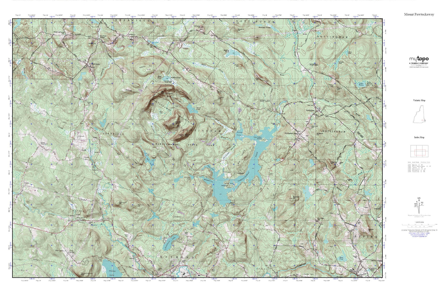
Mount Pawtuckaway MyTopo Explorer Series Map
Couldn't load pickup availability
Topographic map of Mount Pawtuckaway in the state of New Hampshire. From the MyTopo Explorer Series.
This topo map features shaded relief and comes with UTM / MGRS and Latitude/Longitude grids.
For more than two decades, MyTopo has provided maps to the most adventurous among us.. those who love to explore our nation’s remote wilderness areas, climb our highest peaks, and trek across our vast public lands. This map is part of a curated collection of the most popular places for which MyTopo customers have designed maps. It is a “bucket list” of the most amazing places to hike, hunt, and explore.
This map contains the following named places: 03290,Adams Hill,Back Creek,Bean Island,Bean River,Big Island,Burnhams Marshes,Candia,Dame School,Dead Pond,Deer Pond,Deer Pond Dam,Deerfield Center,Deerfield Fairgrounds,Deerfield Fire Department / Deerfield Rescue Squad,Deerfield Police Department,Deerfield Post Office,Dolloff Dam,Drowns Dam,Dudley Brook,Duke Hill,East Candia,Elm Hill,First Baptist Church,Flint Hill,Fundy Cove,Gove Cemetery,Gove Dike,Governors Lake,Hartford Brook,Horse Island,Isinglass Hill,Kennard Hill,Log Cabin,Longview School,Mile Brook,Mount Pawtuckaway,Mountain Brook,Mountain Brook Dam,Mountain Brook Pond,Mountain Cove,Mountain Pond,Neals Cove,Nicholls Brook,North Branch River,Norway Hill,Nottingham,Nottingham Community Church,Nottingham Police Department,Nottingham Post Office,Nottingham Square,Nottingham State Forest,Pawtuckaway Mountains,Pawtuckaway Pond,Pawtuckaway State Reservation,Philbrick-James Library,Quincy Pond,Raymond High School,Robinson Hill,Round Pond,Rundlett Hill,Seamans Point,South Deerfield,South Side Cemetery,Square Schoolhouse,Tavern Hill,Town of Deerfield,Town of Nottingham,White School


