MyTopo
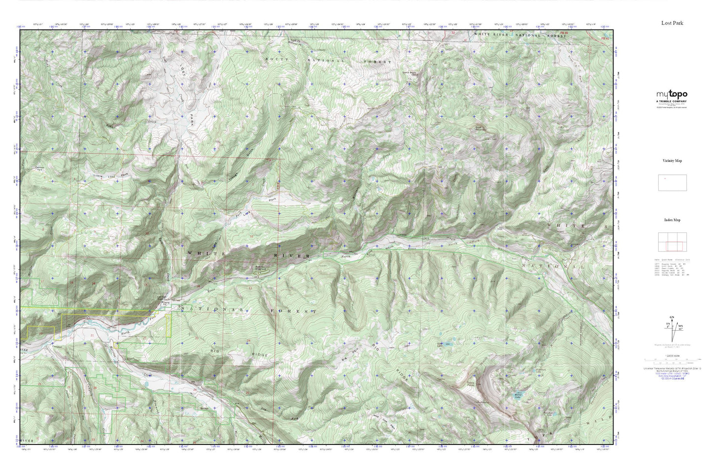
Lost Park MyTopo Explorer Series Map
Couldn't load pickup availability
Topographic map of Lost Park in the state of Colorado. From the MyTopo Explorer Series.
This topo map features shaded relief and comes with UTM / MGRS and Latitude/Longitude grids.
For more than two decades, MyTopo has provided maps to the most adventurous among us.. those who love to explore our nation’s remote wilderness areas, climb our highest peaks, and trek across our vast public lands. This map is part of a curated collection of the most popular places for which MyTopo customers have designed maps. It is a “bucket list” of the most amazing places to hike, hunt, and explore.
This map contains the following named places: Big Park,Big Ridge,Campbell Creek,Deadhorse Creek,Dry Fork Marvine Creek,Hahn Creek,Hammond Creek,Little Lost Park,Long Lost Trailhead,Long Park,Long Park Creek,Lost Creek,Lost Creek Guard Station,Lost Park,Marvine Creek,Mirror Lake,Missouri Creek,North Fork Campground,Papoose Creek,Pattison Park,Sable Lake,Sable Point,Snell Creek,Snell Mountain,Trough Gulch,Ute Creek,Ute Creek Trailhead,West Marvine Creek