
MyTopo
Massies Mill MyTopo Explorer Series Map
Couldn't load pickup availability
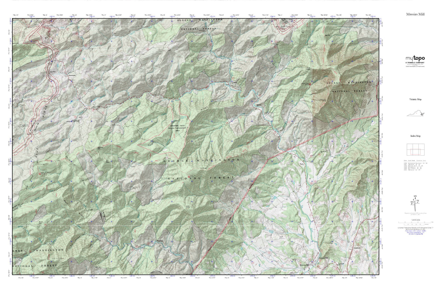
Topographic map of Massies Mill in the state of Virginia. From the MyTopo Explorer Series.
This topo map features shaded relief and comes with UTM / MGRS and Latitude/Longitude grids.
For more than two decades, MyTopo has provided maps to the most adventurous among us.. those who love to explore our nation’s remote wilderness areas, climb our highest peaks, and trek across our vast public lands. This map is part of a curated collection of the most popular places for which MyTopo customers have designed maps. It is a “bucket list” of the most amazing places to hike, hunt, and explore.
This map contains the following named places: 22967,22976,Alhambra,Bethel Cemetery,Big Hollow,Brush Mountain,Campbell Creek,Cash Hollow,Childress Branch,Chimney Rock,Coxs Creek,Crabtree Creek,Crabtree Falls,Cripple Creek,Cub Creek,Elk Pond Branch,Elk Pond Mountain,Evergreen Church,Fork Mountain,Grant Cemetery,Greasy Spring Branch,Harmony Church,Harpers Creek,Harpers Creek Shelter,Irish Creek Mine,Little Hollow,Little Priest,Louisa Spring Branch,Maidenhead Branch,Maintop Mountain,Massies Mill District,Meadow Creek,Mill Creek,Montebello,Montebello Post Office,Montebello State Fish Hatchery,Montebello Volunteer Fire Department and Rescue Squad,Mount Paran Church,Mount Pleasant Church,Muddy Branch,Nash,North Fork Piney River,North Fork Tye River,Pinnacle Ridge,Porters Ridge,Priest Trail Shelter,Priest Wilderness,Sandy Ridge Cemetery,Seeley Woodworth Trail Shelter,Shoe Creek,Silver Creek,South Fork Piney River,South Fork Tye River,Spy Rock,Stillhouse Hollow Parking Area,The Cardinal,The Priest,Three Ridges Wilderness,Twin Springs,Tyro,West District,Whetstone Ridge,Wolf Ridge


